Photographic Print > Universal Images Group (UIG) > Universal Images Group > Satellite and Aerial > Planet Observer 4
Photographic Print : State of Georgia, United States, Relief Map


![]()
Photo Prints from Universal Images Group (UIG)
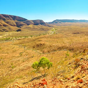
State of Georgia, United States, Relief Map
Relief map of the State of Georgia, United States. This image was compiled from data acquired by LANDSAT 5 & 7 satellites combined with elevation data
Universal Images Group (UIG) manages distribution for many leading specialist agencies worldwide
Media ID 9619161
© Planet Observer/UIG
Atlanta Coastline Georgia Relief Map Shore State Satellite View
10"x8" (25x20cm) Photo Print
Discover the intricacies of Georgia's topography with our stunning and accurate Relief Map Print from Media Storehouse. This exquisite photograph, sourced from Universal Images Group (UIG), is a testament to the power of modern technology, compiled using data from LANDSAT 5 & 7 satellites and elevation data. Bring the beauty and complexity of the State of Georgia into your home or office with our high-quality, museum-grade print. Experience the landscape like never before.
Printed on archival quality paper for unrivalled stable artwork permanence and brilliant colour reproduction with accurate colour rendition and smooth tones. Printed on professional 234gsm Fujifilm Crystal Archive DP II paper. 10x8 for landscape images, 8x10 for portrait images.
Our Photo Prints are in a large range of sizes and are printed on Archival Quality Paper for excellent colour reproduction and longevity. They are ideal for framing (our Framed Prints use these) at a reasonable cost. Alternatives include cheaper Poster Prints and higher quality Fine Art Paper, the choice of which is largely dependant on your budget.
Estimated Image Size (if not cropped) is 18cm x 25.4cm (7.1" x 10")
Estimated Product Size is 20.3cm x 25.4cm (8" x 10")
These are individually made so all sizes are approximate
Artwork printed orientated as per the preview above, with portrait (vertical) orientation to match the source image.
EDITORS COMMENTS
This print showcases the stunning relief map of the State of Georgia, United States. Created using data acquired by LANDSAT 5 & 7 satellites combined with elevation data, this image offers a unique perspective on the topography and physical geography of Georgia. The intricate details captured in this photograph allow viewers to explore the diverse landscape that encompasses this beautiful state. From Atlanta's bustling cityscape to the serene coastline along its shores, every aspect is depicted with remarkable clarity. The vertical composition adds depth and dimension to the map, making it an ideal piece for those fascinated by cartography or anyone seeking a visually striking addition to their collection. The vibrant colors employed in this image further enhance its appeal, bringing life to each contour and feature represented on the map. With no people present in sight, one can truly immerse themselves in studying and appreciating Georgia's natural wonders as seen from a satellite view. Whether you are an avid traveler or simply intrigued by geographical marvels, this print provides an opportunity to delve into Georgia's rich terrain without leaving your home. It serves as a reminder of our planet's extraordinary diversity and invites us to explore new horizons through photography and artistry
MADE IN THE UK
Safe Shipping with 30 Day Money Back Guarantee
FREE PERSONALISATION*
We are proud to offer a range of customisation features including Personalised Captions, Color Filters and Picture Zoom Tools
SECURE PAYMENTS
We happily accept a wide range of payment options so you can pay for the things you need in the way that is most convenient for you
* Options may vary by product and licensing agreement. Zoomed Pictures can be adjusted in the Basket.