Photographic Print > Europe > France > Canton > Landes
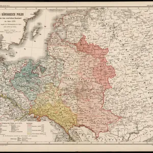
Photographic Print : 1750, Homann Heirs Map of Poland, topography, cartography, geography, land, illustration


![]()
Photo Prints from Liszt Collection
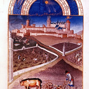
1750, Homann Heirs Map of Poland, topography, cartography, geography, land, illustration
1750, Homann Heirs Map of Poland
Liszt Collection of nineteenth-century engravings and images to browse and enjoy
Media ID 14006664
© Artokoloro Quint Lox Limited
1750 Antique Map Latitude Longitude Mappa Mundi Old Antique Plan Old Antique View Ols Antique Map Rare Old Maps Topo
10"x8" (25x20cm) Photo Print
Discover the rich history and intricate detail of Poland with our stunning Media Storehouse Photographic Print from the Liszt Collection. This beautiful print showcases the 1750 Homann Heirs Map of Poland, a masterpiece of topography, cartography, and geography. With its vibrant colors and crisp lines, this illustration of the Polish land brings the past to life, making it a must-have addition to any home or office. Perfect for history enthusiasts, collectors, or anyone who appreciates the beauty of vintage maps, this print is sure to impress. Order yours today and transport yourself back in time.
Printed on archival quality paper for unrivalled stable artwork permanence and brilliant colour reproduction with accurate colour rendition and smooth tones. Printed on professional 234gsm Fujifilm Crystal Archive DP II paper. 10x8 for landscape images, 8x10 for portrait images.
Our Photo Prints are in a large range of sizes and are printed on Archival Quality Paper for excellent colour reproduction and longevity. They are ideal for framing (our Framed Prints use these) at a reasonable cost. Alternatives include cheaper Poster Prints and higher quality Fine Art Paper, the choice of which is largely dependant on your budget.
Estimated Product Size is 25.4cm x 20.3cm (10" x 8")
These are individually made so all sizes are approximate
Artwork printed orientated as per the preview above, with landscape (horizontal) orientation to match the source image.
FEATURES IN THESE COLLECTIONS
> Europe
> France
> Canton
> Landes
> Europe
> Poland
> Related Images
> Historic
> Space exploration
> Maps and Charts
> Early Maps
> Maps and Charts
> Related Images
> Maps and Charts
> World
EDITORS COMMENTS
This print showcases a remarkable piece of history: the 1750 Homann Heirs Map of Poland. With its intricate topography and precise cartography, this vintage illustration offers a fascinating glimpse into the geography and land formations of Poland during that era. The map's detailed grid, latitude, and longitude markings add to its geometric beauty, making it an invaluable tool for navigation and exploration in times gone by. As we admire this ancient artifact, we are transported back in time to an age when maps were not just practical tools but also works of art. The delicate paper texture and aged appearance lend an air of historical significance to this decorative piece. It serves as a reminder of the journey mankind has taken in discovering our world's vast regions. The Homann Heirs Map is more than just a representation of Poland; it represents the spirit of adventure and curiosity that drove explorers throughout history. This rare old map holds immense value for collectors and enthusiasts alike who appreciate its rich historical context. With its blend of artistry and scientific precision, this antique map from the Liszt Collection allows us to connect with our past while marveling at the wonders that lie beyond our own borders.
MADE IN THE UK
Safe Shipping with 30 Day Money Back Guarantee
FREE PERSONALISATION*
We are proud to offer a range of customisation features including Personalised Captions, Color Filters and Picture Zoom Tools
SECURE PAYMENTS
We happily accept a wide range of payment options so you can pay for the things you need in the way that is most convenient for you
* Options may vary by product and licensing agreement. Zoomed Pictures can be adjusted in the Basket.