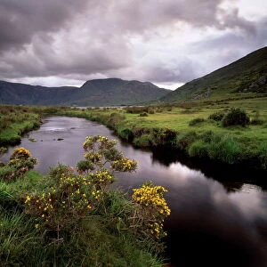
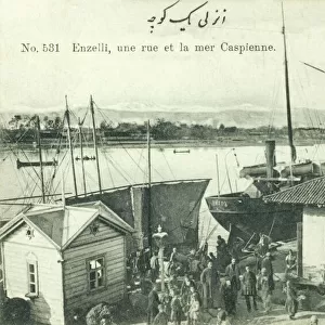
Photographic Print > Asia > Iran > Lakes > Caspian Sea
Photographic Print : arabia, archival, asia, border, cartography, caspian sea, coordinates, document, geography


![]()
Photo Prints from Fine Art Storehouse
arabia, archival, asia, border, cartography, caspian sea, coordinates, document, geography
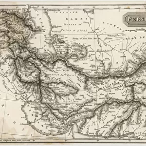
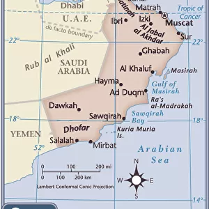
arabia, archival, asia, border, cartography, caspian sea, coordinates, document, geography, historic, historical, insets, iran, iraq, israel, jordan, latitude, legend, longitude, map, mediterranean, middle east, nobody, oman, persia, persian gulf, red, scale, syria, territory, turkey in persia, turkmenistan, vintage, yemen, Antique Maps, 87599887
Unleash your creativity and transform your space into a visual masterpiece!
Hemera Technologies
Media ID 14761254
© Getty Images
Arabia Border Caspian Sea Coordinates Document Geography Iran Iraq Israel Jordan Latitude Legend Longitude Mediterranean Middle East Oman Persia Persian Gulf Scale Syria Territory Turkmenistan Yemen Insets
10"x8" (25x20cm) Photo Print
Step into the captivating world of history and geography with this stunning photographic print from Media Storehouse's Fine Art Storehouse collection. This exquisite piece, titled "Arabia, Archival, Asia, Border, Cartography, Caspian Sea, Coordinates, Document, Geography," showcases a meticulously crafted map that transports you to a time when exploration and discovery were the driving forces of human curiosity. Covering a vast expanse of land from the Arabian Peninsula to the Caspian Sea, this intricately detailed map highlights the borders of historic nations such as Iran, Iraq, Israel, and Jordan. The map's cartography is adorned with coordinates, latitude, and longitude lines, adding an air of authenticity and scholarly intrigue. The rich, archival quality of this print ensures that the vibrant colors and intricate details will endure for generations, making it a cherished addition to any home or office. The historic document-style design, complete with insets and a legend, adds an extra layer of sophistication and depth to this captivating piece. Experience the wonder of geography and the allure of a bygone era with this exquisite photographic print from Media Storehouse's Fine Art Storehouse collection. Perfect for those with a passion for history, geography, or cartography, this print is a must-have for any discerning collector.
Printed on archival quality paper for unrivalled stable artwork permanence and brilliant colour reproduction with accurate colour rendition and smooth tones. Printed on professional 234gsm Fujifilm Crystal Archive DP II paper. 10x8 for landscape images, 8x10 for portrait images.
Our Photo Prints are in a large range of sizes and are printed on Archival Quality Paper for excellent colour reproduction and longevity. They are ideal for framing (our Framed Prints use these) at a reasonable cost. Alternatives include cheaper Poster Prints and higher quality Fine Art Paper, the choice of which is largely dependant on your budget.
Estimated Product Size is 25.4cm x 20.3cm (10" x 8")
These are individually made so all sizes are approximate
Artwork printed orientated as per the preview above, with landscape (horizontal) or portrait (vertical) orientation to match the source image.
FEATURES IN THESE COLLECTIONS
> Fine Art Storehouse
> Map
> Historical Maps
> Arts
> Artists
> S
> Syrian Syrian
> Asia
> Iran
> Lakes
> Caspian Sea
> Asia
> Iran
> Related Images
> Asia
> Iraq
> Related Images
> Asia
> Israel
> Related Images
EDITORS COMMENTS
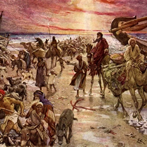
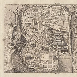
This print by Hemera Technologies showcases an exquisite antique map that takes us on a journey through the rich history and geography of the Middle East. The map, filled with intricate details and stunning craftsmanship, offers a glimpse into the past as it highlights various territories including Arabia, Iran, Iraq, Israel, Jordan, Syria, Turkey in Persia, Turkmenistan, Yemen and more. With its archival value preserved over time, this document serves as a valuable resource for cartography enthusiasts and historians alike. The carefully marked coordinates of latitude and longitude allow for precise navigation across the vast expanse of land depicted on the map. Insets provide additional insights into specific regions such as Oman and Caspian Sea. The legend accompanying this vintage piece unlocks its secrets by explaining symbols used to denote borders and scale measurements. As we explore this historic artifact further, our eyes are drawn to notable landmarks like the Persian Gulf and Mediterranean Sea which played significant roles in shaping trade routes throughout centuries. This print captures not only a tangible piece of history but also invites contemplation about how boundaries have shifted over time in this ever-evolving region. With no human presence visible within the frame itself - nobody interrupts our immersion into these ancient lands where civilizations rose and fell. Overall, this mesmerizing artwork is a testament to both artistic skill and historical significance – an invaluable addition to any collection or display dedicated to preserving our shared heritage.
MADE IN THE UK
Safe Shipping with 30 Day Money Back Guarantee
FREE PERSONALISATION*
We are proud to offer a range of customisation features including Personalised Captions, Color Filters and Picture Zoom Tools
SECURE PAYMENTS
We happily accept a wide range of payment options so you can pay for the things you need in the way that is most convenient for you
* Options may vary by product and licensing agreement. Zoomed Pictures can be adjusted in the Basket.