Fraud Blocker Skip to main content

Territory Collection

"Exploring the Rich Tapestry of Territory

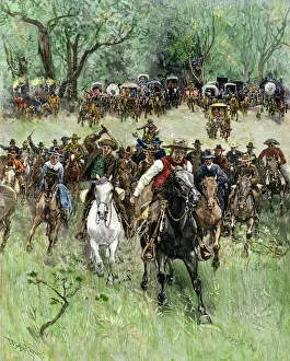
Background imageTerritory Collection: Oklahoma Territory opened to settlers, 1891

Oklahoma Territory opened to settlers, 1891
Homesteaders charge at the start signal, western Oklahoma Land Rush, 1891. Hand-colored woodcut of a 19th-century illustration

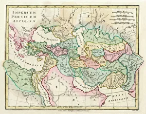
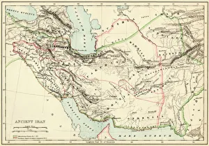
Background imageTerritory Collection: Map of the Ancient Persian Empire

Map of the Ancient Persian Empire, encompassing Greece to the north west, Arabia to the south east, Egypt and Libya to the south west and deep in the Caucasus in the north east. Date: 1798

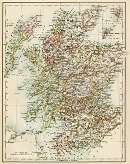
Background imageTerritory Collection: Scotland map, 1870s

Scotland map, 1870s
Map of Scotland, 1870s. Printed color lithograph

Background imageTerritory Collection: Map of Britain in 597 AD

Map of Britain in 597 AD
Map of territory controlled by Celts, Picts, Anglos, Saxons, and other tribes in Britain in 597 AD. Printed color lithograph of a 19th-century illustration

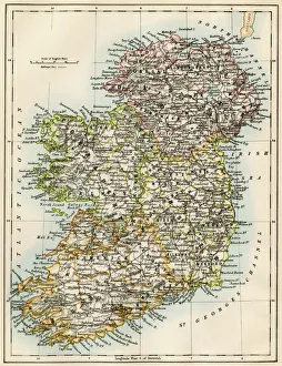
Background imageTerritory Collection: Ireland map, 1870s

Ireland map, 1870s
Map of Ireland, or Eire, 1870s. Printed color lithograph

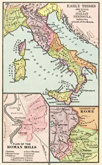
Background imageTerritory Collection: Maps of Italy in ancient times

Maps of Italy in ancient times
Map of early tribes in Italy (top). of the Roman hills (lower left). and the vicinity of Rome (right) in the time of the Roman Empire. Printed color lithograph of a 19th-century illustration

Background imageTerritory Collection: Sunset at Uluru, Ayers Rock, Australia

Sunset at Uluru, Ayers Rock, Australia
Sunset at Uluru, Ayers Rock, Uluru-Kata Tjuta National Park, Northern Territory, Australia

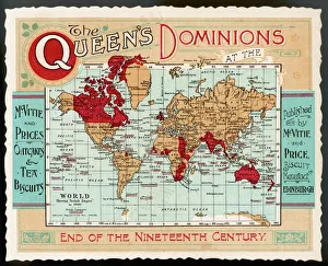
Background imageTerritory Collection: World Map Empire McVitie

World Map Empire McVitie
A map of the world, showing the British Empire coloured in red at the end of the nineteenth century

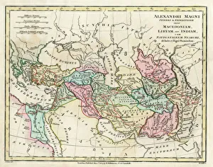
Background imageTerritory Collection: Map of the Empire of King Alexander the Great

Map of the Empire of King Alexander the Great (Alexander III of Macedon 356323 BC), from Greece in the west to India in the east. Date: 1807

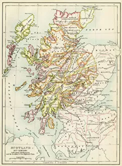
Background imageTerritory Collection: GGBR2A-00076

GGBR2A-00076
Map of Scotland in the 1520s, showing territories of the Highland Clans. Printed color lithograph of a 19th century illustration

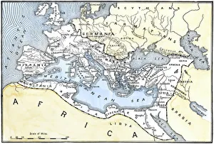
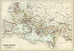
Background imageTerritory Collection: Map of the Roman Empire

Map of the Roman Empire
Map showing the extent of the Roman Empire. Hand-colored woodcut of a 19th-century illustration

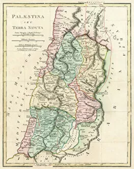
Background imageTerritory Collection: Map of Palestine and the Holy Land

Map of Palestine and the Holy Land - all places named in their Latin form. Date: 1806

Background imageTerritory Collection: PEXP2D-00013

PEXP2D-00013
Explorers Meriwether Lewis and William Clark with their Native American guide Sacagawea. Digital photograph of a bronze statue in Charlottesville Virginia

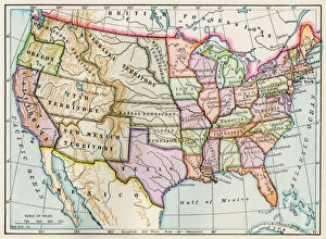
Background imageTerritory Collection: United States in 1860

United States in 1860
United States and territories at the beginning of the Civil War. Printed lithograph map

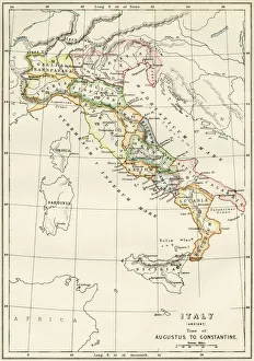
Background imageTerritory Collection: Regions of Italy in the Roman Empire

Regions of Italy in the Roman Empire
Map of Italy, during the time of Caesar Augustus to Emperor Constantine. Color lithograph of a 19th-century illustration

Background imageTerritory Collection: EXPL2A-00164

EXPL2A-00164
Map of the United States at the close of the American Revolution, 1783. Printed color lithograph of a 19th-century illustration

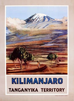
Background imageTerritory Collection: Poster, Kilimanjaro, Tanganyika Territory, Africa

Poster, Kilimanjaro, Tanganyika Territory, Africa. circa 1940

Background imageTerritory Collection: Red Kite - In flight, soaring over nest territory in april. Lower Saxony, Germany

Red Kite - In flight, soaring over nest territory in april. Lower Saxony, Germany
USH-1573 Red KITE - in flight, soaring over nest territory in april Lower Saxony, Germany Milvus milvus Duncan Usher Please note that prints are for personal display purposes only

Background imageTerritory Collection: Bald Eagle - Being harassed by crow during winter snowstorm. Alaska. BE2635

Bald Eagle - Being harassed by crow during winter snowstorm. Alaska. BE2635
TOM-699 Bald Eagle - Being harassed by crow during winter snowstorm Alaska, USA Haliaeetus leucocephalus Tom & Pat Leeson Please note that prints are for personal display purposes only

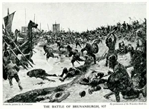
Background imageTerritory Collection: Battle of Brunanburh during the Viking invasions of England

Battle of Brunanburh during the Viking invasions of England
Battle of Brunanburh between the Anglo-Saxon King Aethelstan and an alliance of Olaf Guthfrithson and others, during the Viking invasions of England

Background imageTerritory Collection: Seven Mile Beach, George Town, Grand Cayman, Cayman Islands

Seven Mile Beach, George Town, Grand Cayman, Cayman Islands

Background imageTerritory Collection: Sunset at Uluru, Ayers Rock, Uluru-Kata Tjuta National Park, Northern Territory

Sunset at Uluru, Ayers Rock, Uluru-Kata Tjuta National Park, Northern Territory, Australia

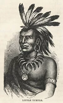
Background imageTerritory Collection: Little Turtle / Miami

Little Turtle / Miami
Chief of the Miami tribe who led a number of raids on settlers in the Northwest Territory. He was forced to sign the Treaty of Greenville in 1795

Background imageTerritory Collection: Sunrise at Uluru, Ayers Rock, Uluru-Kata Tjuta Park, Australia

Sunrise at Uluru, Ayers Rock, Uluru-Kata Tjuta Park, Australia
Sunrise at Uluru, Ayers Rock, Uluru-Kata Tjuta National Park, Northern Territory, Australia

Background imageTerritory Collection: St. Georges, Bermuda - Union Flag flies proudly

St. Georges, Bermuda - Union Flag flies proudly
St. George s, Bermuda - Union Flag flies proudly Date: circa 1920s

Background imageTerritory Collection: Antique map of Russia

Antique map of Russia

Background imageTerritory Collection: Empire Marketing Board poster - Gibraltar

Empire Marketing Board poster - Gibraltar
Empire Marketing Board poster showing a family on the deck of a ship which is sailing close to the rock of Gibraltar

Background imageTerritory Collection: Antique Map of the San Juan Islands - 19th Century

Antique Map of the San Juan Islands - 19th Century
Vintage map of the San Juan Islands. The area has been disputed since the 1850s, in the 21st century the area was finally recognized as the Salish Sea. Vintage etching circa late 19th century

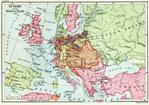
Background imageTerritory Collection: Map of Europe after the Peace of Tilsit in 1807, from A Short History of the

Map of Europe after the Peace of Tilsit in 1807, from A Short History of the
KW392529 Map of Europe after the Peace of Tilsit in 1807, from A Short History of the English People by J. R. Green, published 1893 (colour litho) by English School

Background imageTerritory Collection: EVCW2A-00100

EVCW2A-00100
US map showing seceding states by date, American Civil War, 1860 and 1861. Printed color lithograph 19th century

Background imageTerritory Collection: Extent of the Persian empire

Extent of the Persian empire
Map of the ancient Persian empire. Printed color lithograph of a 19th-century illustration

Background imageTerritory Collection: Roman Empire, circa 200 AD

Roman Empire, circa 200 AD
Map of the Roman Empire in the third century. Printed color lithograph of a 19th-century illustration

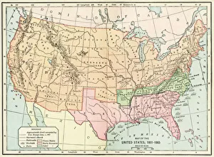
Background imageTerritory Collection: United States during the Civil War

United States during the Civil War
Map of the United States 1861 to 1865. Printed color lithograph of a 19th-century illustration

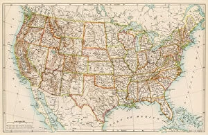
Background imageTerritory Collection: United States in the 1870s

United States in the 1870s
United States map, 1870s. Color lithograph

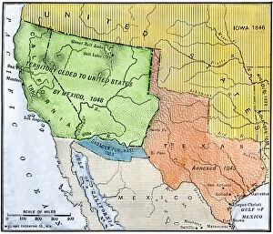
Background imageTerritory Collection: U. S. territory gained from Mexico

U. S. territory gained from Mexico
Map of territory acquired by the U.S. from Mexico. Color lithograph of a 19th-century illustration

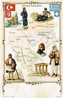
Background imageTerritory Collection: Map of the Balkans, highlighting Greek and Turkish territory

Map of the Balkans, highlighting Greek and Turkish territory
Postcard map showing the Balkans, highlighting Greek and Turkish territory

Background imageTerritory Collection: RAF Bristol Blenheim Fighter-Bombers; Second World War, 19

RAF Bristol Blenheim Fighter-Bombers; Second World War, 19
Illustration showing three Royal Air Force Bristol Blenheim mark IV fighter-bomber-reconnaissance airplanes over enemy territory in 1941

Background imageTerritory Collection: The Kottel Bridge at Konigsberg, East Prussia, 1930 s

The Kottel Bridge at Konigsberg, East Prussia, 1930 s
Photograph showing the Kottel Bridge at Konigsberg, then capital of East Prussia, pictured sometime in the 1930 s. Konigsberg is now known as Kaliningrad and is Russian territory

Background imageTerritory Collection: GMDE2A-00054

GMDE2A-00054
Map of Arabia, 1870s. Printed color lithograph, 19th century

Background imageTerritory Collection: Belle Starr / Bandit / C19Th

Belle Starr / Bandit / C19Th
Belle Starr, noted companion of Western outlaws, jumps bail in Indian territory & leaves town on horseback

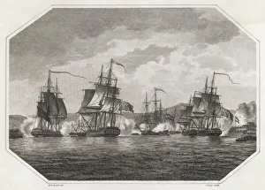
Background imageTerritory Collection: British Navy taking Curacao, Napoleonic Wars

British Navy taking Curacao, Napoleonic Wars
The British Navy taking the Caribbean island of Curacao during the Napoleonic Wars

Background imageTerritory Collection: Red Grouse In Pink and purple heather. North Yorkshire. UK

Red Grouse In Pink and purple heather. North Yorkshire. UK
ROY-31 Red Grouse - in Pink and purple heather. North Yorkshire. UK Lagopus lagopus Roy Glen Please note that prints are for personal display purposes only and may not be reproduced in any way

Background imageTerritory Collection: In Praise of the British Empire

In Praise of the British Empire - Physical representations of the British territories of Canada, India, New Zealand, South Africa and Australia give thanks to King George V

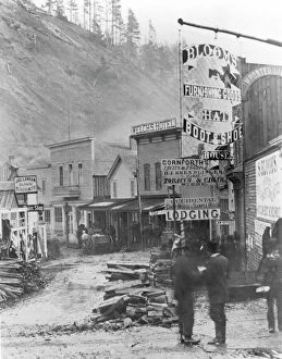
Background imageTerritory Collection: DEADWOOD, SOUTH DAKOTA. Wall Street, following Snaky Gulch bottom

DEADWOOD, SOUTH DAKOTA. Wall Street, following Snaky Gulch bottom, in the frontier town of Deadwood, 1877

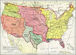
Background imageTerritory Collection: Growth of the United States to 1853

Growth of the United States to 1853
U.S. map, showing territorial growth to 1853. Printed color lithograph of a 19th-century illustration

Background imageTerritory Collection: EXPL2A-00265

EXPL2A-00265
Map of the territory ceded by Mexico to the US after the Mexican-American War, 1848-1853. Hand-colored woodcut of a 19th-century illustration

Background imageTerritory Collection: Seven Mile Beach, West Bay, Grand Cayman, Cayman Islands

Seven Mile Beach, West Bay, Grand Cayman, Cayman Islands

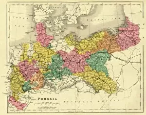
Background imageTerritory Collection: Map of Prussia, c1872. Creator: Unknown

Map of Prussia, c1872. Creator: Unknown
Map of Prussia, c1872. Showing the various regions including Holstein, Hanover, Westphalia, Lower Rhine, Lorraine, Nassau, Cassel, Saxony, Brandedburg, Silesia, Pomerania, West Prussia


All Professionally Made to Order for Quick Shipping

"Exploring the Rich Tapestry of Territory: From Ancient Empires to Majestic Landscapes" Embark on a captivating journey through time and space as we delve into the concept of territory. Let us begin our expedition with a glance at Scotland in the 1870s, where an intricate map unravels tales of clans and their territorial disputes. Shifting our focus eastward, we encounter a mesmerizing Map of the Ancient Persian Empire. Marvel at its vast expanse, once ruled by mighty kings who sought to expand their dominion across ancient lands. Transporting ourselves to Britain in 597 AD, another map reveals how territories evolved over centuries. Witness the birth of kingdoms and empires that shaped this island nation's history. As dusk descends upon Uluru, Ayers Rock in Australia, soak in nature's splendor while contemplating indigenous peoples' connection to their ancestral territories. The sunset paints vibrant hues across this sacred land. Journeying back to Europe, let us explore Ireland through a map from the 1870s. Discover its lush landscapes and ponder upon historical struggles for control over this enchanting island. Expand your horizons further with the World Map Empire McVitie; marvel at how various nations carved out their territories during different eras – each stroke representing power dynamics and conquests. Venturing into antiquity, immerse yourself in Alexander the Great's empire through an awe-inspiring map. Uncover his audacious quest for dominance as he conquered vast stretches of land under his rule. Witnessing nature's wonders takes flight as we observe a majestic Red Kite soaring above its nest territory in Lower Saxony, Germany. A symbol of freedom within defined boundaries - it reminds us that even wildlife has territorial instincts ingrained within them. Turning towards spiritual realms brings us face-to-face with Palestine and Holy Land on an intricately detailed map. Contemplate millennia-old conflicts rooted deeply in territorial claims and religious significance.