Mouse Mat > Africa > South Africa > Maps
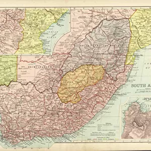
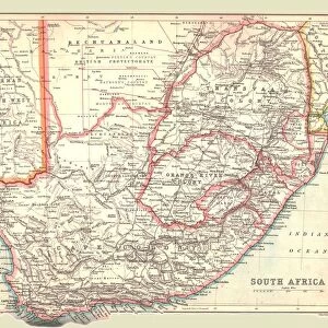
Mouse Mat : General Map Of British South Africa. From The Book South Africa And The Transvaal War, Volume 1 By Louis Creswicke, Published 1900


![]()
Home Decor from Design Pics
General Map Of British South Africa. From The Book South Africa And The Transvaal War, Volume 1 By Louis Creswicke, Published 1900
Design Pics offers Distinctively Different Imagery representing over 1,500 contributors
Media ID 18191341
© Ken Welsh / Design Pics
Africa African Border Borders Cape Colony General South Territories Territory Transvaal
Mouse Mat
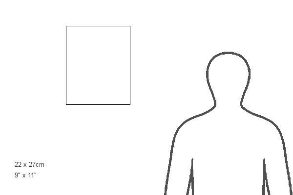
A high quality photographic print manufactured into a durable wipe clean mouse mat (27x22cm) with a non slip backing, which works with all mice.
Archive quality photographic print in a durable wipe clean mouse mat with non slip backing. Works with all computer mice
Estimated Image Size (if not cropped) is 21.3cm x 25.4cm (8.4" x 10")
Estimated Product Size is 21.8cm x 26.9cm (8.6" x 10.6")
These are individually made so all sizes are approximate
Artwork printed orientated as per the preview above, with portrait (vertical) orientation to match the source image.
FEATURES IN THESE COLLECTIONS
> Africa
> South Africa
> Maps
> Africa
> South Africa
> Related Images
> Maps and Charts
> Related Images
EDITORS COMMENTS
This print showcases a historical treasure, the "General Map of British South Africa". Published in 1900 by Louis Creswicke in his renowned book, "South Africa and the Transvaal War" this map offers a fascinating glimpse into the colonial era. The intricate details on this 19th-century map provide an invaluable resource for understanding the territorial landscape of British South Africa during that time. The map encompasses various regions, including Cape Colony and its neighboring territories. It delineates borders with precision, offering insights into the vastness of African lands under British control. As one explores this cartographic masterpiece, it becomes evident how these borders shaped political dynamics and influenced interactions between different African communities. Louis Creswicke's meticulous work not only serves as a geographical reference but also sheds light on significant historical events such as the Transvaal War. This conflict played a crucial role in shaping South Africa's history and had far-reaching consequences for both colonizers and indigenous populations. Ken Welsh has skillfully captured this extraordinary piece of history through his photography expertise. By preserving and presenting this image to us today, we are granted access to an important artifact that allows us to delve deeper into our past. Whether you are a history enthusiast or simply appreciate artistry combined with knowledge, this print is sure to captivate your imagination and spark curiosity about Britain's presence in South Africa during the late 19th century.
MADE IN THE UK
Safe Shipping with 30 Day Money Back Guarantee
FREE PERSONALISATION*
We are proud to offer a range of customisation features including Personalised Captions, Color Filters and Picture Zoom Tools
SECURE PAYMENTS
We happily accept a wide range of payment options so you can pay for the things you need in the way that is most convenient for you
* Options may vary by product and licensing agreement. Zoomed Pictures can be adjusted in the Basket.