Mounted Print > Fine Art Finder > Artists > Grazioso Benincasa
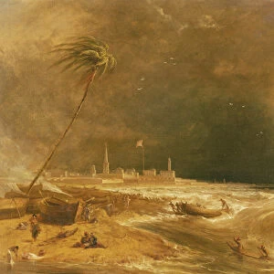
Mounted Print : Map of the Adriatic Sea (ink on parchment)
")
")


Please select a smaller print size for this image
![]()
Mounted Prints from Fine Art Finder
Map of the Adriatic Sea (ink on parchment)
XCF307337 Map of the Adriatic Sea (ink on parchment) by Benincasa, Grazioso (fl.1468); Private Collection; Italian, out of copyright
Media ID 12841982
© www.bridgemanart.com
Atlas Chart Geographic Mapping
14"x12" Mount with 12"x10" Print
Discover the timeless beauty of the past with our exquisite Mounted Photos from Media Storehouse. Featuring this intricately detailed Map of the Adriatic Sea, created by Grazioso Benincasa in the late 15th century, this piece showcases the rich history and artistry of Italian cartography. With its antique parchment texture and meticulous ink detailing, this map transports you back in time. Each Mounted Photo is carefully printed on premium photo paper and mounted on high-quality foam core board, ensuring a stunning presentation. Bring a touch of history and elegance to your home or office with this captivating work of art from Fine Art Finder and Bridgeman Art Library.
Printed on 12"x10" paper and suitable for use in a 14"x12" frame (frame not included). Prints are mounted with card both front and back. Featuring a custom cut aperture to match chosen image. Professional 234gsm Fujifilm Crystal Archive DP II paper.
Photo prints supplied in custom cut card mount ready for framing
Estimated Image Size (if not cropped) is 25.6cm x 25.4cm (10.1" x 10")
Estimated Product Size is 35.6cm x 30.5cm (14" x 12")
These are individually made so all sizes are approximate
Artwork printed orientated as per the preview above, with landscape (horizontal) orientation to match the source image.
EDITORS COMMENTS
This print showcases a remarkable piece of cartographic artistry, the "Map of the Adriatic Sea" by Grazioso Benincasa. Crafted with ink on parchment during the Renaissance period, this exquisite map is a testament to both artistic skill and geographic knowledge. The intricate details depicted on this map are truly awe-inspiring. Every contour of the coastline, every island and inlet, has been meticulously rendered with precision and accuracy. It serves as a valuable historical document that sheds light on the exploration and navigation techniques employed during that era. As we gaze upon this masterpiece, we are transported back in time to an age of discovery and adventure. The map not only provides us with geographical information but also offers glimpses into the cultural significance of coastal towns and cities along the Adriatic Sea. Benincasa's creation exemplifies how art can be intertwined seamlessly with scientific pursuits. This stunning representation combines aesthetics with functionality, making it an invaluable resource for sailors, explorers, and scholars alike. Now preserved within a private collection but made accessible through Fine Art Finder's print reproduction, this Map of the Adriatic Sea invites us to marvel at its beauty while appreciating its historical importance. It serves as a reminder that even centuries later, these masterpieces continue to captivate our imagination and provide insights into our past.
MADE IN THE UK
Safe Shipping with 30 Day Money Back Guarantee
FREE PERSONALISATION*
We are proud to offer a range of customisation features including Personalised Captions, Color Filters and Picture Zoom Tools
SECURE PAYMENTS
We happily accept a wide range of payment options so you can pay for the things you need in the way that is most convenient for you
* Options may vary by product and licensing agreement. Zoomed Pictures can be adjusted in the Basket.