
North Macedonia Collection
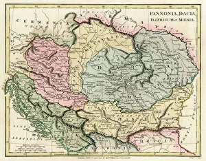
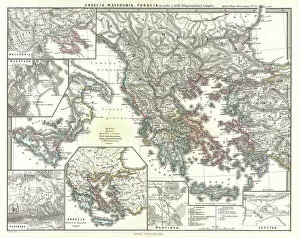
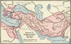
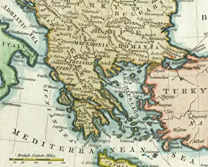
North Macedonia is a small landlocked country located in the Balkans region of Europe and has a population of approximately 2 million people...
Choose a picture from our North Macedonia Collection for your Wall Art and Photo Gifts
78 items


All Professionally Made to Order for Quick Shipping
-
North Macedonia Collection
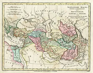
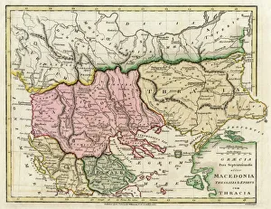
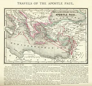
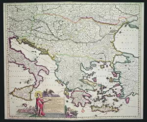
North Macedonia is a small landlocked country located in the Balkans region of Europe and has a population of approximately 2 million people and its capital city is Skopje. The official language is Macedonian, and the currency used is the denar. A diverse landscape that includes mountains, lakes, and rivers. Its economy relies heavily on agriculture, tourism, and manufacturing industries. The country has made significant progress in recent years towards joining the European Union and NATO. It also faces challenges such as corruption, poverty, and political instability which have hindered its development in some areas.
+
Our beautiful pictures are available as Framed Prints, Photos, Wall Art and Photo Gifts
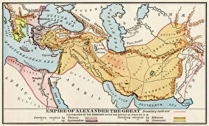
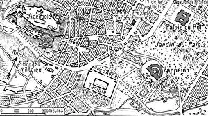
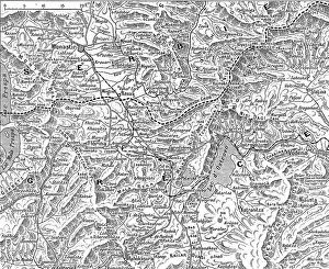
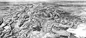
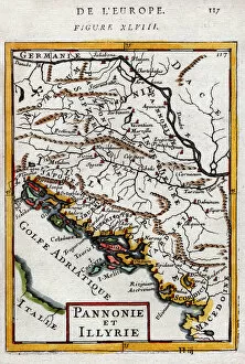
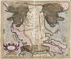
The North Macedonia collection from Media Storehouse offers a wide range of wall art and framed prints that showcase the geography, history, and culture of this Balkan nation. Our collection features vintage maps, charts, and illustrations that depict the country's topography, cities, landmarks, flora and fauna. These artworks are available in various sizes to suit different spaces such as homes or offices. The North Macedonia collection is perfect for those who want to learn more about this fascinating country or have a connection with it. These high-quality prints make great gifts for friends or family members who have visited or lived in North Macedonia. Media Storehouse ensures that all its products are made using premium materials to ensure longevity. With their vast selection of artwork from around the world, Media Storehouse has become one of the leading providers of wall art solutions globally.
+
What are North Macedonia (Maps and Charts) art prints?
North Macedonia art prints are a collection of high-quality, visually stunning prints that showcase the beauty and history of North Macedonia. These prints feature detailed maps and charts that highlight the country's geography, landmarks, cities, and other important features. They are perfect for anyone who wants to learn more about this fascinating region or simply appreciate its unique culture and heritage. Each print is carefully crafted using state-of-the-art printing technology to ensure maximum clarity, color accuracy, and durability. They are available in a variety of sizes to suit any space or decor style. Whether you're an avid traveler looking to add some international flair to your home or office, or simply someone who appreciates beautiful artwork inspired by different cultures around the world, North Macedonia art prints from Media Storehouse are sure to impress.
+
What North Macedonia (Maps and Charts) art prints can I buy from Media Storehouse?
We offer a wide range of North Macedonia maps and charts art prints that are perfect for adding a touch of elegance to any room. You can choose from various styles, including vintage, modern, and contemporary designs. Some popular options include detailed topographical maps that showcase the country's stunning natural beauty or colorful political maps that highlight its borders and major cities. In addition to traditional paper prints, Media Storehouse also offers canvas prints that are perfect for creating a bold statement piece in your home or office. These high-quality prints feature vibrant colors and sharp details that will make your artwork stand out. Whether you're looking for a unique gift idea or simply want to add some personality to your living space, we have something for everyone. With our extensive collection of North Macedonia maps and charts art prints, you're sure to find the perfect piece to suit your style and taste.
+
How do I buy North Macedonia (Maps and Charts) art prints?
To buy North Macedonia art prints from Media Storehouse, you can browse our extensive collection of maps and charts on their website. Once you have found the artwork that you like, simply select the size and format that suits your needs. You can choose from a range of options including canvas prints, framed prints or unframed prints. When placing your order, make sure to provide accurate shipping information so that your print is delivered to the correct address. Payment can be made using various methods such as credit card or PayPal. We offer a wide selection of North Macedonia art prints featuring stunning landscapes and historic landmarks. Whether you are looking for a unique piece of wall art for your home or office, or a gift for someone special, there is something for everyone in their collection. With high-quality printing techniques used on premium materials, these art prints are sure to impress and add character to any space they adorn.
+
How much do North Macedonia (Maps and Charts) art prints cost?
As We offer a wide range of North Macedonia art prints, the cost may vary depending on the size and type of print selected. However, you can be assured that they are getting high-quality prints at competitive prices. The North Macedonia art prints available at Media Storehouse are perfect for those who want to add some cultural flair to their homes or offices. The company takes pride in offering a vast selection of artwork from around the world, including rare vintage maps and charts. These pieces are carefully curated by experts in the field to ensure that customers receive only the best quality products. Whether you're looking for a small print to hang on your wall or a large canvas to make an impact statement, there is something for everyone at Media Storehouse. If you're interested in purchasing North Macedonia art prints from Media Storehouse, rest assured that you'll find affordable options without compromising quality.
+
How will my North Macedonia (Maps and Charts) art prints be delivered to me?
We take great care in ensuring that your North Macedonia art prints are delivered to you safely and securely. We use high-quality packaging materials to protect your artwork during transit, including sturdy cardboard tubes for rolled prints and flat-pack boxes for framed or mounted prints. Once your order has been processed, our team will carefully package your print(s) and dispatch them via a trusted courier service. You will receive a tracking number so that you can monitor the progress of your delivery online. We understand how important it is to receive your artwork promptly, which is why we aim to dispatch all orders within 2-3 working days. Delivery times may vary depending on your location, but we offer both standard and express shipping options to ensure that you receive your North Macedonia art prints as quickly as possible. Rest assured that when you order from Media Storehouse, you can expect a hassle-free delivery experience with top-notch customer service every step of the way.