Jigsaw Puzzle > Universal Images Group (UIG) > Universal Images Group > Satellite and Aerial > Planet Observer 6
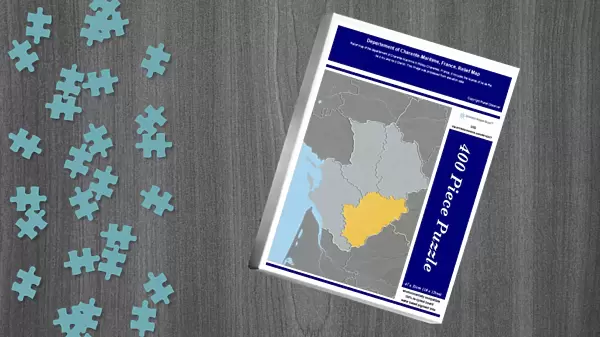
Jigsaw Puzzle : Departement of Charente-Maritime, France, Relief Map


![]()
Jigsaw Puzzles from Universal Images Group (UIG)
Departement of Charente-Maritime, France, Relief Map
Relief map of the departement of Charente-Maritime in Poitou-Charentes, France. It includes the islands of Ile de Re, Ile d Aix and Ile d Oleron. This image was processed from elevation data
Universal Images Group (UIG) manages distribution for many leading specialist agencies worldwide
Media ID 9618227
© Planet Observer
Alsace Bas Rhin Geographical Border Relief Map Satellite View
Jigsaw Puzzle (400 Pieces)
Discover the beauty of Charente-Maritime, France with our intricately designed jigsaw puzzle from Media Storehouse. Featuring a stunning relief map of the departement, this puzzle brings to life the picturesque islands of Ile de Re, Ile d Aix, and Ile d Oleron, nestled in the Poitou-Charentes region. Meticulously crafted from high-quality materials, this puzzle offers a challenging yet rewarding experience for puzzle enthusiasts. Explore the undulating terrain and intricate details of this exquisite map, transporting you to the heart of France. Perfect for individuals seeking a captivating and educational activity, this puzzle is a must-have addition to any home or office.
400 piece puzzles are custom made in the UK and hand-finished on 100% recycled 1.5 mm millboard. There is a level of repetition in jigsaw shapes with each matching piece away from its pair. The completed puzzle measures 31x47cm and is delivered packaged in an attractive presentation box specially designed to fit most letter box slots
Jigsaw Puzzles are an ideal gift for any occasion
Estimated Product Size is 31.5cm x 47.2cm (12.4" x 18.6")
These are individually made so all sizes are approximate
Artwork printed orientated as per the preview above, with landscape (horizontal) or portrait (vertical) orientation to match the source image.
EDITORS COMMENTS
This stunning print showcases the Departement of Charente-Maritime in France, beautifully capturing its intricate relief map. Located in the region of Poitou-Charentes, this department is known for its diverse landscapes and breathtaking islands such as Ile de Re, Ile d Aix, and Ile d Oleron. The image was meticulously processed from elevation data to create a visually striking representation of the area's topography. From rolling hills to valleys and coastal plains, every detail is brought to life through this artful depiction. With vibrant colors and precise cartography, this print offers a unique perspective on the physical geography of Charente-Maritime. The absence of people allows viewers to fully immerse themselves in the natural beauty that defines this region. As you gaze upon this vertical composition, you can almost feel yourself transported to these picturesque landscapes. Whether you have a personal connection to Charente-Maritime or simply appreciate the wonders of our world's geography, this print will surely captivate your imagination. Perfect for enthusiasts of satellite views and outdoor exploration alike, it serves as both an educational tool and a piece of art. Let your eyes wander across geographical borders as you admire the splendor captured within this extraordinary image from Universal Images Group (UIG).
MADE IN THE UK
Safe Shipping with 30 Day Money Back Guarantee
FREE PERSONALISATION*
We are proud to offer a range of customisation features including Personalised Captions, Color Filters and Picture Zoom Tools
SECURE PAYMENTS
We happily accept a wide range of payment options so you can pay for the things you need in the way that is most convenient for you
* Options may vary by product and licensing agreement. Zoomed Pictures can be adjusted in the Basket.