Jigsaw Puzzle > Universal Images Group (UIG) > Universal Images Group > Satellite and Aerial > Planet Observer 4
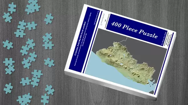
Jigsaw Puzzle : El Salvador, Relief Map With Border and Mask


![]()
Jigsaw Puzzles from Universal Images Group (UIG)
El Salvador, Relief Map With Border and Mask
Relief map of El Salvador (with border and mask). This image was compiled from data acquired by landsat 5 & 7 satellites combined with elevation data
Universal Images Group (UIG) manages distribution for many leading specialist agencies worldwide
Media ID 9613269
© Planet Observer/UIG
Central America Coastline El Salvador Forest Rainforest Relief Map Shore San Salvador Satellite View
Jigsaw Puzzle (400 Pieces)
Discover the beauty and complexity of El Salvador with our Jigsaw Puzzle from Media Storehouse. This intricately designed puzzle features a detailed relief map of El Salvador, complete with borders and a mask. Compiled from satellite data acquired by Landsat 5 & 7, this puzzle offers an educational and engaging experience. Solve the puzzle pieces to reveal the topography and geography of this stunning Central American country. A perfect addition to any home or office, this puzzle is not only fun but also a great conversation starter.
400 piece puzzles are custom made in the UK and hand-finished on 100% recycled 1.5 mm millboard. There is a level of repetition in jigsaw shapes with each matching piece away from its pair. The completed puzzle measures 31x47cm and is delivered packaged in an attractive presentation box specially designed to fit most letter box slots
Jigsaw Puzzles are an ideal gift for any occasion
Estimated Product Size is 47.2cm x 31.5cm (18.6" x 12.4")
These are individually made so all sizes are approximate
Artwork printed orientated as per the preview above, with landscape (horizontal) or portrait (vertical) orientation to match the source image.
EDITORS COMMENTS
This print showcases the stunning relief map of El Salvador, capturing the essence of its diverse landscapes and natural beauty. Compiled from data acquired by landsat 5 & 7 satellites combined with elevation data, this image offers a unique perspective on the physical geography of this Central American gem. The intricate details in this photograph highlight the contrasting features that make El Salvador so enchanting. From lush rainforests to picturesque shorelines, every element is meticulously captured in vibrant colors. The horizontal composition allows viewers to immerse themselves in the rich topography and understand how it shapes the country's identity. With San Salvador at its heart, this relief map reveals not only geographical information but also provides an insight into El Salvador's cultural heritage. The absence of people emphasizes nature's dominance over human presence, allowing us to appreciate the raw beauty untouched by commercialization. Cartography enthusiasts will find joy in studying every contour and curve depicted with precision in this photo print. It serves as a reminder of our planet's incredible diversity and invites exploration beyond borders. Whether you are an avid traveler or simply fascinated by Earth's wonders, this image is a testament to Universal Images Group (UIG)'s commitment to delivering exceptional photography that captures both aesthetic appeal and scientific accuracy.
MADE IN THE UK
Safe Shipping with 30 Day Money Back Guarantee
FREE PERSONALISATION*
We are proud to offer a range of customisation features including Personalised Captions, Color Filters and Picture Zoom Tools
SECURE PAYMENTS
We happily accept a wide range of payment options so you can pay for the things you need in the way that is most convenient for you
* Options may vary by product and licensing agreement. Zoomed Pictures can be adjusted in the Basket.