Home > Animals > Mammals > Muridae > Desert Mouse
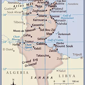
'Relief Map of Tunisie, 1914. Creator: Unknown

![]()
Wall Art and Photo Gifts from Heritage Images
'Relief Map of Tunisie, 1914. Creator: Unknown
'Relief Map of Tunisie, 1914. From "Grande Geographie Bong Illustree", 1914
Heritage Images features heritage image collections
Media ID 36294515
© The Print Collector/Heritage Images
Cartography Colonies Colony Desert Map Making Mapmaking Mediterranean Sea North Africa North African Sahara Sahara Desert Africa
FEATURES IN THESE COLLECTIONS
> Africa
> Tunisia
> Related Images
> Animals
> Mammals
> Muridae
> Desert Mouse
EDITORS COMMENTS
This relief map print, titled "Relief Map of Tunisie," dates back to 1914, hailing from the esteemed publication "Grande Geographie Bong Illustree." The creator of this masterpiece remains unknown, yet its intricate details and exceptional craftsmanship are a testament to the cartographic skills of the era. The map offers a three-dimensional representation of Tunisia, a North African country located in the Mediterranean region. At the time, Tunisia was a French protectorate, and this map reflects the colonial influence of the French Empire. The map's colorful palette highlights various geographical features, including the coastal areas, the Mediterranean Sea, and the vast Sahara Desert. The map's unique relief design showcases the diverse topography of Tunisia, from its mountain ranges and plateaus to its vast expanses of desert and coastal plains. The intricate engravings reveal the location of significant geographical features, such as rivers, lakes, and cities. The map's intricate details offer a glimpse into the colonial era's cartographic practices and the European powers' desire to explore, document, and control the world's diverse landscapes. The map's inclusion in "Grande Geographie Bong Illustree," a prominent geographical publication of the time, underscores its importance as a historical artifact. Today, this relief map print serves as a reminder of the rich history of cartography and the enduring allure of geographical exploration. Its intricate details and stunning design continue to captivate and inspire, offering a glimpse into the world as it was perceived over a century ago.
MADE IN THE UK
Safe Shipping with 30 Day Money Back Guarantee
FREE PERSONALISATION*
We are proud to offer a range of customisation features including Personalised Captions, Color Filters and Picture Zoom Tools
SECURE PAYMENTS
We happily accept a wide range of payment options so you can pay for the things you need in the way that is most convenient for you
* Options may vary by product and licensing agreement. Zoomed Pictures can be adjusted in the Basket.