Greetings Card > Oceania > New Zealand > Maps
Greetings Card : Map / Australia / Nz 1862


![]()
Cards from Mary Evans Picture Library
Map / Australia / Nz 1862
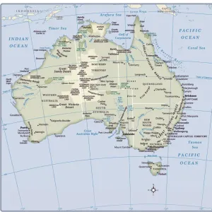
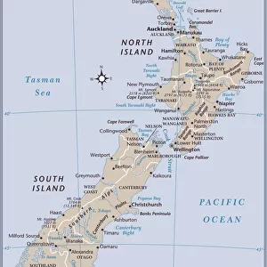
Map of Australia and New Zealand
Mary Evans Picture Library makes available wonderful images created for people to enjoy over the centuries
Media ID 608857
© Mary Evans Picture Library 2015 - https://copyrighthub.org/s0/hub1/creation/maryevans/MaryEvansPictureID/10114191
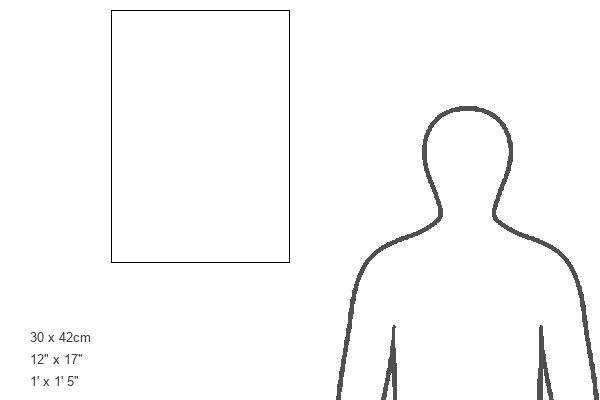
Greetings Card Large (A4)
Introducing the latest addition to our Media Storehouse Greetings Cards collection: a stunning representation of the historical "Map of Australia and New Zealand" from Mary Evans Prints Online, dated 1862. Travel back in time with this intricately detailed map, featuring both countries in their early exploration stages. This exquisite greeting card design is perfect for history buffs, travel enthusiasts, or anyone who appreciates the beauty of vintage maps. Send a piece of the past to your loved ones and let them explore the wonders of Australia and New Zealand from a bygone era.
Create your own large greetings card. Size when folded is A4 (21x30cm or 8.3x11.7 inches)
Greetings Cards suitable for Birthdays, Weddings, Anniversaries, Graduations, Thank You and much more
Estimated Image Size (if not cropped) is 29.7cm x 21cm (11.7" x 8.3")
Estimated Product Size is 29.7cm x 42cm (11.7" x 16.5")
These are individually made so all sizes are approximate
Artwork printed orientated as per the preview above, with landscape (horizontal) orientation to match the source image.
FEATURES IN THESE COLLECTIONS
> Maps and Charts
> Early Maps
> Maps and Charts
> Related Images
> Oceania
> Australia
> Related Images
> Oceania
> New Zealand
> Maps
> Oceania
> New Zealand
> Related Images
EDITORS COMMENTS
This stunning print captures a piece of history with the Map of Australia and New Zealand from 1862. The intricate details on this map showcase the geographical features, cities, and territories of both countries during that time period. It is fascinating to see how these lands were divided and labeled over a century ago.
The Map of Australia and New Zealand serves as a reminder of the rich history and exploration that shaped these nations. From the vast deserts of Australia to the lush landscapes of New Zealand, this map provides a glimpse into the diverse environments that make up these regions.
As we study this historical map, we can appreciate the advancements in cartography and navigation that allowed for such detailed representations to be created. It is truly a work of art that tells a story of discovery and colonization in the southern hemisphere.
Whether you have an interest in geography, history, or simply enjoy admiring antique maps, this print is sure to captivate your imagination. Display it proudly in your home or office as a conversation piece that sparks curiosity about the past.
MADE IN THE UK
Safe Shipping with 30 Day Money Back Guarantee
FREE PERSONALISATION*
We are proud to offer a range of customisation features including Personalised Captions, Color Filters and Picture Zoom Tools
SECURE PAYMENTS
We happily accept a wide range of payment options so you can pay for the things you need in the way that is most convenient for you
* Options may vary by product and licensing agreement. Zoomed Pictures can be adjusted in the Basket.