Greetings Card > Fine Art Storehouse > Map
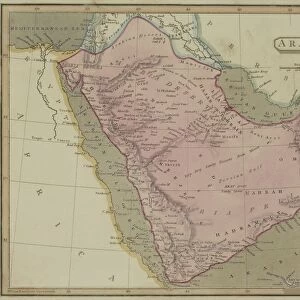
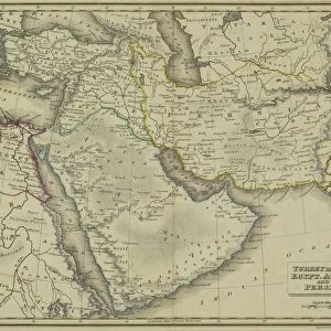
Greetings Card : Antique map of Arabia


![]()
Cards from Fine Art Storehouse
Antique map of Arabia
Unleash your creativity and transform your space into a visual masterpiece!
Hemera Technologies
Media ID 13609433
© Getty Images
Arabian Peninsula Border Direction Document Geography Indian Ocean Iran Latitude Legend Location Longitude Mediterranean Mediterranean Culture Middle East Persia Persian Gulf Place Positioning Red Sea Saudi Arabia Scale Sinai Egypt Sinai Peninsula Suez
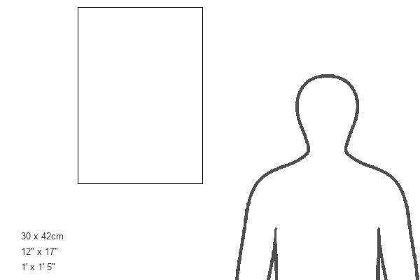
Greetings Card Large (A4)
Add a touch of history and culture to your greetings with Media Storehouse's Antique Map of Arabia card from Fine Art Storehouse. This exquisite greeting card features a beautifully detailed antique map of Arabia by Hemera Technologies. Transport your recipient on a journey through time as they explore the intricate details of this fine art map, adorned with ancient cities and landmarks. Perfect for any occasion, this unique and thoughtful card is sure to leave a lasting impression.
Create your own large greetings card. Size when folded is A4 (21x30cm or 8.3x11.7 inches)
Greetings Cards suitable for Birthdays, Weddings, Anniversaries, Graduations, Thank You and much more
Estimated Image Size (if not cropped) is 29.7cm x 21cm (11.7" x 8.3")
Estimated Product Size is 29.7cm x 42cm (11.7" x 16.5")
These are individually made so all sizes are approximate
Artwork printed orientated as per the preview above, with landscape (horizontal) orientation to match the source image.
FEATURES IN THESE COLLECTIONS
> Fine Art Storehouse
> Map
> Historical Maps
EDITORS COMMENTS
This print showcases an exquisite antique map of Arabia, a true testament to the rich history and cultural significance of this enchanting region. With its intricate details and expert cartography, the map offers a fascinating glimpse into the past. The Arabian Peninsula takes center stage in this archival piece, surrounded by the Indian Ocean, Persian Gulf, Red Sea, and Mediterranean. The borders are meticulously outlined while latitude and longitude lines provide precise positioning. A key and legend add further depth to this historical document. As we delve into this vintage masterpiece, our eyes wander across ancient lands such as Saudi Arabia, Persia (modern-day Iran), Sinai Peninsula (Egypt), and even parts of Africa. It is a visual journey that transports us back in time to explore the Middle East's diverse geography. The horizontal orientation allows us to appreciate every detail with ease. The warm colors evoke a sense of nostalgia while reminding us of the vibrant cultures that have thrived here for centuries. With no people present in the image, we are left alone with our thoughts to ponder upon how these lands have evolved over time. This photograph captures not only physical geography but also mediterranean culture and history itself. Hemera Technologies has masterfully preserved this remarkable piece from their collection at Fine Art Storehouse. It serves as a reminder of our world's interconnectedness throughout history - an invaluable treasure for any lover of art or enthusiast seeking knowledge about distant lands.
MADE IN THE UK
Safe Shipping with 30 Day Money Back Guarantee
FREE PERSONALISATION*
We are proud to offer a range of customisation features including Personalised Captions, Color Filters and Picture Zoom Tools
SECURE PAYMENTS
We happily accept a wide range of payment options so you can pay for the things you need in the way that is most convenient for you
* Options may vary by product and licensing agreement. Zoomed Pictures can be adjusted in the Basket.