Glass Frame > North Wind Picture Archives > Exploration
Glass Frame : EXPL2A-00183


![]()
Mounted Prints from North Wind
EXPL2A-00183
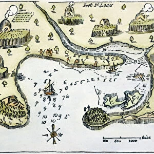
Samuel de Champlains fortified camp at Quebec on the St Lawrence River, 1600s
Hand-colored 19th-century woodcut of a 17th-century map
North Wind Picture Archives brings history to life with stock images and hand-colored illustrations
Media ID 5879604
© North Wind Picture Archives
1600s 17th Century Camp Canada Canadian Champlain Chart Colonial Colonist Colony Discover Drawing Exploration Explore Fort French French Canada Frontier New France New World Outpost Quebec River Samuel De Champlain Settlement Settler Sketch St Lawrence River Wilderness
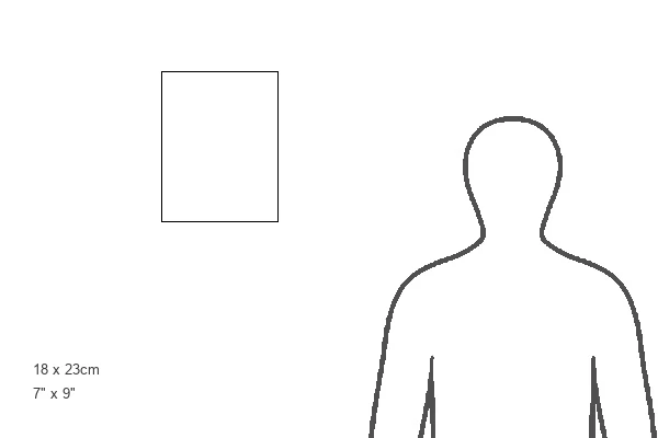
8"x6" Glass Mount
Wall mounted or free-standing, these black edged glass frames feature a smooth chamfered edge and a stylish black border (on back face of the glass). Manufactured from 4mm thick glass, Glass Mounts are a durable, professional way of displaying and protecting your prints. Your 8x6 print is slotted into the back of the frame so can easily be changed if needed.
Tempered Glass Mounts are ideal for wall display, plus the smaller sizes can also be used free-standing via an integral stand
Estimated Image Size (if not cropped) is 15.2cm x 20.3cm (6" x 8")
Estimated Product Size is 17.7cm x 22.8cm (7" x 9")
These are individually made so all sizes are approximate
Artwork printed orientated as per the preview above, with portrait (vertical) orientation to match the source image.
FEATURES IN THESE COLLECTIONS
> North Wind Picture Archives
> Canadian history
> North Wind Picture Archives
> Exploration
> North Wind Picture Archives
> Maps
EDITORS COMMENTS
This print takes us back in time to the 1600s, showcasing Samuel de Champlain's fortified camp at Quebec on the majestic St Lawrence River. Hand-colored with meticulous detail, this 19th-century woodcut of a 17th-century map transports us to an era of exploration and colonial settlement. The image captures the essence of the American wilderness, as we witness a historic frontier fort nestled amidst the untamed Canadian landscape. The illustration beautifully depicts Champlain's vision for a thriving outpost in New France, highlighting his role as a pioneer and colonist. As we delve into this piece of art, we are reminded of the rich history that unfolded along these shores. The French influence is palpable, with Quebec serving as a vital hub for their Canadian endeavors. This visual representation allows us to appreciate how settlers like Champlain played an instrumental role in shaping North America during its early years. The intricate sketch invites us to explore every nook and cranny of this detailed chart. It sparks our curiosity about what life must have been like for those who ventured into uncharted territories centuries ago. With its blend of historical significance and artistic flair, this print serves as both an educational tool and a stunning work of art. It reminds us that beneath modern cities lie stories waiting to be discovered – tales from our past that continue to shape our present-day world.
MADE IN THE UK
Safe Shipping with 30 Day Money Back Guarantee
FREE PERSONALISATION*
We are proud to offer a range of customisation features including Personalised Captions, Color Filters and Picture Zoom Tools
SECURE PAYMENTS
We happily accept a wide range of payment options so you can pay for the things you need in the way that is most convenient for you
* Options may vary by product and licensing agreement. Zoomed Pictures can be adjusted in the Basket.