Glass Frame > Asia > Israel > Jerusalem Heritage Sites > Old City of Jerusalem and its Walls
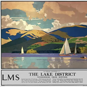
Glass Frame : MA Franklin Wendell Vector Road Map


![]()
Mounted Prints from Fine Art Storehouse
MA Franklin Wendell Vector Road Map
MA Franklin Wendell Vector Road Map. All source data is in the public domain. U.S. Census Bureau Census Tiger. Used Layers: areawater, linearwater, roads, rails, cousub, pointlm, uac10
Unleash your creativity and transform your space into a visual masterpiece!
Frank Ramspott
Media ID 20689649
© Frank Ramspott, all rights reserved
City Map Computer Graphic County Digital Composite District Franklin Geographical Border Massachusetts Road Map Text Vector Bear Mountain Digitally Generated Image Erving Farley Wendell
8"x6" Glass Mount
Wall mounted or free-standing, these black edged glass frames feature a smooth chamfered edge and a stylish black border (on back face of the glass). Manufactured from 4mm thick glass, Glass Mounts are a durable, professional way of displaying and protecting your prints. Your 8x6 print is slotted into the back of the frame so can easily be changed if needed.
Tempered Glass Mounts are ideal for wall display, plus the smaller sizes can also be used free-standing via an integral stand
Estimated Image Size (if not cropped) is 15.2cm x 20.3cm (6" x 8")
Estimated Product Size is 17.7cm x 22.8cm (7" x 9")
These are individually made so all sizes are approximate
Artwork printed orientated as per the preview above, with portrait (vertical) orientation to match the source image.
FEATURES IN THESE COLLECTIONS
> Fine Art Storehouse
> Map
> Reference Maps
> Animals
> Mammals
> Cats (Wild)
> Tiger
> Arts
> Contemporary art
> Digital artwork
> Street art
> Arts
> Street art graffiti
> Digital art
> Digital paintings
> Asia
> Israel
> Jerusalem Heritage Sites
> Old City of Jerusalem and its Walls
> Maps and Charts
> Related Images
> Popular Themes
> Lake District
EDITORS COMMENTS
This print titled "MA Franklin Wendell Vector Road Map" showcases a visually stunning and intricately designed map of Massachusetts. Created by the talented artist Frank Ramspott, this digitally generated image is a true masterpiece in cartography. The map encompasses various layers of information, including areawater, linearwater, roads, rails, cousub, pointlm, and uac10 data sourced from the U. S. Census Bureau Census Tiger database. With its vibrant colors and precise detailing, it offers a comprehensive view of the state's physical geography and geographical borders. While devoid of any human presence or commercial use references, this artwork focuses solely on capturing the essence of Massachusetts' diverse cities and towns. From bustling urban centers to serene lakeside retreats like Bear Mountain and Stoneville; from historic landmarks such as Orcutt Hill to Morse Village's charming streets - every corner is meticulously depicted with utmost accuracy. Franklin Wendell Vector Road Map serves as an ode to both artistry and functionality. Its computer-generated graphics seamlessly blend with traditional cartographic techniques to create a visually striking composition that will captivate any viewer's attention. Whether you're an admirer of maps or simply appreciate fine digital artistry, this print is sure to be a remarkable addition to your collection. Let yourself be transported into the intricate world of Massachusetts' landscapes through this extraordinary piece by Frank Ramspott.
MADE IN THE UK
Safe Shipping with 30 Day Money Back Guarantee
FREE PERSONALISATION*
We are proud to offer a range of customisation features including Personalised Captions, Color Filters and Picture Zoom Tools
SECURE PAYMENTS
We happily accept a wide range of payment options so you can pay for the things you need in the way that is most convenient for you
* Options may vary by product and licensing agreement. Zoomed Pictures can be adjusted in the Basket.