Glass Frame > Arts > Artists > C > Calopodio da Candia
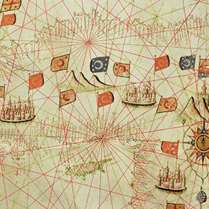
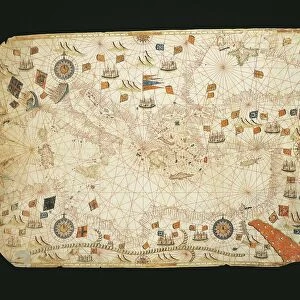
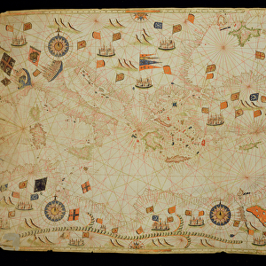
Glass Frame : Egypt and the Red Sea, from a nautical atlas of the Mediterranean and Middle East


Please select a smaller print size for this image
![]()
Mounted Prints from Fine Art Finder
Egypt and the Red Sea, from a nautical atlas of the Mediterranean and Middle East
XOT330930 Egypt and the Red Sea, from a nautical atlas of the Mediterranean and Middle East (ink on vellum) by Calopodio da Candia (fl. 16th century); Museo Correr, Venice, Italy; Italian, out of copyright
Media ID 12852615
© www.bridgemanart.com
Chart Cities Compass Holy Land Mapping Navigation Portolan
7"x5" Glass Mount
Wall mounted or free-standing, these black edged glass frames feature a smooth chamfered edge and a stylish black border (on back face of the glass). Manufactured from 4mm thick glass, Glass Mounts are a durable, professional way of displaying and protecting your prints. Your 7x5 print is slotted into the back of the frame so can easily be changed if needed.
Tempered Glass Mounts are ideal for wall display, plus the smaller sizes can also be used free-standing via an integral stand
Estimated Image Size (if not cropped) is 17.7cm x 12.7cm (7" x 5")
Estimated Product Size is 20.3cm x 16.2cm (8" x 6.4")
These are individually made so all sizes are approximate
Artwork printed orientated as per the preview above, with landscape (horizontal) orientation to match the source image.
FEATURES IN THESE COLLECTIONS
> Fine Art Finder
> Artists
> C
> Calopodio da Candia Calopodio da Candia
> Fine Art Finder
> Artists
> Calopodio da Candia
> Arts
> Artists
> C
> Calopodio da Candia
EDITORS COMMENTS
This print showcases a historic nautical atlas titled "Egypt and the Red Sea" by Calopodio da Candia, a renowned 16th-century Italian cartographer. The artwork is inked on vellum and currently resides in the Museo Correr in Venice, Italy. The map itself is a testament to the artistry and precision of early cartography. It depicts the intricate details of Egypt's coastline along with the mesmerizing expanse of the Red Sea. Every city, port, and flag has been meticulously marked, providing an invaluable resource for sailors navigating these treacherous waters. As we delve into this masterpiece, we are transported back in time to an era when maps were not just utilitarian tools but also works of art. The delicate lines and vibrant colors bring life to each element portrayed – from bustling cities to majestic flags fluttering in the wind. One cannot help but be captivated by this visual representation of history unfolding before our eyes. It serves as a reminder of how far we have come in terms of navigation technology while appreciating the skill and dedication required to create such detailed charts without modern instruments like GPS or satellites. In essence, this print invites us to marvel at both the beauty and functionality inherent in ancient cartography while paying homage to Calopodio da Candia's contribution to our understanding of geographical knowledge during his time.
MADE IN THE UK
Safe Shipping with 30 Day Money Back Guarantee
FREE PERSONALISATION*
We are proud to offer a range of customisation features including Personalised Captions, Color Filters and Picture Zoom Tools
SECURE PAYMENTS
We happily accept a wide range of payment options so you can pay for the things you need in the way that is most convenient for you
* Options may vary by product and licensing agreement. Zoomed Pictures can be adjusted in the Basket.