Glass Coaster > Animals > Fishes > G > Grouper
Glass Coaster : Map of Alaska and adjoining regions, 1882. Creator: Ivan Petrof


![]()
Home Decor from Heritage Images
Map of Alaska and adjoining regions, 1882. Creator: Ivan Petrof
Map of Alaska and adjoining regions, 1882. This multi-sheet map was produced by Ivan Petroff (also seen as Petroof and Petrof), a U.S. Census agent, in 1882, 15 years after Russia's sale of Alaska to the United States. The sheets of this map show the zoogeography of Alaska for various animals, including the typical range for land otter, sea otter, polar bear, brown bear, black bear, red fox, cross fox, black (silver) fox, white and blue Arctic foxes, mink, and marten. The maps use a variety of colors to highlight specific species for easy reference to their habitat and distribution across the region. They also provide ecological information, for example concerning the crisis stemming from the precipitous regional decline of the sea otter. The Russian American Company had severely overhunted this marine mammal for more than a century, owing to the enormous value of its fur, and the relevant map in this set reveals the reduced range of the sea otter in the early American period. Each map assesses related groups of animals and uses unique colors for each species. The maps also include basic geographical information, such as the names of mountain ranges as well as key rivers and bodies of water
Heritage Images features heritage image collections
Media ID 35129427
© Heritage Art/Heritage Images
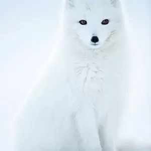
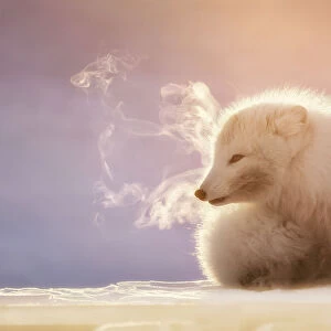
1880s Alaska United States Of America Arctic Ocean Bear Cartographic Cartography Department Of The Interior Government Habitat Map Making Mapmaking Mountain Range North America Ocean Otter Polar Bear Rivers Siberia Russia Species Us Government Arctic Fox Black Bear Brown Bear Ecological Marten Meeting Of Frontiers Mink
Glass Coaster
Individual Glass Coaster. Stylish and elegant polished safety glass, toughened and heat resistant (10x10cm, 7mm thick). Price shown is per individual coaster.
Individual Glass Coaster. Elegant polished safety toughened glass and heat resistant, matching Place Mats are also available
Estimated Image Size (if not cropped) is 7.6cm x 6.2cm (3" x 2.4")
Estimated Product Size is 10cm x 10cm (3.9" x 3.9")
These are individually made so all sizes are approximate
Artwork printed orientated as per the preview above, with landscape (horizontal) orientation to match the source image.
FEATURES IN THESE COLLECTIONS
> Animals
> Fishes
> G
> Grouper
> Animals
> Fishes
> R
> Red Grouper
> Animals
> Mammals
> Arctic Fox
> Animals
> Mammals
> Black Bear
> Animals
> Mammals
> Brown Bear
> Animals
> Mammals
> Cats (Domestic)
> Russian Blue
> Animals
> Mammals
> Cats (Domestic)
> Russian White
> Animals
> Mammals
> Dogs (Wild)
> Arctic Fox
> Animals
> Mammals
> Dogs (Wild)
> Red Fox
> Animals
> Mammals
> Muridae
> Water Mouse
EDITORS COMMENTS
This stunning map print, titled "Map of Alaska and adjoining regions," was created by Ivan Petroff in 1882, fifteen years after the United States purchased Alaska from Russia. Petroff, a U.S. Census agent, meticulously crafted this multi-sheet map to illustrate the zoogeography of Alaska and its surrounding areas, providing valuable insights into the distribution and habitats of various animal species. The maps in this set showcase a range of animals, including the land otter, sea otter, polar bear, brown bear, black bear, red fox, cross fox, black (silver) fox, white Arctic fox, blue Arctic fox, mink, and marten. Each map assesses related groups of animals and uses distinct colors to distinguish between species, making it an essential resource for understanding the regional ecology of the time. Petroff's maps offer more than just a visual representation of animal habitats; they also provide essential ecological information. For instance, the map detailing the sea otter's range reveals the significant decline of this marine mammal population in the early American period. Overhunted for their valuable fur by the Russian American Company for over a century, the sea otter's reduced range is a testament to the devastating impact of overexploitation on wildlife populations. Beyond the animal distribution data, the maps include basic geographical information, such as the names of mountain ranges, key rivers, and bodies of water. This comprehensive representation of Alaska's natural world offers a fascinating glimpse into the region's ecology during the late 19th century. This map print is an essential addition to any collection focusing on Alaska, wildlife, or the history of cartography.
MADE IN THE UK
Safe Shipping with 30 Day Money Back Guarantee
FREE PERSONALISATION*
We are proud to offer a range of customisation features including Personalised Captions, Color Filters and Picture Zoom Tools
SECURE PAYMENTS
We happily accept a wide range of payment options so you can pay for the things you need in the way that is most convenient for you
* Options may vary by product and licensing agreement. Zoomed Pictures can be adjusted in the Basket.