Glass Coaster > Arts > Artists > S > Syrian Syrian
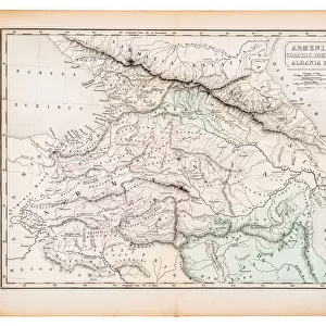
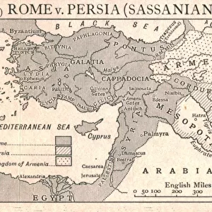
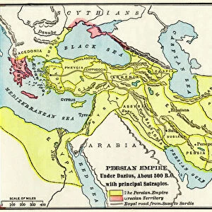
Glass Coaster : Seleucid Empire, 3rd to 2nd century BC, published in 1861


![]()
Home Decor from Fine Art Storehouse
Seleucid Empire, 3rd to 2nd century BC, published in 1861
The Seleucid Empire was created after the death of Alexander the Great and dominated the Near East from the 3rd to 2nd century BC. Legend in Latin language. Steel engraving with hand colored borderlines, published in 1861
Unleash your creativity and transform your space into a visual masterpiece!
Media ID 13666863
© ZU_09
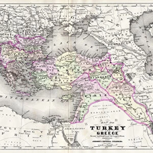
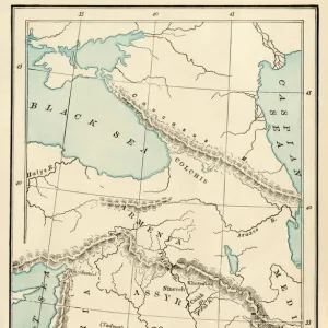
Alexander The Great Anatolia Ancient Greece Armenia Classical Greek Empire Greece Greek Culture Mediterranean Countries Mediterranean Sea Mesopotamian Middle East Near East Steel Engraving Syria Topography Turkey Middle East
Glass Coaster
Individual Glass Coaster. Stylish and elegant polished safety glass, toughened and heat resistant (10x10cm, 7mm thick). Price shown is per individual coaster.
Individual Glass Coaster. Elegant polished safety toughened glass and heat resistant, matching Place Mats are also available
Estimated Image Size (if not cropped) is 7.6cm x 5cm (3" x 2")
Estimated Product Size is 10cm x 10cm (3.9" x 3.9")
These are individually made so all sizes are approximate
Artwork printed orientated as per the preview above, with landscape (horizontal) orientation to match the source image.
FEATURES IN THESE COLLECTIONS
> Fine Art Storehouse
> Map
> Historical Maps
> Arts
> Artists
> S
> Syrian Syrian
> Asia
> Armenia
> Related Images
> Asia
> Related Images
> Asia
> Syria
> Related Images
> Asia
> Turkey
> Related Images
> Europe
> Armenia
> Related Images
EDITORS COMMENTS
This print takes us back in time to the ancient Seleucid Empire, which emerged following the demise of Alexander the Great. Published in 1861, this steel engraving beautifully captures the topography and boundaries of this once-dominant empire that spanned from the 3rd to 2nd century BC. The intricate hand-colored borderlines add a touch of elegance to this historical piece. The map showcases various Mediterranean countries, including Anatolia and Mesopotamia, regions that were at the heart of trade and cultural exchange during classical Greek civilization. The legend inscribed in Latin language further enhances our understanding of this ancient world. As we delve into its details, we can appreciate how vast and influential this empire was, stretching across modern-day Turkey, Syria, Armenia, and parts of Asia. Its strategic location allowed it to flourish as a center for commerce between Europe and Asia. Through this antique print's lens, we are transported to an era when Greek culture thrived alongside other civilizations in the Near East. It serves as a reminder of our rich past and invites us to explore deeper into these fascinating chapters of human history.
MADE IN THE UK
Safe Shipping with 30 Day Money Back Guarantee
FREE PERSONALISATION*
We are proud to offer a range of customisation features including Personalised Captions, Color Filters and Picture Zoom Tools
SECURE PAYMENTS
We happily accept a wide range of payment options so you can pay for the things you need in the way that is most convenient for you
* Options may vary by product and licensing agreement. Zoomed Pictures can be adjusted in the Basket.