Fraud Blocker Skip to main content

From Space Collection (page 10)

"Exploring the vastness of space, we catch a glimpse of our humble abode - the Pale Blue Dot

Background imageFrom Space Collection: SpaceX Dragon capsule at the ISS C016 / 4215

SpaceX Dragon capsule at the ISS C016 / 4215
SpaceX Dragon capsule at the ISS. View from the International Space Station (ISS) of the Dragon cargo capsule from SpaceX (Space Exploration Technologies)

Background imageFrom Space Collection: Pakistan-India at night, ISS image C016 / 4204

Pakistan-India at night, ISS image C016 / 4204
Pakistan-India at night. View from the International Space Station (ISS) of the western Himalayas (left) with the city lights of northern Pakistan and India (upper right) on the Indo-Gangetic Plain

Background imageFrom Space Collection: London, true-colour satellite image C016 / 3888

London, true-colour satellite image C016 / 3888
London and its surrounds, true-colour satellite image. North is at top. The Thames Estuary is at right. London is the capital city of the UK

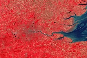
Background imageFrom Space Collection: London, infrared satellite image C016 / 3890

London, infrared satellite image C016 / 3890
London and its surrounds, infrared satellite image. North is at top. The Thames Estuary is at right. This view is used for geological, agricultural

Background imageFrom Space Collection: London, infrared satellite image C016 / 3889

London, infrared satellite image C016 / 3889
London and its surrounds, infrared satellite image. North is at top. The Thames Estuary is at right. This view is used for studies of vegetation

Background imageFrom Space Collection: North-western Europe at night, ISS image C016 / 3892

North-western Europe at night, ISS image C016 / 3892
North-western Europe at night. View from the International Space Station (ISS) of the city lights of north-western Europe. North is at left

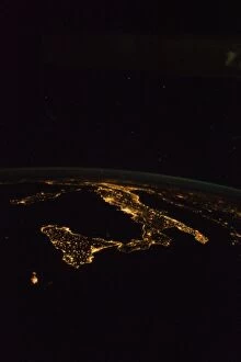
Background imageFrom Space Collection: Italy at night, ISS image C016 / 3891

Italy at night, ISS image C016 / 3891
Italy at night. View from the International Space Station (ISS) of the city lights of Italy. North is towards upper right. Sicily is at lower left, below Sardinia and Corsica

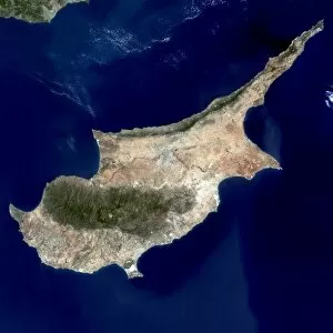
Background imageFrom Space Collection: Cyprus, satellite image C016 / 3887

Cyprus, satellite image C016 / 3887
Cyprus, satellite image. North is at top. Vegetation is green, bare ground is brown and tan, built up areas are grey, and water is dark blue

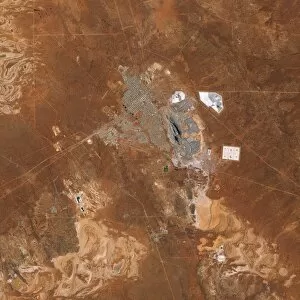
Background imageFrom Space Collection: Kalgoorlie and Super Pit mine, Australia C016 / 3883

Kalgoorlie and Super Pit mine, Australia C016 / 3883
Kalgoorlie and Super Pit mine, Australia

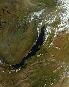
Background imageFrom Space Collection: Lake Baikal, satellite image C016 / 3879

Lake Baikal, satellite image C016 / 3879
Lake Baikal, satellite image. North is at top. Water is blue, vegetation is dark green, drier areas are brown, clouds and snow and ice are white

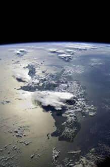
Background imageFrom Space Collection: Isle of Man, satellite image C016 / 3886

Isle of Man, satellite image C016 / 3886
Isle of Man, satellite image. North is at bottom. Visible features include fields and hills (shades of green), beaches and barren or dry areas (brown), clouds (white, across upper left)

Background imageFrom Space Collection: Nukuoro Atoll, ISS image C016 / 3885

Nukuoro Atoll, ISS image C016 / 3885
Nukuoro Atoll. View from the International Space Station (ISS) of Nukuoro Atoll, one of 607 islands that form part of the Federated States of Micronesia

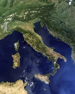
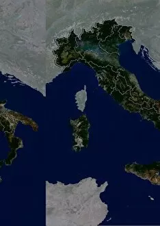
Background imageFrom Space Collection: Italy, satellite image C016 / 3878

Italy, satellite image C016 / 3878
Italy and the surrounding region, satellite image. North is at top. Water is blue, vegetation is dark green, drier areas are brown, clouds and snow and ice are white, and developed areas are grey

Background imageFrom Space Collection: Atlantic hurricanes, August 2010 C016 / 3873

Atlantic hurricanes, August 2010 C016 / 3873
Atlantic hurricanes. Earth globe satellite image showing hurricanes developing in the Atlantic in August 2010. North is at top

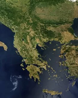
Background imageFrom Space Collection: Greece, satellite image C016 / 3876

Greece, satellite image C016 / 3876
Greece and the surrounding region, satellite image. North is at top. Water is blue, vegetation is dark green, drier areas are brown, clouds are white, and developed areas are grey

Background imageFrom Space Collection: Saharan dust plume, Bay of Biscay C016 / 3874

Saharan dust plume, Bay of Biscay C016 / 3874
Saharan dust plume, Bay of Biscay. Satellite image of a dust plume (brown) from the Sahara, stretching across the Bay of Biscay and the Atlantic from Spain (lower right) to Ireland and the UK (top)

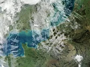
Background imageFrom Space Collection: Contrails over the English Channel C016 / 3875

Contrails over the English Channel C016 / 3875
Contrails over the English Channel, satellite image. Contrails (condensation trails) are artificial clouds formed from frozen water droplets from the exhaust of the engines of an aircraft

Background imageFrom Space Collection: Cloud layers, ISS image C016 / 3872

Cloud layers, ISS image C016 / 3872
Cloud layers. View from the International Space Station (ISS) of cloud layers in Earths atmosphere over eastern Brazil. The blue haze is the upper regions of Earths atmosphere

Background imageFrom Space Collection: Thunderstorms, space shuttle image C016 / 3867

Thunderstorms, space shuttle image C016 / 3867
Thunderstorms. Space shuttle image of multiple thunderstorm cells (lower frame and at upper right) in Earths atmosphere. This view is from the space shuttle Discovery

Background imageFrom Space Collection: Hispaniola, ISS image C016 / 3868

Hispaniola, ISS image C016 / 3868
Hispaniola. View from the International Space Station (ISS) of the island of Hispaniola (foreground) with Cuba extending over the horizon at top. North is at right. Jamaica is at upper left

Background imageFrom Space Collection: North Africa and Europe, satellite image C016 / 3866

North Africa and Europe, satellite image C016 / 3866
North Africa and Europe, satellite image. North is towards top. Clouds (white) are seen over most of Europe, with a cloud-free view over the vast expanse of the Sahara (brown) in North Africa

Background imageFrom Space Collection: Moonrise over Earth, ISS image C016 / 3865

Moonrise over Earth, ISS image C016 / 3865
Moonrise over Earth. Composite of three images of the Full Moon, obscured and distorted by Earths atmosphere, as seen from the International Space Station (ISS)

Background imageFrom Space Collection: Sea surface temperature, 2010 global map C016 / 3800

Sea surface temperature, 2010 global map C016 / 3800
Sea surface temperature, 2010 global map. The worlds oceans are heated by sunlight, with variations in the surface temperature caused by varying latitude, the Earths rotation, and axial tilt

Background imageFrom Space Collection: Sea surface salinity, 2012 global map C016 / 3796

Sea surface salinity, 2012 global map C016 / 3796
Sea surface salinity, 20 January 2012 global map. The salinity (salt content) of the sea surface, used in climate models, depends on sea surface temperature and evaporation, winds

Background imageFrom Space Collection: Earths atmosphere, cutaway Earth globe

Earths atmosphere, cutaway Earth globe. Computer graphic of an Earth globe centred on the Atlantic Ocean and a cutaway atmosphere, generated using satellite and mapping data

Background imageFrom Space Collection: Dusk over the Americas, Earth globe C016 / 3730

Dusk over the Americas, Earth globe C016 / 3730
Dusk over the Americas, Earth globe. Computer graphic of a crescent Earth globe centred on the northern Atlantic, generated using satellite and mapping data

Background imageFrom Space Collection: Dawn over Europe and Africa, Earth globe C016 / 3729

Dawn over Europe and Africa, Earth globe C016 / 3729
Waxing crescent Moon. Image 5 of 27. Optical image of a waxing (increasing in apparent size) crescent Moon 5 days into its 28-day cycle

Background imageFrom Space Collection: Atlantic Ocean, cloud-free C016 / 3728

Atlantic Ocean, cloud-free C016 / 3728
Atlantic Ocean, cloud-free. Computer graphic of the Atlantic Ocean on an Earth globe, generated using satellite and mapping data

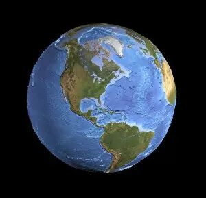
Background imageFrom Space Collection: The Americas, sea floor topography C016 / 3726

The Americas, sea floor topography C016 / 3726
The Americas, sea floor topography. Computer graphic of an Earth globe centred on the Americas, generated using satellite and mapping data

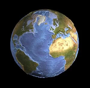
Background imageFrom Space Collection: Atlantic Ocean, sea floor topography C016 / 3725

Atlantic Ocean, sea floor topography C016 / 3725
Atlantic Ocean, sea floor topography. Computer graphic of an Earth globe centred on the Atlantic Ocean, generated using satellite and mapping data

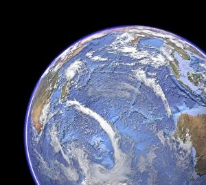
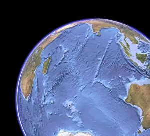
Background imageFrom Space Collection: Indian Ocean, sea floor topography C016 / 3723

Indian Ocean, sea floor topography C016 / 3723
Indian Ocean, sea floor topography and clouds. Computer graphic of the Indian Ocean on an Earth globe, generated using satellite and mapping data

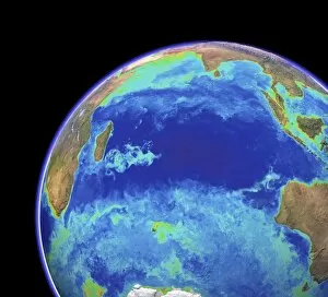
Background imageFrom Space Collection: Indian Ocean, chlorophyll concentration C016 / 3722

Indian Ocean, chlorophyll concentration C016 / 3722
Indian Ocean, chlorophyll concentration and clouds. Computer graphic of the Indian Ocean on an Earth globe, generated using satellite and mapping data

Background imageFrom Space Collection: Indian Ocean, chlorophyll and bathymetry C016 / 3721

Indian Ocean, chlorophyll and bathymetry C016 / 3721
Indian Ocean, chlorophyll concentration and bathymetry with clouds. Computer graphic of the Indian Ocean on an Earth globe, generated using satellite and mapping data

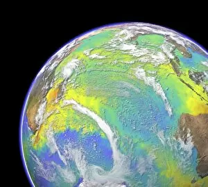
Background imageFrom Space Collection: Indian Ocean, surface temperatures C016 / 3720

Indian Ocean, surface temperatures C016 / 3720
Indian Ocean, surface temperatures and clouds. Computer graphic of the Indian Ocean on an Earth globe, generated using satellite and mapping data

Background imageFrom Space Collection: Indian Ocean, satellite imaging data C016 / 3718

Indian Ocean, satellite imaging data C016 / 3718
Indian Ocean, satellite imaging data. Computer graphic of the Indian Ocean on an Earth globe, showing the various parameters that can be measured by satellite instruments

Background imageFrom Space Collection: Indian Ocean, chlorophyll and bathymetry

Indian Ocean, chlorophyll and bathymetry
Indian Ocean, chlorophyll concentration and bathymetry. Computer graphic of the Indian Ocean on an Earth globe, generated using satellite and mapping data

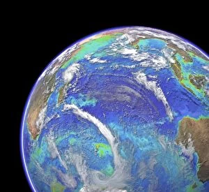
Background imageFrom Space Collection: Indian Ocean, with clouds C016 / 3714

Indian Ocean, with clouds C016 / 3714
Indian Ocean, with clouds. Computer graphic of the Indian Ocean on an Earth globe, generated using satellite and mapping data

Background imageFrom Space Collection: Indian Ocean, surface temperatures C016 / 3716

Indian Ocean, surface temperatures C016 / 3716
Indian Ocean, surface temperatures. Computer graphic of the Indian Ocean on an Earth globe, generated using satellite and mapping data. Cloud-free satellite images show the natural land colours

Background imageFrom Space Collection: Indian Ocean, sea floor topography C016 / 3715

Indian Ocean, sea floor topography C016 / 3715
Indian Ocean, sea floor topography. Computer graphic of the Indian Ocean on an Earth globe, generated using satellite and mapping data

Background imageFrom Space Collection: Indian Ocean, cloud-free C016 / 3713

Indian Ocean, cloud-free C016 / 3713
Indian Ocean, cloud-free. Computer graphic of the Indian Ocean on an Earth globe, generated using satellite and mapping data

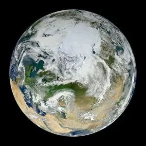
Background imageFrom Space Collection: Earth, satellite image C016 / 3076

Earth, satellite image C016 / 3076
Earth. Blue Marble satellite image of the Earth, showing the North Pole (white, upper centre), Europe (centre left) and Asia (centre right)

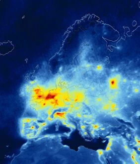
Background imageFrom Space Collection: European nitrogen dioxide emissions, 2008 C016 / 3063

European nitrogen dioxide emissions, 2008 C016 / 3063
European nitrogen dioxide emissions, 2008. Map of Europe showing average annual tropospheric nitrogen dioxide (NO2) measurements as recorded by the Ozone Monitoring Instrument (OMI)

Background imageFrom Space Collection: Mexico State, Mexico, satellite image

Mexico State, Mexico, satellite image
Mexico City, satellite image. North is at top. Natural colour satellite image showing the state of Mexico City, Mexico, with the surrounding Mexican states shaded out

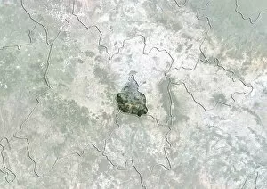
Background imageFrom Space Collection: Mexico State, Mexico, satellite image C014 / 0071

Mexico State, Mexico, satellite image C014 / 0071
Mexico City, satellite image. North is at top. Natural colour satellite image showing the state of Mexico City, Mexico, with the surrounding Mexican states shaded out

Background imageFrom Space Collection: Chihuahua, Mexico, satellite image

Chihuahua, Mexico, satellite image
Chihuahua, satellite image. North is at top. Natural colour satellite image showing the state of Chihuahua, Mexico, with the surrounding Mexican states shaded out

Background imageFrom Space Collection: Italy, satellite image C014 / 0065

Italy, satellite image C014 / 0065
Italy, satellite image. North is at top. Natural colour satellite image showing Italy divided into its 20 regions. Italy is located in south-central Europe and is bordered by France (upper left)

Background imageFrom Space Collection: Lower Saxony, Germany, satellite image

Lower Saxony, Germany, satellite image
Lower Saxony, satellite image. North is at top. Natural colour satellite image showing the state of Lower Saxony, Germany, with the surrounding German states shaded out

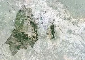
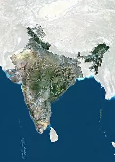
Background imageFrom Space Collection: Madhya Pradesh, India, satellite image

Madhya Pradesh, India, satellite image
Madhya Pradesh, satellite image. North is at top. Natural colour satellite image showing the state of Madhya Pradesh, India, with the surrounding Indian states shaded out


All Professionally Made to Order for Quick Shipping

"Exploring the vastness of space, we catch a glimpse of our humble abode - the Pale Blue Dot. Voyager 1's iconic image reminds us of Earth's insignificance in the grand scheme of things. " "The breathtaking Earthrise over Moon captured by Apollo 8 serves as a reminder that even from space, our home planet remains an awe-inspiring sight to behold. " "A mesmerizing view of the Whole Earth, also known as Blue Marble 2000, showcases the stunning beauty and fragility of our precious planet. " "From high above, a satellite image reveals the intricate details and natural splendor of the British Isles, offering a unique perspective on this enchanting region. " "As night falls upon the UK, its illuminated cities create a dazzling spectacle when viewed from space. The vibrant lights paint a picture of human activity against the dark canvas of night. " "Gazing down at Europe at night through satellite imagery unveils an interconnected web of bustling metropolises and tranquil landscapes intertwined under twinkling stars. " "Inspired by darkness, Europe at night captivates with its ethereal glow emanating from countless cities scattered across its diverse lands. A testament to humanity's constant motion even after sunset. " "Astonishingly beautiful yet hauntingly mysterious, witnessing Whole Earth at night through satellite imagery evokes contemplation about our place in this vast universe and how we illuminate it with life. " "Jupiter and Io dance gracefully in their celestial ballet as captured by New Horizons' lens. This captivating image transports us beyond our own world into realms where giants roam amidst swirling storms. " "Awe-inspiring from any angle; an exquisite satellite image captures Earth's majestic presence against infinite blackness. A reminder that every corner holds hidden wonders waiting to be discovered. "With remarkable clarity seen from above Scotland within UK is unveiled like never before through detailed satellite imaging—a land steeped in history and adorned with rugged beauty.