Fraud Blocker Skip to main content

From Space Collection (page 9)

"Exploring the vastness of space, we catch a glimpse of our humble abode - the Pale Blue Dot

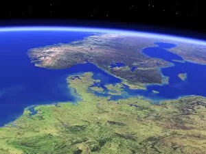
Background imageFrom Space Collection: Northern Europe, satellite artwork C015 / 6583

Northern Europe, satellite artwork C015 / 6583
Northern Europe. Simulated panoramic satellite image of northern Europe taken from low Earth orbit, created using a cloud-free mosaic of satellite images
Background imageFrom Space Collection: Scandinavia, satellite artwork C015 / 6582

Scandinavia, satellite artwork C015 / 6582
Scandinavia. Simulated satellite image of Scandinavia taken from low Earth orbit, created using a cloud-free mosaic of satellite images

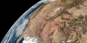
Background imageFrom Space Collection: US South West, satellite artwork C015 / 6578

US South West, satellite artwork C015 / 6578
US South West. Simulated panoramic satellite image of the southwestern United States taken from low Earth orbit. Image created using a cloud-free mosaic of satellite images of the Earths surface

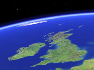
Background imageFrom Space Collection: British Isles, satellite artwork C015 / 6581

British Isles, satellite artwork C015 / 6581
British Isles. Simulated satellite image of the British Isles taken from low Earth orbit, created using a cloud-free mosaic of satellite images

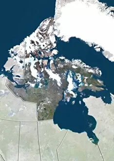
Background imageFrom Space Collection: Nunavut, Canada, satellite image

Nunavut, Canada, satellite image. North is at top. Natural colour satellite image showing the Canadian province of Nunavut

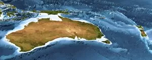
Background imageFrom Space Collection: Australia and New Zealand, 3D artwork C015 / 6576

Australia and New Zealand, 3D artwork C015 / 6576
Australia and New Zealand. 3D computer graphic map of Australia and New Zealand, and the surrounding sea floor in the Pacific and Southern oceans

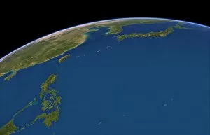
Background imageFrom Space Collection: Philippine Sea, satellite artwork C015 / 6580

Philippine Sea, satellite artwork C015 / 6580
Philippine Sea. Simulated satellite map of the Philippine Sea in perspective projection, taken from low Earth orbit over the western Pacific Ocean

Background imageFrom Space Collection: Tocantins, Brazil, satellite image

Tocantins, Brazil, satellite image
Amazonas, Brazil. North is at top. Natural colour satellite image showing the state of Tocantins in Brazil, with the surrounding states shaded out

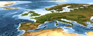
Background imageFrom Space Collection: Europe, 3D artwork C015 / 6574

Europe, 3D artwork C015 / 6574
Europe. 3D computer graphic map of Europe and the surrounding sea floor in the Atlantic Ocean and Mediterranean Sea. Image based on cloud-free satellite imagery, digital terrain and bathymetry data

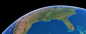
Background imageFrom Space Collection: US Southern States, satellite artwork C015 / 6577

US Southern States, satellite artwork C015 / 6577
US Southern States. Simulated panoramic satellite image of the southern United States taken from low Earth orbit over the Gulf of Mexico

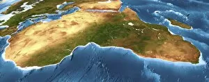
Background imageFrom Space Collection: Africa, 3D artwork C015 / 6573

Africa, 3D artwork C015 / 6573
Africa. 3D computer graphic map of Africa and the surrounding sea floor in the Atlantic and Indian oceans. Image based on cloud-free satellite imagery, digital terrain and bathymetry data

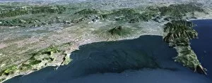
Background imageFrom Space Collection: Mount Vesuvius, 3D artwork C015 / 6570

Mount Vesuvius, 3D artwork C015 / 6570
Mount Vesuvius. Simulated 3D high-altitude panoramic view of Mount Vesuvius and the Bay of Naples, Italy, viewed from the west

Background imageFrom Space Collection: Alberta, Canada, satellite image

Alberta, Canada, satellite image
Alberta, Canada. North is at top. Natural colour satellite image showing the Canadian province of Alberta with the surrounding provinces and territories shaded out

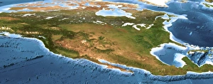
Background imageFrom Space Collection: North America, 3D artwork C015 / 6571

North America, 3D artwork C015 / 6571
North America. 3D computer graphic map of North America and the surrounding sea floor in the Pacific and Atlantic oceans. Image based on cloud-free satellite imagery

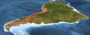
Background imageFrom Space Collection: South America, 3D artwork C015 / 6572

South America, 3D artwork C015 / 6572
South America. 3D computer graphic map of South America and the surrounding sea floor in the Atlantic and Pacific oceans. Image based on cloud-free satellite imagery

Background imageFrom Space Collection: The Himalayas, 3D artwork C015 / 6569

The Himalayas, 3D artwork C015 / 6569
The Himalayas. Simulated 3D high-altitude panoramic view of the Himalayas viewed from the southeast. Image based on cloud-free satellite images and detailed digital terrain data

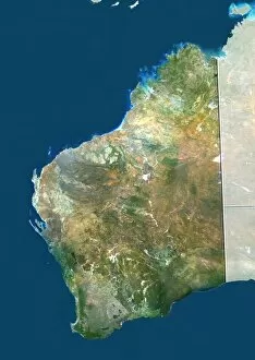
Background imageFrom Space Collection: Western Australia

Western Australia. True colour satellite image showing the state of Western Australia, with the surrounding states and territories shaded out, the Great Australian Bight (blue, bottom right)

Background imageFrom Space Collection: Southern Alps, New Zealand, 3D artwork C015 / 6567

Southern Alps, New Zealand, 3D artwork C015 / 6567
Southern Alps. Simulated 3D high-altitude panoramic view of the Southern Alps on New Zealands South Island, viewed from the southwest

Background imageFrom Space Collection: The Alps, 3D artwork C015 / 6563

The Alps, 3D artwork C015 / 6563
The Alps. Simulated 3D high-altitude panoramic view of the Alps, viewed from the west. Image based on Landsat satellite images and detailed digital terrain data

Background imageFrom Space Collection: Mount Kilimanjaro, Tanzania, 3D artwork C015 / 6565

Mount Kilimanjaro, Tanzania, 3D artwork C015 / 6565
Mount Kilimanjaro. Simulated 3D high-altitude panoramic view of Mount Kilimanjaro, Tanzanian, viewed from the southeast. Image based on Landsat satellite images and detailed digital terrain data

Background imageFrom Space Collection: Hawaiian Islands, 3D artwork C015 / 6568

Hawaiian Islands, 3D artwork C015 / 6568
Hawaiian Islands. Simulated 3D high-altitude view of the Hawaiian Islands, viewed from the east. Image based on Landsat satellite images and detailed digital terrain data

Background imageFrom Space Collection: Mount Etna, Italy, 3D artwork C015 / 6564

Mount Etna, Italy, 3D artwork C015 / 6564
Mount Etna. Simulated 3D high-altitude panoramic view of Mount Etna, Italy, viewed from the south. Image based on Landsat satellite images and detailed digital terrain data

Background imageFrom Space Collection: Victoria, Australia

Victoria, Australia. True colour satellite image showing the state of Victoria, Australia, with the surrounding states and territories shaded out, and the Great Australian Bight (blue) at bottom

Background imageFrom Space Collection: Mount Fuji, Japan, 3D artwork C015 / 6566

Mount Fuji, Japan, 3D artwork C015 / 6566
Mount Fuji. Simulated 3D high-altitude panoramic view of Mount Fuji, Japan, viewed from the west. Image based on Landsat satellite images and detailed digital terrain data

Background imageFrom Space Collection: South Australia

South Australia. True colour satellite image showing the state of South Australia, with the surrounding states and territories shaded out, and the Great Australian Bight (blue) at bottom

Background imageFrom Space Collection: Northern Territory, Australia

Northern Territory, Australia. Natural colour satellite image showing Australias Northern Territory, with the surrounding states and territories shaded out

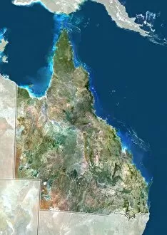
Background imageFrom Space Collection: Queensland, Australia

Queensland, Australia. True colour satellite image showing the state of Queensland, Australia, with the surrounding states and territories shaded out, and the island of New Guinea at top

Background imageFrom Space Collection: New South Wales, Australia

New South Wales, Australia. True colour satellite image showing the state of New South Wales, Australia, with the surrounding states and territories shaded out

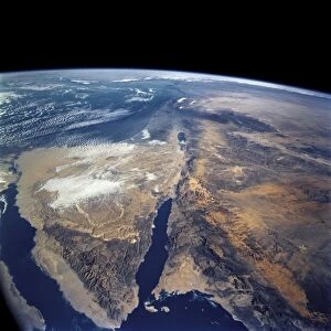
Background imageFrom Space Collection: Earth from space, astronaut photo C014 / 0570

Earth from space, astronaut photo C014 / 0570
Earth from space, astronaut photo. Image taken by the STS-109 crew members onboard Space Shuttle Columbia. This image shows the Red Sea (blue, lower left), Sinai Peninsula (triangular)

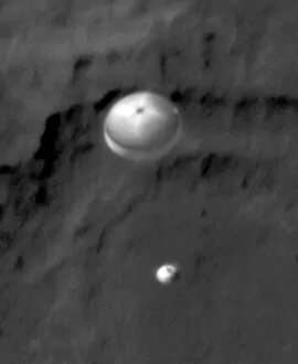
Background imageFrom Space Collection: Curiosity rover descending to Mars C014 / 0576

Curiosity rover descending to Mars C014 / 0576
Curiosity rover descending to Mars. Satellite image showing NASAs Curiosity Rover floating under a parachute to the Martian surface

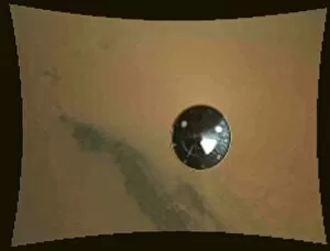
Background imageFrom Space Collection: Curiosity rovers descent

Curiosity rovers descent. Image taken by NASAs Curiosity Rover during its descent to the surface of Mars on 6th August 2012 (EDT), showing its heat shield (round) below it

Background imageFrom Space Collection: Curiosity rover descending to Mars C014 / 0575

Curiosity rover descending to Mars C014 / 0575
Curiosity rover descending to Mars. Satellite image showing NASAs Curiosity rover floating under a parachute to the Martian surface

Background imageFrom Space Collection: West Africa, satellite image

West Africa, satellite image
West Africa. Satellite image centre over West Africa, with Spain and Portugal on the Iberian Peninsula at upper right

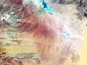
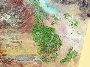
Background imageFrom Space Collection: Saudi Arabia agriculture, 2000

Saudi Arabia agriculture, 2000
Saudi Arabia agriculture. False-colour satellite image showing the extent of agricultural operations in the Wadi As-Sirhan Basin of Saudi Arabia in 2000

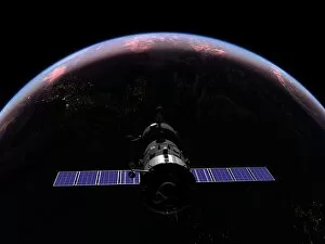
Background imageFrom Space Collection: Soyuz spacecraft in Earth orbit, artwork

Soyuz spacecraft in Earth orbit, artwork
Soyuz spacecraft in Earth orbit. Artwork of a Soyuz TMA-M spacecraft at sunset over the Atlantic Ocean at an orbital altitude of 320 kilometres

Background imageFrom Space Collection: Saudi Arabia agriculture, 1987

Saudi Arabia agriculture, 1987
Saudi Arabia agriculture. False-colour satellite image showing the extent of agricultural operations in the Wadi As-Sirhan Basin of Saudi Arabia in 1987

Background imageFrom Space Collection: Saudi Arabia agriculture, 1991

Saudi Arabia agriculture, 1991
Saudi Arabia agriculture. False-colour satellite image showing the extent of agricultural operations in the Wadi As-Sirhan Basin of Saudi Arabia in 1991

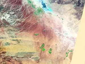
Background imageFrom Space Collection: Saudi Arabia agriculture, 2012

Saudi Arabia agriculture, 2012
Saudi Arabia agriculture. False-colour satellite image showing the extent of agricultural operations in the Wadi As-Sirhan Basin of Saudi Arabia in 2012

Background imageFrom Space Collection: Lake Baikal, Russia, satellite image C015 / 4568

Lake Baikal, Russia, satellite image C015 / 4568
Lake Baikal. Satellite image showing ice breaking up in the central part of the lake Baikal, Russia. Ice remains throughout the northern portion

Background imageFrom Space Collection: Venus from space, artwork C017 / 7814

Venus from space, artwork C017 / 7814
Venus from space. Computer artwork of the planet Venus. Venus is the second planet from the Sun. It is both the closest planet to Earth and the closest to Earth in size

Background imageFrom Space Collection: Iberian Peninsula, satellite image

Iberian Peninsula, satellite image
Iberian Peninsula. North is at top. Satellite image centre on the Iberian Peninsula, showing Spain and Portugal, with France at upper right

Background imageFrom Space Collection: Ouarkziz Impact Crater from space

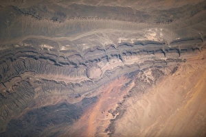
Ouarkziz Impact Crater from space
Ouarkziz Impact Crater. Image of the Ouarkziz Impact Crater, Algeria, taken by an astronaut on board the International Space Station

Background imageFrom Space Collection: Origins of life, conceptual artwork C016 / 4666

Origins of life, conceptual artwork C016 / 4666
Origins of life, conceptual computer artwork

Background imageFrom Space Collection: SpaceX Dragon capsule at the ISS C016 / 4215

SpaceX Dragon capsule at the ISS C016 / 4215
SpaceX Dragon capsule at the ISS. View from the International Space Station (ISS) of the Dragon cargo capsule from SpaceX (Space Exploration Technologies)

Background imageFrom Space Collection: Pakistan-India at night, ISS image C016 / 4204

Pakistan-India at night, ISS image C016 / 4204
Pakistan-India at night. View from the International Space Station (ISS) of the western Himalayas (left) with the city lights of northern Pakistan and India (upper right) on the Indo-Gangetic Plain

Background imageFrom Space Collection: London, true-colour satellite image C016 / 3888

London, true-colour satellite image C016 / 3888
London and its surrounds, true-colour satellite image. North is at top. The Thames Estuary is at right. London is the capital city of the UK

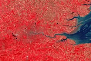
Background imageFrom Space Collection: London, infrared satellite image C016 / 3890

London, infrared satellite image C016 / 3890
London and its surrounds, infrared satellite image. North is at top. The Thames Estuary is at right. This view is used for geological, agricultural

Background imageFrom Space Collection: London, infrared satellite image C016 / 3889

London, infrared satellite image C016 / 3889
London and its surrounds, infrared satellite image. North is at top. The Thames Estuary is at right. This view is used for studies of vegetation


All Professionally Made to Order for Quick Shipping

"Exploring the vastness of space, we catch a glimpse of our humble abode - the Pale Blue Dot. Voyager 1's iconic image reminds us of Earth's insignificance in the grand scheme of things. " "The breathtaking Earthrise over Moon captured by Apollo 8 serves as a reminder that even from space, our home planet remains an awe-inspiring sight to behold. " "A mesmerizing view of the Whole Earth, also known as Blue Marble 2000, showcases the stunning beauty and fragility of our precious planet. " "From high above, a satellite image reveals the intricate details and natural splendor of the British Isles, offering a unique perspective on this enchanting region. " "As night falls upon the UK, its illuminated cities create a dazzling spectacle when viewed from space. The vibrant lights paint a picture of human activity against the dark canvas of night. " "Gazing down at Europe at night through satellite imagery unveils an interconnected web of bustling metropolises and tranquil landscapes intertwined under twinkling stars. " "Inspired by darkness, Europe at night captivates with its ethereal glow emanating from countless cities scattered across its diverse lands. A testament to humanity's constant motion even after sunset. " "Astonishingly beautiful yet hauntingly mysterious, witnessing Whole Earth at night through satellite imagery evokes contemplation about our place in this vast universe and how we illuminate it with life. " "Jupiter and Io dance gracefully in their celestial ballet as captured by New Horizons' lens. This captivating image transports us beyond our own world into realms where giants roam amidst swirling storms. " "Awe-inspiring from any angle; an exquisite satellite image captures Earth's majestic presence against infinite blackness. A reminder that every corner holds hidden wonders waiting to be discovered. "With remarkable clarity seen from above Scotland within UK is unveiled like never before through detailed satellite imaging—a land steeped in history and adorned with rugged beauty.