Fraud Blocker Skip to main content

Cartographic Collection (page 5)

"Unveiling the World Through Cartographic Masterpieces" Step back in time and embark on a journey through history with these captivating cartographic treasures

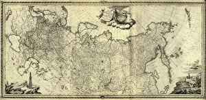
Background imageCartographic Collection: Imperial Map of Russia, 1890

Imperial Map of Russia, 1890
2902726 Imperial Map of Russia, 1890; (add.info.: Imperial Map of Russia, 1890.); Buyenlarge Archive/UIG.

Background imageCartographic Collection: Egypt, Syria - Arabia, 1700s

Egypt, Syria - Arabia, 1700s
2902289 Egypt, Syria - Arabia, 1700s; (add.info.: Egypt, Syria - Arabia, 1700s.); Buyenlarge Archive/UIG.

Background imageCartographic Collection: Central Asia, 1885

Central Asia, 1885
2902279 Central Asia, 1885; (add.info.: Afghanistan and her relation to British and Russian territories.); Buyenlarge Archive/UIG.

Background imageCartographic Collection: Afghanistan - Beluchistan, 1893

Afghanistan - Beluchistan, 1893
2902269 Afghanistan - Beluchistan, 1893; (add.info.: Afghanistan - Beluchistan, 1893.); Buyenlarge Archive/UIG.

Background imageCartographic Collection: Population of New Spain, 1885

Population of New Spain, 1885
2902263 Population of New Spain, 1885; (add.info.: Population Bar Map. Printed in Spanish.); Buyenlarge Archive/UIG.

Background imageCartographic Collection: Map of Mexican Public Education, Schools, Colleges - Universities, 1885

Map of Mexican Public Education, Schools, Colleges - Universities, 1885
2902257 Map of Mexican Public Education, Schools, Colleges - Universities, 1885; (add.info.: Map of Mexican Public Education, Schools, Colleges - Universities, 1885.); Buyenlarge Archive/UIG.

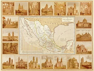
Background imageCartographic Collection: Ecclesiastical Map of Mexico, 1885

Ecclesiastical Map of Mexico, 1885
2902255 Ecclesiastical Map of Mexico, 1885; (add.info.: Ecclesiastical Map of Mexico. Map surrounded by Churches - Cathedrals. Printed in Spanish.); Buyenlarge Archive/UIG.

Background imageCartographic Collection: Map of America

Map of America
2902810 Map of America; (add.info.: Map of America, Western Hemisphere, 1781.); Buyenlarge Archive/UIG.

Background imageCartographic Collection: Pittsburg, Allegheny - Birmingham, 1871

Pittsburg, Allegheny - Birmingham, 1871
2903021 Pittsburg, Allegheny - Birmingham, 1871; (add.info.: Pittsburg, Allegheny - Birmingham, 1871.); Buyenlarge Archive/UIG.

Background imageCartographic Collection: Imperial Russia, 1776

Imperial Russia, 1776
2902736 Imperial Russia, 1776; (add.info.: Imperial Russia, 1776.); Buyenlarge Archive/UIG.

Background imageCartographic Collection: Ukraine

Ukraine
2901937 Ukraine; (add.info.: The predecessor of Odessa, - small Tatar settlement, was founded by Hac - Giray, the Khan of Crimea, in 1440 and originally named after him as Hac?bey)

Background imageCartographic Collection: St Petersburg, Russia, 1703

St Petersburg, Russia, 1703
2902725 St Petersburg, Russia, 1703; (add.info.: St. Petersburg, Russia, 1703.); Buyenlarge Archive/UIG.

Background imageCartographic Collection: English - French Possessions in North America, 1763

English - French Possessions in North America, 1763
2902793 English - French Possessions in North America, 1763; (add.info.: English - French Possessions in North America, 1763.); Buyenlarge Archive/UIG.

Background imageCartographic Collection: City Plan, Moscow

City Plan, Moscow
2902735 City Plan, Moscow; (add.info.: City Plan, Moscow, Russia, 1745.); Buyenlarge Archive/UIG.

Background imageCartographic Collection: Russia, Tomsk, 1898

Russia, Tomsk, 1898
2902724 Russia, Tomsk, 1898; (add.info.: Russia, Tomsk, 1898.); Buyenlarge Archive/UIG.

Background imageCartographic Collection: Ethnographic Map of Mexico, 1885

Ethnographic Map of Mexico, 1885
2902254 Ethnographic Map of Mexico, 1885; (add.info.: Ethnographic Map surrounded by the people in Mexico in their native costumes. Printed in Spanish.); Buyenlarge Archive/UIG.

Background imageCartographic Collection: Vincenza, Italy

Vincenza, Italy
2901900 Vincenza, Italy; (add.info.: Founded by Ligurians in 1st cen. BCE; gained independence in 1164 and joined Lombard League; was destroyed by Emperor Frederick II in 1236; ruled by Della Scala)

Background imageCartographic Collection: Map of Imperial Russia, 1745

Map of Imperial Russia, 1745
2902741 Map of Imperial Russia, 1745; (add.info.: Map of Imperial Russia, 1745.); Buyenlarge Archive/UIG.

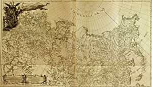
Background imageCartographic Collection: Russian Tartary, 1745

Russian Tartary, 1745
2902748 Russian Tartary, 1745; (add.info.: Russian Tartary, 1745.); Buyenlarge Archive/UIG.

Background imageCartographic Collection: Map of the Nerchinsk Region from the Office of His Majesty, 1914. Creator

Map of the Nerchinsk Region from the Office of His Majesty, 1914. Creator
Map of the Nerchinsk Region from the Office of His Majesty, 1914. From the atlas "Atlas of Asian Russia."

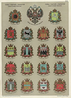
Background imageCartographic Collection: Seals of the Provinces and Oblasts of Asiatic Russia, 1914. Creator

Seals of the Provinces and Oblasts of Asiatic Russia, 1914. Creator: Resettlement Department of the Land Regulation
Seals of the Provinces and Oblasts of Asiatic Russia, 1914. From the atlas "Atlas of Asian Russia."

Background imageCartographic Collection: Map on the drainage of the Barabinsk steppe in the Tomsk province, Kainsk district, 1914

Map on the drainage of the Barabinsk steppe in the Tomsk province, Kainsk district, 1914. From the atlas "Atlas of Asian Russia."

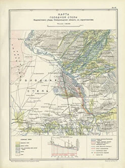
Background imageCartographic Collection: Map of the barren steppe of the Khodzhentsk distric, Samarkand region, with its environs, 1914

Map of the barren steppe of the Khodzhentsk distric, Samarkand region, with its environs, 1914. From the atlas "Atlas of Asian Russia."

Background imageCartographic Collection: Plan Murgabskogo Gosudareva imeniia, Zakaspiiskoi oblasti, Mervskogo uezda, 1914

Plan Murgabskogo Gosudareva imeniia, Zakaspiiskoi oblasti, Mervskogo uezda, 1914. From the atlas "Atlas of Asian Russia."

Background imageCartographic Collection: Map of the Altai Region from the Office of His Majesty, 1914

Map of the Altai Region from the Office of His Majesty, 1914. Creator: Resettlement Department of the Land Regulation
Map of the Altai Region from the Office of His Majesty, 1914. From the atlas "Atlas of Asian Russia."

Background imageCartographic Collection: Map of Zabaikal Province, 1914. Creator: Resettlement Department of the Land Regulation

Map of Zabaikal Province, 1914. Creator: Resettlement Department of the Land Regulation and Agriculture Administration
Map of Zabaikal Province, 1914. From the atlas "Atlas of Asian Russia."

Background imageCartographic Collection: Map of Enisei Province, 1914. Creator: Resettlement Department of the Land Regulation

Map of Enisei Province, 1914. Creator: Resettlement Department of the Land Regulation and Agriculture Administration
Map of Enisei Province, 1914. From the atlas "Atlas of Asian Russia."

Background imageCartographic Collection: Map of Irkutsk Province, 1914. Creator: Resettlement Department of the Land Regulation

Map of Irkutsk Province, 1914. Creator: Resettlement Department of the Land Regulation and Agriculture Administration
Map of Irkutsk Province, 1914. From the atlas "Atlas of Asian Russia."

Background imageCartographic Collection: Map of Tomsk Province, 1914. Creator: Resettlement Department of the Land Regulation

Map of Tomsk Province, 1914. Creator: Resettlement Department of the Land Regulation and Agriculture Administration
Map of Tomsk Province, 1914. From the atlas "Atlas of Asian Russia."

Background imageCartographic Collection: Map of the Military Districts of Asiatic Russia, 1914. Creator

Map of the Military Districts of Asiatic Russia, 1914. Creator: Resettlement Department of the Land Regulation
Map of the Military Districts of Asiatic Russia, 1914. From the atlas "Atlas of Asian Russia."

Background imageCartographic Collection: Portrait of Lenin, 1970. Creator: Unknown

Portrait of Lenin, 1970. Creator: Unknown
Portrait of Lenin, 1970. From We Live and Work According to Lenin: Atlas of the Novosibirsk Region, 1970. The Communist Party of the Soviet Union drew its legitimacy from the life

Background imageCartographic Collection: Map of exploration work carried out in 1895 in the Mariinsky District. Ubienka.. 1895

Map of exploration work carried out in 1895 in the Mariinsky District. Ubienka.. 1895. Creator: Unknown
Map of exploration work carried out in 1895 in the Mariinsky District. Ubienka, B. Barandat, lake; Pike and so on, 1895

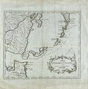
Background imageCartographic Collection: Map of the Kuril Islands with Surrounding Areas, 1700-1799. Creator: Unknown

Map of the Kuril Islands with Surrounding Areas, 1700-1799. Creator: Unknown
Map of the Kuril Islands with Surrounding Areas, 1700-1799. This 18th century Russian map depicts the Kurile Islands archipelago, located on the far eastern edge of the Russian Empire

Background imageCartographic Collection: Geognostic Map of the Localities of Irkutsk, Verkholensk, and Balagansk Districts, 1873

Geognostic Map of the Localities of Irkutsk, Verkholensk, and Balagansk Districts, 1873. The first geological (geognostic) maps in Russia were produced in the 1850s

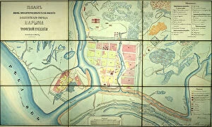
Background imageCartographic Collection: Plan of the newly designed location of the provincial town of Narym, Tomsk province, 1868

Plan of the newly designed location of the provincial town of Narym, Tomsk province, 1868. Creator: Unknown
Plan of the newly designed location of the provincial town of Narym, Tomsk province, 1868

Background imageCartographic Collection: Projecting Plan of a District City Tomsk, Made in 1872, 1873. Creator: Unknown

Projecting Plan of a District City Tomsk, Made in 1872, 1873. Creator: Unknown
Projecting Plan of a District City Tomsk, Made in 1872, 1873

Background imageCartographic Collection: Map of the Route of the Siberian Railway Line, 1891-1916.. Creator: Unknown

Map of the Route of the Siberian Railway Line, 1891-1916.. Creator: Unknown
Map of the Route of the Siberian Railway Line, 1891-1916

Background imageCartographic Collection: Map of the Far East of the USSR, Northern China (Manchuria) and Mongolia, 1930. Creator: Unknown

Map of the Far East of the USSR, Northern China (Manchuria) and Mongolia, 1930. Creator: Unknown
Map of the Far East of the USSR, Northern China (Manchuria) and Mongolia, 1930. This Soviet-era map is intended to serve a propaganda purpose

Background imageCartographic Collection: Karta I?A?kutskoi? oblasti chasti Olekminskago okruga i Irkutskoi? guberni¯i? Kirenskogo... 1853

Karta I?A?kutskoi? oblasti chasti Olekminskago okruga i Irkutskoi? guberni¯i? Kirenskogo... 1853. Creator: Unknown
Karta I?A?kutskoi? oblasti chasti Olekminskago okruga i Irkutskoi? guberni¯i? Kirenskogo [sic] chast okrugas pokazani¯em zolotosoderzhashchikh pri¯i?skov razrabatyvaemyi?a? : gg

Background imageCartographic Collection: The direction of reindeer husbandry and dog breeding, 1932. Creator: Unknown

The direction of reindeer husbandry and dog breeding, 1932. Creator: Unknown
The direction of reindeer husbandry and dog breeding, 1932. Conventional signs: adult reindeer with the distinction of sled dogs, adult dogs with the distinction of sled dogs, herding dogs

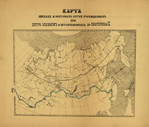
Background imageCartographic Collection: [Karty pochtovykh soobshcheni¯i? uchrezhdennykh v Rossi¯i?skoi? Imperi¯i pri T?S?ari?e... (186-?)

[Karty pochtovykh soobshcheni¯i? uchrezhdennykh v Rossi¯i?skoi? Imperi¯i pri T?S?ari?e... (186-?). Creator: Unknown
[Karty pochtovykh soobshcheni¯i? uchrezhdennykh v Rossi¯i?skoi? Imperi¯i pri T?S?ari?e? Aleksi?e?i?e? Mikhailovichi?e? i ego preemnikakh do Ekateriny II], (186-?)

Background imageCartographic Collection: Western motor car route guide, (1915?). Creator: Unknown

Western motor car route guide, (1915?). Creator: Unknown
Western motor car route guide, (1915?). This automobile guide shows the main highway route between Vancouver, Canada, and San Diego, California, circa 1915

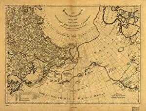
Background imageCartographic Collection: The Russian discoveries from the map published by the Imperial Academy of St. Petersburg, 1775

The Russian discoveries from the map published by the Imperial Academy of St. Petersburg, 1775. Creator: Unknown
The Russian discoveries from the map published by the Imperial Academy of St. Petersburg, 1775. This map, showing the known geography of Alaska in the late 18th century

Background imageCartographic Collection: Kartogramma 'grippa' : [Russia], 1890. Creator: Unknown. Kartogramma 'grippa' : [Russia], 1890

Kartogramma "grippa" : [Russia], 1890. Creator: Unknown. Kartogramma "grippa" : [Russia], 1890
Kartogramma "grippa" : [Russia], 1890. Shows occurrence of influenza by province. Each map has a number at head of title, and a month or months at the end of the title: No. 50

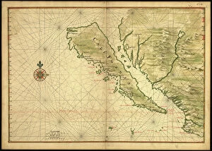
Background imageCartographic Collection: Map of California shown as an island, c 1650. Creator: Johannes Vingboons

Map of California shown as an island, c 1650. Creator: Johannes Vingboons
Map of California shown as an island, c 1650. This map from around 1650 shows California as an island. A half-century would pass before Spanish explorers determined with certainty that California was

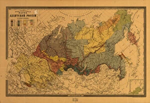
Background imageCartographic Collection: E?tnograficheskai?a? karta Azi¯i?a?tskoi? Rossi¯i, (187-?). Creator: Mikhail Veniukov

E?tnograficheskai?a? karta Azi¯i?a?tskoi? Rossi¯i, (187-?). Creator: Mikhail Veniukov
E?tnograficheskai?a? karta Azi¯i?a?tskoi? Rossi¯i, (187-?). Pulkovo meridian

Background imageCartographic Collection: Map showing the lands assigned to emigrant Indians west of Arkansas and Missouri, 1836

Map showing the lands assigned to emigrant Indians west of Arkansas and Missouri, 1836. Creator: Topographical Bureau
Map showing the lands assigned to emigrant Indians west of Arkansas and Missouri, 1836. Following passage of the Indian Removal Act in 1830

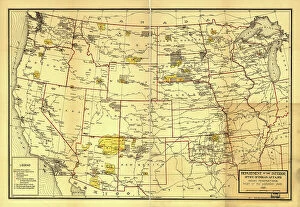
Background imageCartographic Collection: Indian Reservations west of the Mississippi River, 1923. Creator: Office of Indian Affairs

Indian Reservations west of the Mississippi River, 1923. Creator: Office of Indian Affairs
Indian Reservations west of the Mississippi River, 1923. This map, created by the Office of Indian Affairs in 1923, shows the location of Indian reservations west of the Mississippi River


All Professionally Made to Order for Quick Shipping

"Unveiling the World Through Cartographic Masterpieces" Step back in time and embark on a journey through history with these captivating cartographic treasures. From Al-Idrisi's world map of 1154 to Orteliuss' intricate creations from the 16th century, each map tells a unique story about the world as it was known at that time. Al-Idrisi's world map, crafted in 1154, offers a glimpse into medieval Islamic geography, showcasing an impressive understanding of global trade routes and geographical features. Meanwhile, the British Empire world map from the 19th century illustrates the vast extent of Britain's dominion across continents and oceans. The Catalan Atlas transports us to the 14th century with its exquisite craftsmanship and detailed depictions of various regions. It serves as a testament to Catalonia's rich maritime tradition and exploration during this period. Orteliuss' maps take center stage throughout this collection, providing invaluable insights into specific regions such as Ottoman Empire, Italy, Poland, Greece, Germany, Netherlands - all meticulously documented in his renowned Theatrum Orbis Terrarum. These masterpieces not only showcase Orteliuss' cartographic expertise but also shed light on political boundaries and cultural nuances prevalent during his era. Moving closer to home is the Map of City Dublin from 1797 which showcases Ireland's capital city at that time - offering glimpses into its urban layout and architectural landmarks that have shaped Dublin's identity over centuries. Lastly Zaragoza’s (19th c. ) Map takes us to Spain where we can explore Madrid through intricate details capturing its streetscape during that period - allowing us to immerse ourselves in Spanish history while navigating through its vibrant capital city. These remarkable cartographic works serve as windows into our past – they are not just maps; they are gateways connecting us with bygone eras.