Framed Print > Universal Images Group (UIG) > Universal Images Group > Satellite and Aerial > Planet Observer 6
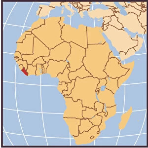
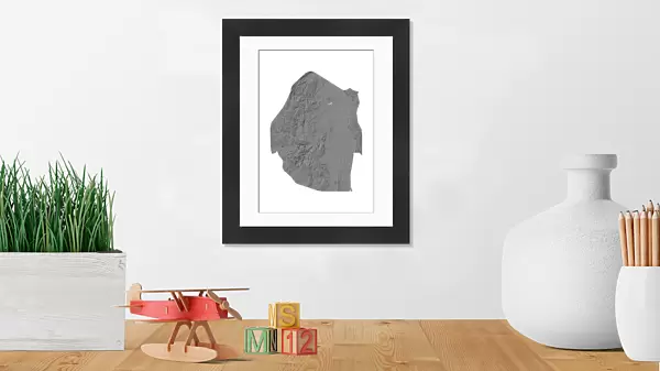
Framed Print : Swaziland, Relief Map


![]()
Framed Photos from Universal Images Group (UIG)
Swaziland, Relief Map
Relief map of Swaziland. This map was processed from elevation data
Universal Images Group (UIG) manages distribution for many leading specialist agencies worldwide
Media ID 9634211
© Planet Observer
Alsace Bas Rhin Geographical Border Relief Map Satellite View
14"x12" (38x32cm) Modern Frame
Discover the beauty and complexity of Swaziland with our Framed Prints from Media Storehouse. Featuring an intricately detailed relief map of this intriguing African country, sourced from Universal Images Group (UIG), these prints offer a unique perspective on Swaziland's topography. Each print is expertly framed to enhance the map's visual appeal, making it an excellent addition to any home or office. Bring a piece of the world into your space with our Framed Prints of Swaziland Relief Map.
Wood effect frame, card mounted, 10x8 archival quality photo print. Overall outside dimensions 14x12 inches (38x32cm). Environmentally and ozone friendly, 40mm wide x 15mm Polycore® moulding has the look of real wood, is durable and light and easy to hang. Biodegradable and made with non-chlorinated gases (no toxic fumes) it is efficient; producing 100 tons of polystyrene can save 300 tons of trees! Prints are glazed with lightweight, shatterproof, optical clarity acrylic (providing the same general protection from the environment as glass). The back is stapled hardboard with a sawtooth hanger attached. Note: To minimise original artwork cropping, for optimum layout, and to ensure print is secure, the visible print may be marginally smaller
Contemporary Framed and Mounted Prints - Professionally Made and Ready to Hang
Estimated Image Size (if not cropped) is 17.3cm x 24.4cm (6.8" x 9.6")
Estimated Product Size is 32.5cm x 37.6cm (12.8" x 14.8")
These are individually made so all sizes are approximate
Artwork printed orientated as per the preview above, with portrait (vertical) orientation to match the source image.
EDITORS COMMENTS
This print showcases the intricate relief map of Swaziland, a landlocked country nestled in southern Africa. The map, meticulously processed from elevation data, offers a stunning visual representation of Swaziland's topography and physical geography. With its vibrant colors and detailed contours, this image transports viewers to the heart of this enchanting nation. The photograph captures the beauty and diversity of Swaziland's landscape with remarkable precision. From towering mountains to rolling hills, every geographical feature is brought to life through this satellite view. The absence of people allows us to focus solely on nature's grandeur as we explore the vastness of Swaziland's terrain. As our eyes wander across the relief map, we are reminded that borders can be more than just political divisions; they can also delineate unique landscapes shaped by time and natural forces. This print serves as a testament to both human ingenuity in cartography and Mother Nature's awe-inspiring artistry. Whether you are an avid traveler seeking inspiration or simply fascinated by maps and geography, this image will undoubtedly captivate your imagination. It invites you on a virtual journey through one of Africa's hidden gems – Swaziland – where untamed wilderness meets cultural heritage in perfect harmony.
MADE IN THE UK
Safe Shipping with 30 Day Money Back Guarantee
FREE PERSONALISATION*
We are proud to offer a range of customisation features including Personalised Captions, Color Filters and Picture Zoom Tools
SECURE PAYMENTS
We happily accept a wide range of payment options so you can pay for the things you need in the way that is most convenient for you
* Options may vary by product and licensing agreement. Zoomed Pictures can be adjusted in the Basket.