Framed Print > Europe > United Kingdom > England > London > Transport > Underground
Framed Print : If London flooded tomorrow, what would you do?


![]()
Framed Photos from Mary Evans Picture Library
If London flooded tomorrow, what would you do?
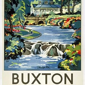
Text with map of London, showing Flood Risk Area, and underground and railway lines. If London flooded tomorrow, what would you do? This is what you must do if you live work or travel in the Flood Risk Area. Designed and prduced by Stuart Advertising Agency Ltd Printed by G and B Arts Date: 1980
Mary Evans Picture Library makes available wonderful images created for people to enjoy over the centuries
Media ID 19152196
© Mary Evans Picture Library 2015
1980 Area Flood Flooded Lines Risk This Tomorrow Underground
22"x18" (58x48cm) Modern Frame
Introducing the captivating "If London Flooded Tomorrow, What Would You Do?" framed print from Media Storehouse, in collaboration with Mary Evans Prints Online. This evocative image not only showcases the iconic London skyline but also highlights the potential flood risk areas, underground lines, and railway networks, sparking intrigue and thought. Perfectly blending art and geography, this framed print serves as a thought-provoking conversation starter, inspiring discussions on the importance of preparedness and resilience in the face of natural disasters. Add a touch of intellect and intrigue to your space with this unique and captivating piece.
Wood effect frame, card mounted, 16x12 archival quality photo print. Overall outside dimensions 22x18 inches (58x48cm). Environmentally and ozone friendly, 40mm wide x 15mm Polycore® moulding has the look of real wood, is durable and light and easy to hang. Biodegradable and made with non-chlorinated gases (no toxic fumes) it is efficient; producing 100 tons of polystyrene can save 300 tons of trees! Prints are glazed with lightweight, shatterproof, optical clarity acrylic (providing the same general protection from the environment as glass). The back is stapled hardboard with a sawtooth hanger attached. Note: To minimise original artwork cropping, for optimum layout, and to ensure print is secure, the visible print may be marginally smaller
Contemporary Framed and Mounted Prints - Professionally Made and Ready to Hang
Estimated Image Size (if not cropped) is 26.5cm x 39.6cm (10.4" x 15.6")
Estimated Product Size is 47.8cm x 57.9cm (18.8" x 22.8")
These are individually made so all sizes are approximate
Artwork printed orientated as per the preview above, with portrait (vertical) orientation to match the source image.
FEATURES IN THESE COLLECTIONS
> Europe
> United Kingdom
> England
> London
> Related Images
> Europe
> United Kingdom
> England
> London
> Transport
> Underground
> Maps and Charts
> Related Images
> Popular Themes
> Railway Posters
EDITORS COMMENTS
1. "Preparing for the Unforeseen: A 1980s Guide to Surviving a Flood in London If London flooded tomorrow, what would you do? This question was a pressing concern for residents, workers, and commuters in the Flood Risk Area of the city in the late 1970s and early 1980s. The map before you, produced by an unknown advertising agency and printed by G and B Arts in 1980, outlines the areas most susceptible to flooding, as well as the crucial underground and railway lines that crisscross the city. The Flood Risk Area, marked in red on the map, encompasses many parts of central and eastern London, including the Southwark, Tower Hamlets, and Wandsworth boroughs. The Thames River, which flows through the heart of the city, poses the greatest risk, but heavy rainfall and storm surges can also cause flooding in other parts of the metropolis. In the event of a flood, the map advises several courses of action. First and foremost, residents and workers in the Flood Risk Area are urged to heed evacuation orders issued by local authorities. If evacuation is not possible, they are encouraged to move to the upper floors of their buildings and stay there, away from windows and doors. For those who rely on public transportation, the map provides alternative routes using the underground and railway lines that are least likely to be affected by flooding. It is essential to check with transport authorities for the latest information on service disruptions and closures before traveling. In conclusion, being prepared for a flood in London in the 1980s required careful planning and a solid understanding of the city's flood risk areas and transportation networks. This map, produced by an unknown advertising agency and printed by G and B Arts, serves as a testament to the importance of being informed and vigilant in the face of natural disasters.
MADE IN THE UK
Safe Shipping with 30 Day Money Back Guarantee
FREE PERSONALISATION*
We are proud to offer a range of customisation features including Personalised Captions, Color Filters and Picture Zoom Tools
SECURE PAYMENTS
We happily accept a wide range of payment options so you can pay for the things you need in the way that is most convenient for you
* Options may vary by product and licensing agreement. Zoomed Pictures can be adjusted in the Basket.