Framed Print > Maps and Charts > British Empire Maps
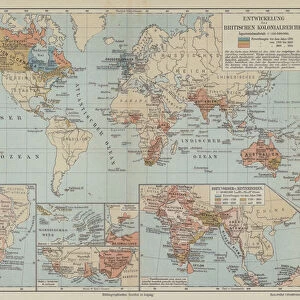
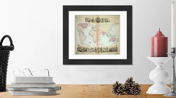
Framed Print : British Empire throughout the World (coloured engraving)
")

")


![]()
Framed Photos from Fine Art Finder
British Empire throughout the World (coloured engraving)
XCF275033 British Empire throughout the World (coloured engraving) by English School, (19th century); Private Collection; English, out of copyright
Media ID 12790621
© www.bridgemanimages.com
Cartouche Colonies Colonisation Geographical Globalisation Imperialism Mapping Georgraphy
14"x12" (38x32cm) Modern Frame
Add a touch of historical grandeur to your home or office with the Media Storehouse Framed Print of "British Empire throughout the World (coloured engraving)" by the English School. This stunning coloured engraving, out of copyright and sourced from Bridgeman Images via Fine Art Finder, showcases the vast reach of the British Empire during the 19th century. Bring the rich history of this iconic era into your space with this beautifully framed and preserved print, sure to be a conversation starter and a source of pride for any room.
Wood effect frame, card mounted, 10x8 archival quality photo print. Overall outside dimensions 14x12 inches (38x32cm). Environmentally and ozone friendly, 40mm wide x 15mm Polycore® moulding has the look of real wood, is durable and light and easy to hang. Biodegradable and made with non-chlorinated gases (no toxic fumes) it is efficient; producing 100 tons of polystyrene can save 300 tons of trees! Prints are glazed with lightweight, shatterproof, optical clarity acrylic (providing the same general protection from the environment as glass). The back is stapled hardboard with a sawtooth hanger attached. Note: To minimise original artwork cropping, for optimum layout, and to ensure print is secure, the visible print may be marginally smaller
Contemporary Framed and Mounted Prints - Professionally Made and Ready to Hang
Estimated Image Size (if not cropped) is 24.4cm x 20.7cm (9.6" x 8.1")
Estimated Product Size is 37.6cm x 32.5cm (14.8" x 12.8")
These are individually made so all sizes are approximate
Artwork printed orientated as per the preview above, with landscape (horizontal) orientation to match the source image.
FEATURES IN THESE COLLECTIONS
> Fine Art Finder
> Exploration & Colonisation
> Fine Art Finder
> Schools
> English School
> Maps and Charts
> British Empire Maps
> Maps and Charts
> Related Images
> Maps and Charts
> World
EDITORS COMMENTS
This print showcases a remarkable piece of history, the "British Empire throughout the World (coloured engraving)" by an anonymous English School artist from the 19th century. With its vibrant colors and intricate details, this map offers a fascinating glimpse into the vast reach and influence of one of history's most powerful empires. The image takes us on a journey across continents, revealing the extent of British colonial territories during that era. From North America to Africa, Asia to Australia, this map highlights how Britain's imperial ambitions spanned across oceans and cultures. It serves as a visual testament to the global power and dominance that characterized Victorian-era Britain. The cartography in this print is meticulously executed, showcasing not only geographical accuracy but also artistic flair. The inclusion of decorative elements like cartouches adds an elegant touch to this historical document. As we explore each region depicted on the map, we are reminded of both the benefits and controversies associated with colonization. Beyond its historical significance, this image also invites contemplation about broader themes such as globalization and imperialism. It prompts us to reflect on how past events have shaped our present world order. Displayed in private collections worldwide, this print from Fine Art Finder allows art enthusiasts and history buffs alike to appreciate the beauty and complexity of this important artifact from British history.
MADE IN THE UK
Safe Shipping with 30 Day Money Back Guarantee
FREE PERSONALISATION*
We are proud to offer a range of customisation features including Personalised Captions, Color Filters and Picture Zoom Tools
SECURE PAYMENTS
We happily accept a wide range of payment options so you can pay for the things you need in the way that is most convenient for you
* Options may vary by product and licensing agreement. Zoomed Pictures can be adjusted in the Basket.