Fraud Blocker Skip to main content

Geographical Collection

"Journey through Time and Space: Exploring the Geographical Evolution" Al-Idrisi's World Map, 1154: Unveiling ancient cartographic wisdom

Background imageGeographical Collection: Al-Idrisis world map, 1154

Al-Idrisis world map, 1154
Al-Idrisis world map. This world map, known as the Tabula Rogeriana, dates from 1154, and is orientated with North at bottom

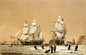
Background imageGeographical Collection: Ross Arctic search expedition, 1848-9 C016 / 4490

Ross Arctic search expedition, 1848-9 C016 / 4490
Ross Arctic search expedition. 19th-century artwork of the ships HMS Enterprise and HMS Investigator caught in pack ice in Baffin Bay off Devils Point in the Arctic

Background imageGeographical Collection: Continental drift after 250 million years

Continental drift after 250 million years, showing the supercontinent of Pangea Ultima, which was named for the ancient supercontinent of Pangea

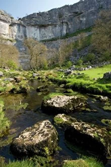
Background imageGeographical Collection: Malham Cove, Yorkshire Dales

Malham Cove, Yorkshire Dales National Park, England. This curving limestone cliff feature was formed by glacial action. It used to have a waterfall running over it

Background imageGeographical Collection: Orteliuss map of Ottoman Empire, 1570

Orteliuss map of Ottoman Empire, 1570
Orteliuss map of the Ottoman Empire. This map is from the 1570 first edition of Theatrum orbis terrarum ( Theatre of the World )

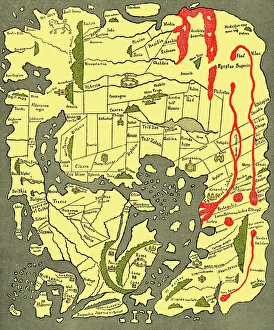
Background imageGeographical Collection: Anglo-Saxon 10th century world map

Anglo-Saxon 10th century world map
Anglo-Saxon world map, dating from the 10th century. East is top. This map of the known world was probably produced by an Irish monk
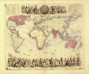
Background imageGeographical Collection: British Empire world map, 19th century

British Empire world map, 19th century
British Empire world map. This world map shows the 19th-century British Empire (pink) and its indigenous peoples. Five illustrations (clockwise from upper left) show the people of Australia

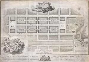
Background imageGeographical Collection: 1768, James Craig Map of New Town, Edinburgh, Scotland, First Plan of New Town, topography

1768, James Craig Map of New Town, Edinburgh, Scotland, First Plan of New Town, topography
1768, James Craig Map of New Town, Edinburgh, Scotland, First Plan of New Town

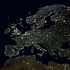
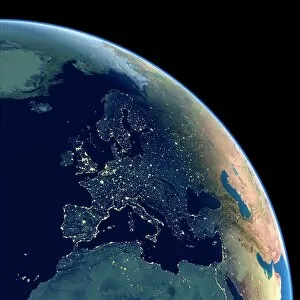
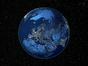
Background imageGeographical Collection: Europe at night

Europe at night, satellite image. North is at top. Yellow lights mark the major cities and population areas, showing a clearly delineated Mediterranean coast

Background imageGeographical Collection: 17th century world map

17th century world map
World map, published around 1664 in Amsterdam, the Netherlands, by Dutch mapmaker Joan Blaeu (c.1599- 1673). The Latin title is Nova et Accuratissima Totius Terrarum Orbis Tabula

Background imageGeographical Collection: Catalan Atlas, 14th century

Catalan Atlas, 14th century. The 6-page Catalan Atlas (1375) was produced on vellum by the Jewish cartographer Abraham Cresques

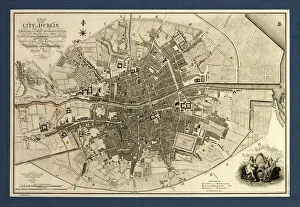
Background imageGeographical Collection: Map of the City of Dublin, 1797

Map of the City of Dublin, 1797
Map of the City of Dublin, Ireland. Published in 1797, this map includes details of the canals being built at the time. Canal Harbour (lower right)

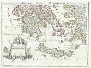
Background imageGeographical Collection: 1794, Delisle Map of Southern Ancient Greece, Greeks Isles, and Crete, topography

1794, Delisle Map of Southern Ancient Greece, Greeks Isles, and Crete, topography
1794, Delisle Map of Southern Ancient Greece, Greeks Isles, and Crete

Background imageGeographical Collection: Durers world map, 1515

Durers world map, 1515. Albrecht Durer (1471- 1528) was a German artist. His skillful use of perspective and mathematical proportions made him one of the outstanding artistic figures of the early

Background imageGeographical Collection: UK at night from space

UK at night from space
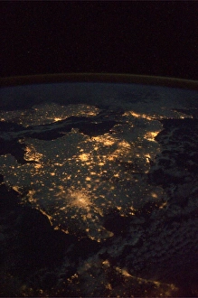
UK at night, as seen from the International Space Station (ISS). City lights (yellow) show areas of dense population. France is at bottom. Image taken on 24th December 2010

Background imageGeographical Collection: Earth from space, satellite image

Earth from space, satellite image
Earth from space. Satellite image showing North and South America as seen from 35, 000 kilometres above the Earths surface. North is at top and the Moon is at upper right

Background imageGeographical Collection: Europe at night, satellite image

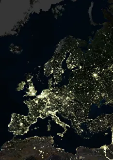
Europe at night, satellite image. City lights (yellow) of increasing intensity show areas of increasing population, with areas of few lights being more sparsely populated

Background imageGeographical Collection: Whole Earth at night, satellite image

Whole Earth at night, satellite image
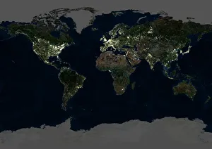
Whole Earth map at night, satellite image. Here, Africa is seen at centre. City lights (yellow) of increasing intensity show areas of increasing population

Background imageGeographical Collection: Oronce Fines world map, 1531

Oronce Fines world map, 1531
Oronce Fines world map. Map of the worlds northern and southern hemispheres by the French mathematician and cartographer Oronce Fine (1494-1555)

Background imageGeographical Collection: Tenerife, satellite image

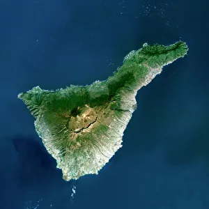
Tenerife, satellite image. Satellite image of Tenerife showing Mount Teide (lower centre). Vegetation is green, and water is blue

Background imageGeographical Collection: Europe at night, satellite image

Europe at night, satellite image. City lights (yellow) show areas of dense population. There are few lights in North Africa (bottom) and the Arctic (top) since they are more sparsely populated

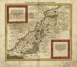
Background imageGeographical Collection: Map of Palestine, 1588

Map of Palestine, 1588
16th century map of Palestine. North is towards upper right. Published in 1588, this German map shows the geography of Palestine, centred on the area that later become the state of Israel

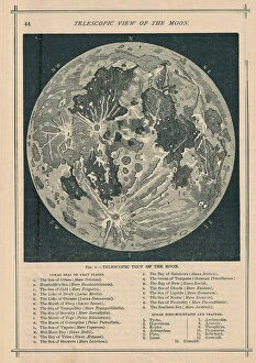
Background imageGeographical Collection: 1886, Telescopic View and Map of the Moon, topography, cartography, geography, land

1886, Telescopic View and Map of the Moon, topography, cartography, geography, land
1886, Telescopic View and Map of the Moon

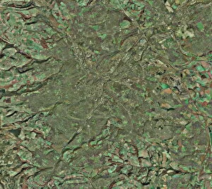
Background imageGeographical Collection: Sheffield, UK, aerial image

Sheffield, UK, aerial image
Sheffield, UK, aerial photograph. Sheffield is a city of some 510, 000 people (2003) in South Yorkshire. The M1 motorway (running down right) links Sheffield with London (to the south)

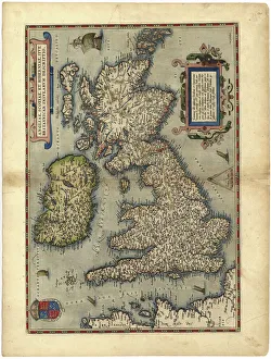
Background imageGeographical Collection: 16th century map of the British Isles

16th century map of the British Isles
Map of the British Isles, in the 1570 edition of Ortelius Atlas (Theatrum Orbis Terrarum). Abraham Ortelius (1527-1598) was a Flemish mapmaker who is considered to have produced the first true atlas

Background imageGeographical Collection: 16th Century Plan of Florence

16th Century Plan of Florence
16th century plan of Florence, Italy. Detail from the map of Etruria (Tuscany and Northern Lazio), in the Gallery of Maps in the Vatican Museum.The Gallery of Maps holds maps which were commissioned

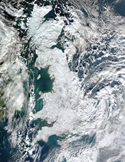
Background imageGeographical Collection: Snow-covered United Kingdom, January 2010

Snow-covered United Kingdom, January 2010. Satellite image of snow and ice (white) covering the UK during the cold spell in January 2010

Background imageGeographical Collection: North America at night, satellite image

North America at night, satellite image
Africa at night. Satellite image of the Earth at night, set against a background of stars, centred on the continent of Africa. North is at top. City lights (yellow) show areas of dense population

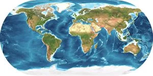
Background imageGeographical Collection: Earth, topographic and bathymetric map

Earth, topographic and bathymetric map. This whole Earth map is centred on the Greenwich meridian, at zero degrees latitude

Background imageGeographical Collection: Map of Europe, 1600

Map of Europe, 1600
16th century map of Europe. Published in Sienna in 1600, this Italian map shows the latest knowledge of the geography of Europe

Background imageGeographical Collection: 16th century world map

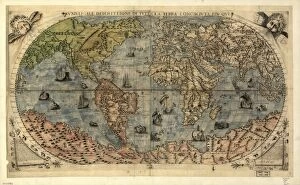
16th century world map
World map, published around 1565 in Venice, Italy, by Italian mapmaker Ferando Bertelli. The title of the map: Universale Descrittione di Tutta la Terra Conosciuta Fin Qui

Background imageGeographical Collection: Map of the world, 1720

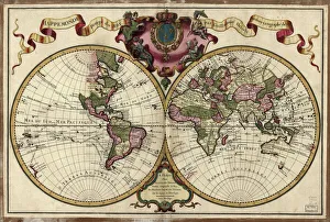
Map of the world, 1720
(Original Caption) 18th century map of the world. Published in Paris in 1720, this French map shows the known world, including the new lands that had been discovered in the preceding centuries by

Background imageGeographical Collection: Scotland, UK, satellite image

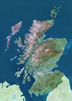
Scotland, UK, satellite image
Scotland, UK. North is at top. Natural colour satellite image showing Scotland in the United Kingdom, with the surrounding territories shaded out

Background imageGeographical Collection: 17th century map of Europe

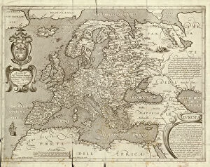
17th century map of Europe

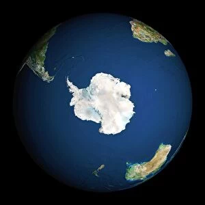
Background imageGeographical Collection: Earth

Earth. Satellite image of the Earth, centred on Antarctica. The South Pole is at centre. Water is blue, vegetation is green, arid areas are brown, and snow and ice are white

Background imageGeographical Collection: Soil triangle diagram

Soil triangle diagram. This diagram is used to work out the type of soil in an area. A sample of soil is left to settle in water. Larger particles settle out of suspension faster than smaller ones

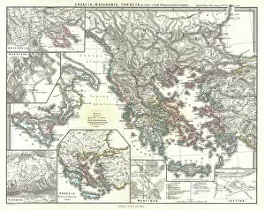
Background imageGeographical Collection: 1865, Spruner Map of Greece, Macedonia and Thrace before the Peloponnesian War. topography

1865, Spruner Map of Greece, Macedonia and Thrace before the Peloponnesian War. topography
1865, Spruner Map of Greece, Macedonia and Thrace before the Peloponnesian War

Background imageGeographical Collection: Map of Scandinavia

Map of Scandinavia

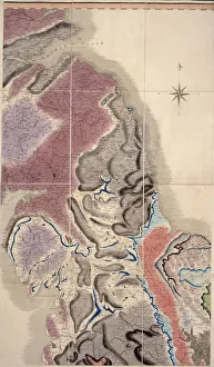
Background imageGeographical Collection: First geological map of Britain, 1815 C016 / 5683

First geological map of Britain, 1815 C016 / 5683
First geological map of Britain, detail of the north east coast (figure 8). This map was published in 1815 by British geologist William Smith (1769-1839)

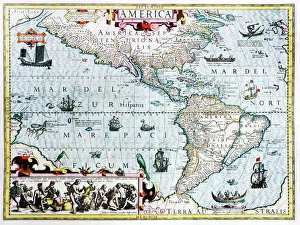
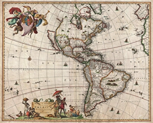
Background imageGeographical Collection: 17th century map of the New World

17th century map of the New World
Western Hemisphere, 17th century Dutch map. This shows the New World that was being discovered by Europeans exploring the Western Hemisphere of the Earth

Background imageGeographical Collection: Continental drift, 100 million years ago

Continental drift, 100 million years ago. Map of the Earth showing the continents some 100 million years after the start of the break-up of the ancient supercontinent of Pangea

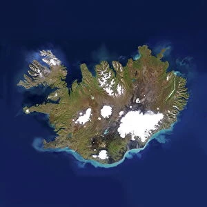
Background imageGeographical Collection: Iceland

Iceland, satellite image. Located in the Atlantic Ocean, just below the Arctic Circle, Iceland is a sparsely populated country of around 300, 000 people and an area of 100, 000 square kilometres

Background imageGeographical Collection: Cave of Crystals, Naica Mine, Mexico

Cave of Crystals, Naica Mine, Mexico
^BCave of Crystals.^b Geologist in the Cave of Crystals (^ICueva de los Cristales^i) in Naica Mine, Chihuahua, Mexico. The crystals are the largest known in the world

Background imageGeographical Collection: 1658, Visscher Map of North America and South America, topography, cartography, geography

1658, Visscher Map of North America and South America, topography, cartography, geography
1658, Visscher Map of North America and South America

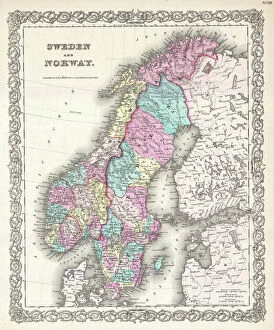
Background imageGeographical Collection: 1855, Colton Map of Scandinavia, Norway, Sweden, Finland, topography, cartography

1855, Colton Map of Scandinavia, Norway, Sweden, Finland, topography, cartography
1855, Colton Map of Scandinavia, Norway, Sweden, Finland

Background imageGeographical Collection: Ocean currents off the Americas

Ocean currents off the Americas. Satellite-based graphic showing ocean currents (swirling coloured lines) on an Earth globe centred on the Americas

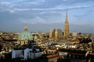
Background imageGeographical Collection: Austria. Vienna. Vienna

Austria. Vienna. Vienna
AUSTRIA. VIENNA. Vienna

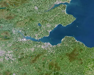
Background imageGeographical Collection: Firth of Forth, UK, satellite image

Firth of Forth, UK, satellite image. The Firth of Forth is the major estuary of the River Forth in Scotland. The grey area at centre is the city of Edinburgh


All Professionally Made to Order for Quick Shipping

"Journey through Time and Space: Exploring the Geographical Evolution" Al-Idrisi's World Map, 1154: Unveiling ancient cartographic wisdom, this map showcases the Islamic scholar's remarkable understanding of global geography. Continental Drift after 250 Million Years: Witnessing Earth's transformative power, this concept reveals how tectonic plates shaped our continents over millions of years. Malham Cove, Yorkshire Dales: A geological marvel standing tall in the picturesque Yorkshire Dales, showcasing nature's artistic prowess carved by ice and water. British Empire World Map, 19th Century: Tracing the vast expanse of an empire on which the sun never set; a testament to Britain's once-global dominance. James Craig Map of New Town, Edinburgh, Scotland (1768): The birth of urban planning captured in ink; explore Edinburgh’s meticulously designed New Town with its unique topography. Anglo-Saxon 10th Century World Map: Delving into medieval perceptions of our planet; discover how early societies envisioned their place within a world still shrouded in mystery. Catalan Atlas, 14th Century: Marvel at one of history’s most exquisite maps as it unveils Europe’s expanding knowledge during the Middle Ages – a true masterpiece. UK at Night from Space: Behold Britain illuminated like never before. This awe-inspiring view from space captures the vibrant tapestry that is modern-day United Kingdom after sundown. Orteliuss Map of Ottoman Empire (1570): Step back into time and witness one man’s meticulous depiction of an empire that spanned three continents - revealing cultural diversity and grandeur. Europe at Night - Satellite Image & Europe at Night - Illuminating Boundaries : Gaze upon two contrasting images capturing Europe under different lights – highlighting both unity and division across nations 17th Century World Map.