
Maps Framed Print Collection
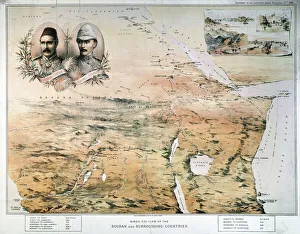
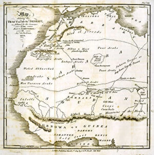
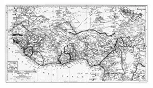
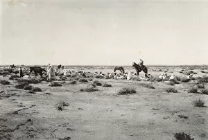
Discover the rich cultural heritage and diverse landscapes of Sudan with our Maps of Sudan, Africa collection of Framed Prints. Each map is meticulously designed to showcase the intricate details of this fascinating country. The high-quality paper used ensures vibrant colors and sharp details, while the elegant frame adds a touch of sophistication to any room. Explore the ancient ruins of Meroe, the vast expanse of the Nubian Desert, or the lush greenery of the Sudd Swamp. Bring a piece of Africa into your home and ignite your sense of adventure with our Maps of Sudan collection.
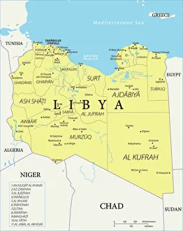
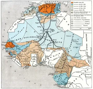
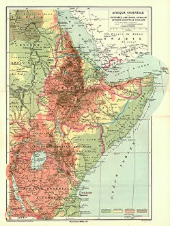
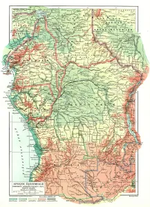
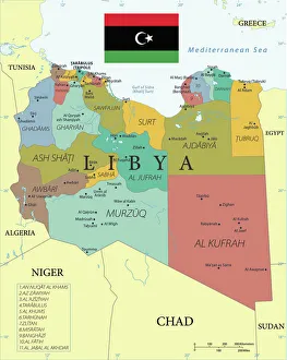
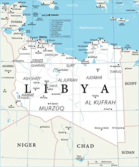
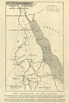
Sudan is a country located in the northeast corner of Africa, and is bordered by Egypt to the north, Libya to the northwest, Chad to the west
Choose a picture from our Maps Framed Print Collection for your Wall Art and Photo Gifts
160 Framed Prints


All Professionally Made to Order for Quick Shipping
-
Maps Framed Print Collection
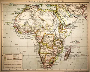
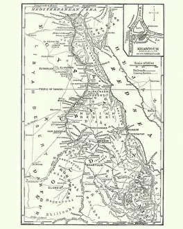
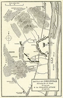
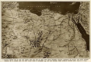
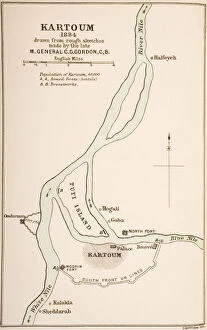
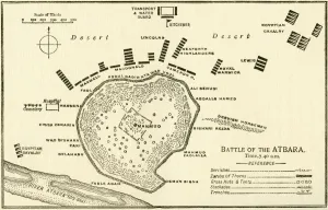
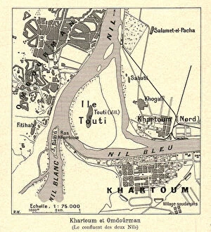
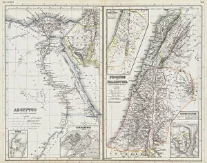
Sudan is a country located in the northeast corner of Africa, and is bordered by Egypt to the north, Libya to the northwest, Chad to the west, Central African Republic to the southwest, South Sudan to the south and Ethiopia and Eritrea to the east. Maps of Sudan provide an overview of its physical features such as mountains, rivers and deserts as well as its political divisions. They also show major cities such as Khartoum (the capital), Port Sudan (the largest port) and Omdurman (the second-largest city). Maps of Sudan can be used for navigation purposes or just for reference when studying this fascinating country and are useful for understanding how climate change has affected this region over time.
+
Our beautiful pictures are available as Framed Prints, Photos, Wall Art and Photo Gifts
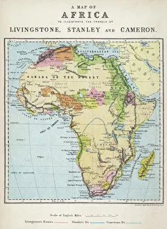
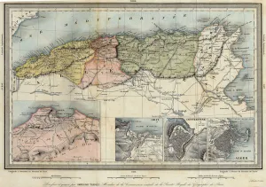
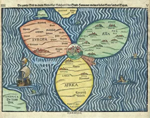
The Maps of Sudan Africa collection from Media Storehouse offers a unique and fascinating glimpse into the history and geography of Sudan. Our collection features a wide range of maps, including antique maps dating back to the 19th century as well as more modern topographical maps. These maps showcase the diverse terrain of Sudan, from its vast deserts to its lush river valleys. They also provide insight into the country's rich cultural heritage, with detailed depictions of ancient cities and landmarks. Whether you're a history buff or simply looking for an eye-catching piece of wall art, our collection has something for everyone. Each map is expertly reproduced using high-quality printing techniques and can be ordered in a variety of sizes and framing options to suit your needs. With their intricate details and stunning visuals, these maps are sure to spark conversation and inspire curiosity about one of Africa's most fascinating countries.
+
What are Maps of Sudan Africa art prints?
Maps of Sudan Africa art prints are high-quality reproductions of maps depicting the country of Sudan and its surrounding areas. These prints showcase intricate details such as topography, political boundaries, major cities, and bodies of water. They are a great way to add a touch of sophistication and elegance to any space while also serving as educational tools. These art prints come in various sizes and can be framed or mounted for display purposes. They are printed on premium quality paper using state-of-the-art printing technology that ensures vibrant colors and sharp details that will last for years without fading. Whether you're an avid traveler or simply interested in geography, Maps of Sudan Africa art prints make excellent additions to your home decor collection. We offer a unique perspective on the world around us while also providing valuable information about one specific region.
+
What Maps of Sudan Africa art prints can I buy from Media Storehouse?
We offer a wide range of Maps of Sudan Africa art prints that are perfect for anyone looking to add some African flair to their home or office. These maps showcase the diverse geography and topography of Sudan, including its deserts, mountains, rivers, and lakes. You can choose from a variety of styles and designs, including vintage maps with intricate details or modern interpretations with bold colors. Some popular options include antique maps dating back to the 19th century that show the country's historical boundaries and colonial influences. Other contemporary prints feature satellite imagery that highlights Sudan's natural resources such as oil fields and agricultural lands. Whether you're an avid traveler or simply appreciate beautiful artwork, we have something for everyone. Their high-quality prints are available in various sizes and materials so you can find the perfect fit for your space.
+
How do I buy Maps of Sudan Africa art prints?
To buy Maps of Sudan Africa art prints from Media Storehouse, you can browse our extensive collection of maps and select the one that best suits your needs. Once you have found the map that you want to purchase, simply add it to your cart and proceed to checkout. During the checkout process, you will be prompted to enter your shipping information and payment details. We offer a range of payment options including credit card, PayPal and bank transfer. Once your order has been processed, they will print the map on high-quality paper using state-of-the-art printing technology. Maps of Sudan Africa art prints are perfect for anyone who loves geography or wants to decorate their home or office with unique artwork. They make great gifts for friends and family members who are interested in travel or history as well. With our easy-to-use website and fast shipping times, buying maps has never been easier.
+
How much do Maps of Sudan Africa art prints cost?
We offer a wide range of Maps of Sudan Africa art prints at varying prices. Our collection includes vintage and contemporary maps that showcase the country's diverse landscapes, cities, and regions. The cost of these prints depends on several factors such as the size, quality, and framing options selected by our customers. We understand that every customer has unique preferences when it comes to purchasing art prints. That is why we provide an extensive selection of Maps of Sudan Africa art prints to cater to different tastes and budgets. Whether you are looking for a small print or a large canvas print, we have something for everyone. Our Maps of Sudan Africa art prints are perfect for home decor or office spaces. They make great gifts for friends or family members who love travel or geography-related artwork. We take pride in offering high-quality products at affordable prices without compromising on quality or service standards.
+
How will my Maps of Sudan Africa art prints be delivered to me?
We offer a range of delivery options for our Maps of Sudan Africa art prints. We understand the importance of ensuring that your order is delivered to you in perfect condition and in a timely manner. Our standard delivery option usually takes between 3-5 working days from the date of dispatch, while our express delivery option guarantees next day delivery within the UK. All our art prints are carefully packaged using high-quality materials to ensure they arrive at your doorstep undamaged. We use sturdy cardboard tubes or flat packaging depending on the size and type of print you have ordered. We also offer international shipping for customers outside the UK, with varying delivery times depending on your location. Rest assured that we will do everything possible to get your Maps of Sudan Africa art prints delivered to you as quickly and safely as possible.