Home > Europe > Bosnia and Herzegovina > Maps
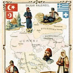
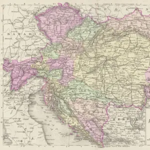
Antique Map of Austria Empire Late 19th Century

![]()
Wall Art and Photo Gifts from Fine Art Storehouse
Antique Map of Austria Empire Late 19th Century
Antique Map of Austria Empire in the Late 19th Century
Unleash your creativity and transform your space into a visual masterpiece!
duncan1890
Media ID 14757152
© duncan1890
Austria Austrian Culture Balkans Bosnia And Hercegovina Central Europe Eastern Europe Empire Equipment European Culture Hapsburg Dynasty Hungarian Culture Hungary Navigational Equipment Romania Styles Transylvania Austrian Empire Drawing Art Product Image Created 19th Century Victorian Style
FEATURES IN THESE COLLECTIONS
> Europe
> Bosnia and Herzegovina
> Maps
> Fine Art Storehouse
> Map
> Historical Maps
> Maps and Charts
> Bosnia and Herzegovina
> Maps and Charts
> Early Maps
EDITORS COMMENTS
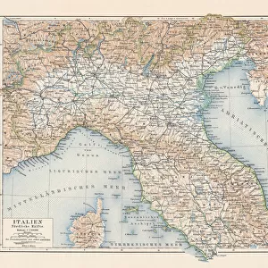
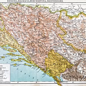
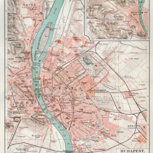
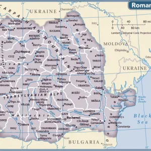
This print showcases an Antique Map of the Austria Empire in the late 19th century, offering a glimpse into European culture and history. The intricate cartography and exquisite engraving bring to life the grandeur of this bygone era. The map encompasses various regions, including Transylvania, Hungary, Romania, Bosnia and Hercegovina, and the Balkans. It reflects the rich tapestry of cultures that once thrived within these borders. With its Victorian-style aesthetics and vibrant colors, this image transports us back to a time when navigational equipment was meticulously crafted and maps were works of art themselves. The Hapsburg Dynasty's influence is evident throughout this empire as it expanded across Central Europe. As we delve into this piece, we are reminded of how our world has evolved over time while cherishing the past. This antique illustration serves as a testament to Austrian culture's enduring legacy. Duncan1890's expertise in capturing historical beauty shines through in every detail of this print. Whether you have an affinity for history or simply appreciate fine art products with cultural significance, this Antique Map of Austria Empire will undoubtedly make a striking addition to any collection or space it graces.
MADE IN THE UK
Safe Shipping with 30 Day Money Back Guarantee
FREE PERSONALISATION*
We are proud to offer a range of customisation features including Personalised Captions, Color Filters and Picture Zoom Tools
SECURE PAYMENTS
We happily accept a wide range of payment options so you can pay for the things you need in the way that is most convenient for you
* Options may vary by product and licensing agreement. Zoomed Pictures can be adjusted in the Basket.