Fine Art Print > Science Photo Library > Aerial and Satellite
Fine Art Print : River Nile Delta and Suez Canal
![]()

Fine Art Prints from Science Photo Library
River Nile Delta and Suez Canal
River Nile Delta and Suez Canal, Egypt, satellite image. North is at top. Water is black, vegetation is green and arid land is brown. The image data has been decorrelated to enhance the colours. The delta of the River Nile is intensively farmed due to the rich and fertile sediment deposited by the river as it reaches the Mediterranean Sea. Centre- pivot irrigation circles are seen at lower centre. At right, the Suez Canal connects the Red Sea to the Mediterranean. This 180-kilometre-wide image was taken on 20 September 1984, in visible and infrared wavelengths, with the Thematic Mapper (TM) sensor on a NASA Landsat satellite
Science Photo Library features Science and Medical images including photos and illustrations
Media ID 1705383
© EARTH SATELLITE CORPORATION/SCIENCE PHOTO LIBRARY
1984 Africa African Agricultural Agriculture Arid Coast Coast Line Coastal Cover Cultivated Cultivation Deposits Desert Egypt Egyptian Enhanced Enhancement Environmental Farmed Farms Fields From Space Infra Red Irrigation Land Use Landsat Mediterranean Sea Mouth Nile Delta Optical River Satellite Sediment September Suez Canal Visible Irrigated Riparian
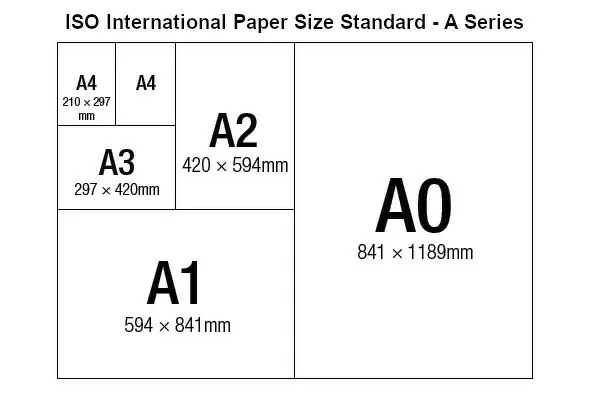
A2 (42x59cm) Fine Art Print
Discover the timeless beauty of Egypt's rich history with our stunning Fine Art Print of the River Nile Delta and Suez Canal from Science Photo Library. This captivating satellite image showcases the breathtaking contrast between the shimmering black waters of the Nile and the lush green delta, framed by the arid, golden brown land. Decorrelating the image data enhances the vibrant colors, bringing the essence of this iconic landscape right into your home or office. Add a touch of history and wonder to your space with this exquisite Fine Art Print from Media Storehouse.
Our Fine Art Prints are printed on 100% acid free, PH neutral paper with archival properties. This printing method is used by museums and art collections to exhibit photographs and art reproductions. Hahnemühle certified studio for digital fine art printing. Printed on 308gsm Photo Rag Paper.
Our fine art prints are high-quality prints made using a paper called Photo Rag. This 100% cotton rag fibre paper is known for its exceptional image sharpness, rich colors, and high level of detail, making it a popular choice for professional photographers and artists. Photo rag paper is our clear recommendation for a fine art paper print. If you can afford to spend more on a higher quality paper, then Photo Rag is our clear recommendation for a fine art paper print.
Estimated Image Size (if not cropped) is 42cm x 43.3cm (16.5" x 17")
Estimated Product Size is 42cm x 59.4cm (16.5" x 23.4")
These are individually made so all sizes are approximate
Artwork printed orientated as per the preview above, with portrait (vertical) orientation to match the source image.
EDITORS COMMENTS
This stunning satellite image captures the breathtaking beauty of the River Nile Delta and Suez Canal in Egypt. The photo, taken on 20 September 1984 by a NASA Landsat satellite, showcases the diverse landscape of this region. With north at the top, we can see the contrasting colors that define different elements of this area. The black water of the river stands out against the vibrant green vegetation along its banks. This lushness is a result of rich sediment deposited by the Nile as it flows into the Mediterranean Sea, making it an ideal location for intensive farming. In fact, at lower center, you can observe circular patterns created by center-pivot irrigation systems used to cultivate crops. To the right side of the image lies one of Egypt's most iconic landmarks -the Suez Canal- connecting both Red Sea and Mediterranean waters. Spanning an impressive width of 180 kilometers, this man-made marvel plays a crucial role in global trade and transportation. The enhanced colors in this image provide us with a unique perspective on land use and environmental factors within this African nation. From space, we witness how human activity has shaped these landscapes through cultivation and agricultural practices. Overall, this photograph serves as a testament to both nature's wonders and humanity's ability to harness its resources for sustenance and progress.
MADE IN THE UK
Safe Shipping with 30 Day Money Back Guarantee
FREE PERSONALISATION*
We are proud to offer a range of customisation features including Personalised Captions, Color Filters and Picture Zoom Tools
SECURE PAYMENTS
We happily accept a wide range of payment options so you can pay for the things you need in the way that is most convenient for you
* Options may vary by product and licensing agreement. Zoomed Pictures can be adjusted in the Basket.


