Home > Arts > Artists > C > Calopodio da Candia
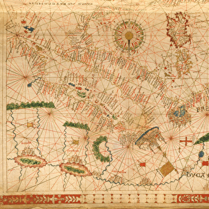
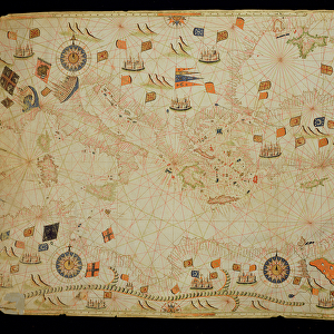
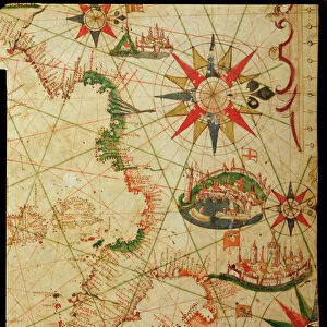
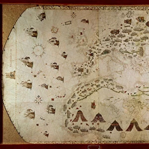
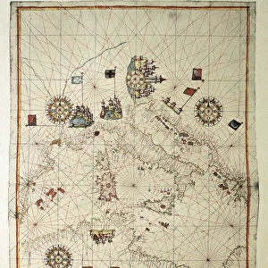
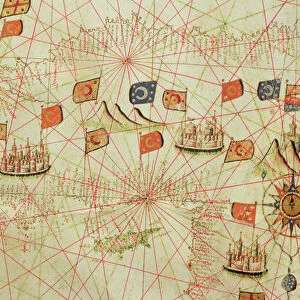
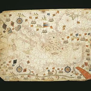
The Balkans, from a nautical atlas of the Mediterranean and Middle East (ink on vellum)
")
![]()
Wall Art and Photo Gifts from Fine Art Finder
The Balkans, from a nautical atlas of the Mediterranean and Middle East (ink on vellum)
XOT330931 The Balkans, from a nautical atlas of the Mediterranean and Middle East (ink on vellum) by Calopodio da Candia (fl. 16th century); 40.3x60 cm; Museo Correr, Venice, Italy; Italian, out of copyright
Media ID 12852617
© www.bridgemanart.com
Chart Compass Mapping Portolan
FEATURES IN THESE COLLECTIONS
> Arts
> Artists
> C
> Calopodio da Candia
> Europe
> Italy
> Veneto
> Venice
> Fine Art Finder
> Artists
> C
> Calopodio da Candia Calopodio da Candia
> Fine Art Finder
> Artists
> Calopodio da Candia
> Maps and Charts
> Italy
> Maps and Charts
> Related Images
EDITORS COMMENTS
This print showcases "The Balkans" from a nautical atlas of the Mediterranean and Middle East, created by Calopodio da Candia in the 16th century. The intricate details and skilled craftsmanship are evident in this ink on vellum masterpiece, measuring 40.3x60 cm. Displayed at the Museo Correr in Venice, Italy, this Italian artwork offers a glimpse into historical cartography and mapping techniques. The map features various elements such as mountains, ports, compasses, and flags representing different regions within the Balkan Peninsula. As we delve into this image's rich history, it is important to note that it falls under public domain due to its age. This means that anyone can appreciate its beauty without any commercial restrictions. "The Balkans" invites us to explore an era when maps were meticulously hand-drawn with great precision. It serves as a reminder of how far we have come in terms of technology and navigation methods. Whether you are fascinated by cartography or simply drawn to historical artistry, this print captures the essence of exploration and discovery. It allows us to appreciate both the artistic talent behind it and gain insight into past geographical knowledge. Experience a piece of history through "The Balkans" immortalized on ink-stained vellum for all generations to admire.
MADE IN THE UK
Safe Shipping with 30 Day Money Back Guarantee
FREE PERSONALISATION*
We are proud to offer a range of customisation features including Personalised Captions, Color Filters and Picture Zoom Tools
SECURE PAYMENTS
We happily accept a wide range of payment options so you can pay for the things you need in the way that is most convenient for you
* Options may vary by product and licensing agreement. Zoomed Pictures can be adjusted in the Basket.