Fraud Blocker Skip to main content

Home > Europe > Italy > Maps

Maps Collection

Maps of Italy Europe are invaluable resources for anyone looking to explore the country

Choose a picture from our Maps Collection for your Wall Art and Photo Gifts

4,065 items

Background imageMaps Collection: Sicily map 1895

Sicily map 1895
Meyers Konversations-Lexikon. Ein Nachschlagewerk des allgemeinen Wissens, 5th edition 17 volumes Bibliographisches Institut - Leipzig 1895-1897

Background imageMaps Collection: Philosophy, self-portrait by Italian artist Salvator Rosa (oil painting)

Philosophy, self-portrait by Italian artist Salvator Rosa (oil painting)
7172079 Philosophy, self-portrait by Italian artist Salvator Rosa (oil painting) by Rosa, Salvator (1615-73) (after); Private Collection; (add.info.: Philosophy)

Background imageMaps Collection: Austro-Hungarian Empire, Habsburg Monarchy, lithograph, published in 1877

Austro-Hungarian Empire, Habsburg Monarchy, lithograph, published in 1877
Ancient map of Austro-Hungarian Empire. Habsburg Monarchy. Lithograph, published in 1877

Background imageMaps Collection: Italy Map - illustration

Italy Map - illustration
Colored Map of Italy The urls of the reference files are (country, continent, world map and globe). - The illustration was completed January 09

Background imageMaps Collection: Al-Idrisis world map, 1154

Al-Idrisis world map, 1154
Al-Idrisis world map. This world map, known as the Tabula Rogeriana, dates from 1154, and is orientated with North at bottom

Background imageMaps Collection: Map of Venice in 1500, by Jacopo de Barbari

Map of Venice in 1500, by Jacopo de Barbari
Cartography, Italy, 16th century. Map of Venice in 1500, by Jacopo de Barbari

Background imageMaps Collection: Map of ancient Rome

Map of ancient Rome
City plan of ancient Rome. Lithograph

Background imageMaps Collection: Italy country map

Italy country map
2011 edition

Background imageMaps Collection: Battle of Cannae plan, 216 BC

Battle of Cannae plan, 216 BC
Map of the Battle of Cannae, in which Hannibal defeated the Romans during the Second Punic War, 216 BC. Hand-colored woodcut of a 19th-century illustration

Background imageMaps Collection: Map of Florence known as Della Catena Map of Florence, Attributed to Francesco di Lorenzo

Map of Florence known as Della Catena Map of Florence, Attributed to Francesco di Lorenzo Rosselli, 1470, illustration
Cartography, Italy, 15th century. Map of Florence known as The Della Catena Map of Florence. Attributed to Francesco di Lorenzo Rosselli, 1470

Background imageMaps Collection: Maps of Italy in ancient times

Maps of Italy in ancient times
Map of early tribes in Italy (top). of the Roman hills (lower left). and the vicinity of Rome (right) in the time of the Roman Empire. Printed color lithograph of a 19th-century illustration

Background imageMaps Collection: MAP OF ITALY, c1585. By Ignazio Danti from Sistine Chapel Gallery of Maps

MAP OF ITALY, c1585. By Ignazio Danti from Sistine Chapel Gallery of Maps

Background imageMaps Collection: The Mappa Mundi of Fra Mauro, a Camaldolese monk from the monastery of San Michele in Murano, 1459

The Mappa Mundi of Fra Mauro, a Camaldolese monk from the monastery of San Michele in Murano, 1459
ALI75764 The Mappa Mundi of Fra Mauro, a Camaldolese monk from the monastery of San Michele in Murano, 1459 by Italian School, (15th century); Palazzo Ducale, Venice, Italy; Alinari

Background imageMaps Collection: Europe Map with France, Portugal, Spain and Netherlands

Europe Map with France, Portugal, Spain and Netherlands
Europe Map. Vector Illustration with France, Portugal, Spain and Netherlands

Background imageMaps Collection: Roman Republic and Carthage during the Second Punic War (218-201-BC)

Roman Republic and Carthage during the Second Punic War (218-201-BC)
Ancient map of the Roman Republic and Carthage during the Second Punic War (218 to 201 BC). Legend in Latin language. Steel engraving with hand colored borderlines, published in 1861

Background imageMaps Collection: Antique colored illustrations: Geological map of England and Wales

Antique colored illustrations: Geological map of England and Wales

Background imageMaps Collection: Map of the Roman Empire

Map of the Roman Empire
Map showing the extent of the Roman Empire. Hand-colored woodcut of a 19th-century illustration

Background imageMaps Collection: Map of Europe under the Roman Empire

Map of Europe under the Roman Empire
Map of Europe in the time of the Roman Empire. Printed color lithograph of a 19th-century illustration

Background imageMaps Collection: Italy Reference Map

Italy Reference Map
950857450

Background imageMaps Collection: Cartoon map of ITALY

Cartoon map of ITALY

Background imageMaps Collection: Antique Damaged Map of Italy 19th Century

Antique Damaged Map of Italy 19th Century
Antique damaged map of Italy 19th Century

Background imageMaps Collection: 16th Century Plan of Florence

16th Century Plan of Florence
16th century plan of Florence, Italy. Detail from the map of Etruria (Tuscany and Northern Lazio), in the Gallery of Maps in the Vatican Museum.The Gallery of Maps holds maps which were commissioned

Background imageMaps Collection: Regions of Italy in the Roman Empire

Regions of Italy in the Roman Empire
Map of Italy, during the time of Caesar Augustus to Emperor Constantine. Color lithograph of a 19th-century illustration

Background imageMaps Collection: Map of Europe, 1600

Map of Europe, 1600
16th century map of Europe. Published in Sienna in 1600, this Italian map shows the latest knowledge of the geography of Europe

Background imageMaps Collection: Map of Italy, 1902. Creator: Unknown

Map of Italy, 1902. Creator: Unknown
Map of Italy, 1902. Showing the various administrative regions, the islands of Sardinia and Sicily, with inset of Rome. From The Century Atlas of the World. [John Walker & Co, Ltd. London, 1902]

Background imageMaps Collection: Antquie Map of Italy

Antquie Map of Italy
Vintage map of Italy fron 1837

Background imageMaps Collection: Map of Venice 1897

Map of Venice 1897
Map of the city of Venice, Italy

Background imageMaps Collection: Barbarossa-Era Italy Map

Barbarossa-Era Italy Map
A map of Italy in the reign of Holy Roman Emperor Friedrich I, known as Barbarossa

Background imageMaps Collection: City map of Florence, Italy, lithograph, published in 1897

City map of Florence, Italy, lithograph, published in 1897
City map of Florence - capital city of the Italian region of Tuscany. Lithograph, published in 1897

Background imageMaps Collection: Vintage map of Magna Graecia

Vintage map of Magna Graecia, showing the settlements of the ancient greeks in Italy. Magna GrA|cia is the name of the coastal areas of Southern Italy on the Tarentine Gulf that was extensively

Background imageMaps Collection: 16th century world map

16th century world map
World map, published around 1565 in Venice, Italy, by Italian mapmaker Ferando Bertelli. The title of the map: Universale Descrittione di Tutta la Terra Conosciuta Fin Qui

Background imageMaps Collection: Antique Map of Italy, with detail of straits of Messina, 19th Century

Antique Map of Italy, with detail of straits of Messina, 19th Century

Background imageMaps Collection: George Bradshaws Plan of Trieste, Italy 1896

George Bradshaws Plan of Trieste, Italy 1896
This is a very detailed Plan of the Port and City of Trieste showing the Port, streets, canals, principal buildings, railways and railway stations

Background imageMaps Collection: Map of Greek island of Corfu. Ionian Sea. Italian map. 1537

Map of Greek island of Corfu. Ionian Sea. Italian map. 1537

Background imageMaps Collection: Travels of The Apostle Paul Map Engraving

Travels of The Apostle Paul Map Engraving
Engraved illustration of the Travels of The Apostle Paul Map Engraving from The Popular Pictorial Bible, Containing the Old and New Testaments, Published in 1862

Background imageMaps Collection: Italy map 1875

Italy map 1875
The Independent Course Comprehensive Geography by James Monteith, A.S. Barnes & Co, New York & Chicago 1875

Background imageMaps Collection: Map of Molfetta (Bari), Engraving

Map of Molfetta (Bari), Engraving
Italy, 17th century. Map of Molfetta (Bari). Engraving

Background imageMaps Collection: Map of Venice

Map of Venice
Map of the city of Venice, Italy Date: 19th century

Background imageMaps Collection: Map of Naples and surrounding, Campania, Italy, lithograph, published 1897

Map of Naples and surrounding, Campania, Italy, lithograph, published 1897
Topographic map of Naples (Italian: Napoli) and surrounding, Campania, Italy. Lithograph, published in 1897

Background imageMaps Collection: City map of Rome, lithograph, published in 1878

City map of Rome, lithograph, published in 1878
City map of Rome, Italy. Lithograph, published in 1878

Background imageMaps Collection: Map of Venice 1898

Map of Venice 1898
Antique illustration of a Map of Venice 1898

Background imageMaps Collection: Map of Florence

Map of Florence
Map of the city of Florence, Italy and the River Arno Date: 19th century

Background imageMaps Collection: Map of Italy and the Mediterranean made out of ceramic tiles on a street in Seville

Map of Italy and the Mediterranean made out of ceramic tiles on a street in Seville, Spain

Background imageMaps Collection: Europe map 1867

Europe map 1867
Mitchellas Modern Atlas - Published by E.H. Butler and Co - Philadelphia 1867

Background imageMaps Collection: Map of Sicily region, by Joan Blaeu

Map of Sicily region, by Joan Blaeu
Cartography, Italy, 17th century. Map of Sicily region, by Joan Blaeu

Background imageMaps Collection: Cantino planisphere by Alberto Cantino, 1502

Cantino planisphere by Alberto Cantino, 1502
Cartography, 16th century. Cantino planisphere, by Alberto Cantino, 1502

Background imageMaps Collection: Fra Mauro ( -1460). Fra Mauro map. 1459. Detail

Fra Mauro ( -1460). Fra Mauro map. 1459. Detail of Southeast Asia with the island of Borneo. The map is oriented with south at top. Miniature Painting. ITALY. Venice

Background imageMaps Collection: PTOLEMY, Claudius Ptolemaeus ( c. AD 100 - c

PTOLEMY, Claudius Ptolemaeus ( c. AD 100 - c
" PTOLEMY, Claudius Ptolemaeus ( c. AD 100 - c. AD 170). Egyptian astronomer, mathematician and geographer. Map of the Ancient World. From the work " Ptolomeus Geographicorum Libri"


All Professionally Made to Order for Quick Shipping


-

Maps Collection

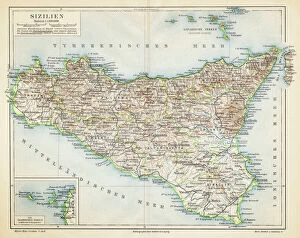
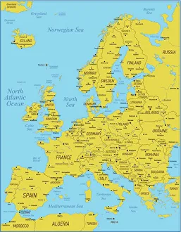
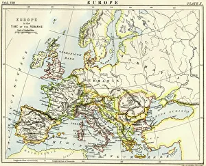
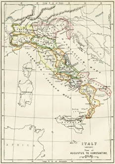
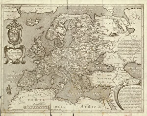
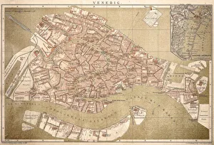
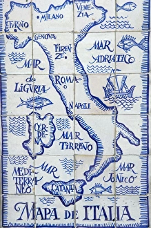
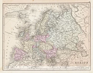
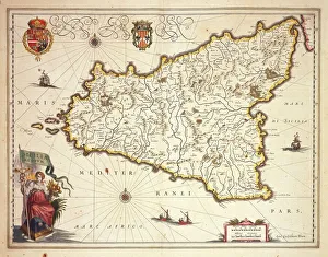
Maps of Italy Europe are invaluable resources for anyone looking to explore the country. They provide detailed information about the terrain, roads, cities, and other points of interest, and are be found in a variety of formats such as paper maps, online maps, and apps. Paper they can great for planning trips or getting an overview of the area while online maps provide more detailed information such as street names and directions. Apps are also useful for navigating while on-the-go. Maps of Italy Europe can help travelers find their way around unfamiliar places with ease and make sure they don’t miss out on any must-see attractions along their journey.
+

Our beautiful pictures are available as Framed Prints, Photos, Wall Art and Photo Gifts

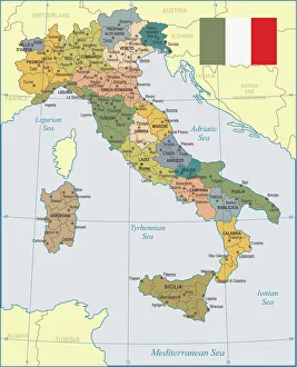
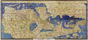
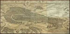
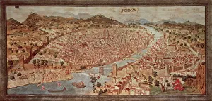
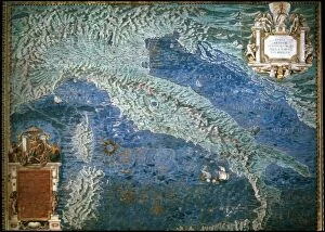
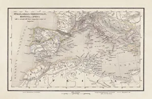
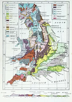
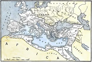
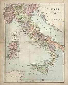
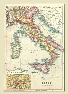
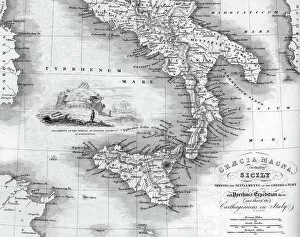
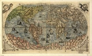
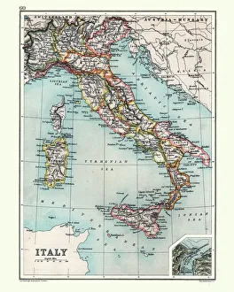
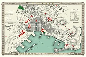
The Maps of Italy Europe collection from Media Storehouse is a stunning range of wall art and framed prints that showcase the beauty and diversity of Italy. Our collection features an extensive selection of maps, ranging from antique maps dating back to the 16th century to modern-day cartography. Each map has been carefully selected for its historical significance or aesthetic appeal, making it a perfect addition to any home or office space. The Maps of Italy Europe collection offers something for everyone, with maps depicting different regions and cities across Italy. From the rolling hills of Tuscany to the bustling streets of Rome, these maps capture the essence of this beautiful country in intricate detail. Whether you are looking for a unique piece of wall art or a thoughtful gift for someone special, the Maps of Italy Europe collection is sure to impress. With high-quality printing and framing options available, these prints are designed to last a lifetime and bring joy to all who view them.
+

What are Maps of Italy Europe art prints?

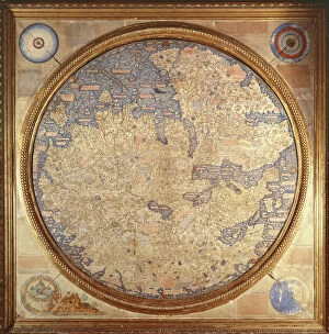
Maps of Italy Europe art prints are high-quality reproductions of vintage and contemporary maps that showcase the intricate details and beauty of Italy and other European countries. These prints are perfect for those who love to travel, history enthusiasts, or anyone looking to add a touch of sophistication to their home decor. These art prints come in various sizes and styles, from colorful antique maps depicting the regions of Italy to modern minimalist designs highlighting the country's famous landmarks. They are printed on premium paper using archival inks that ensure long-lasting color vibrancy. Maps of Italy Europe art prints make great gifts for friends or family members who have a special connection with Italy or Europe. They can also be used as educational tools in classrooms or offices. Whether you're looking for a unique piece to decorate your living room wall or want to add some character to your workspace, Maps of Italy Europe art prints offer endless possibilities for personalization and creativity.
+

What Maps of Italy Europe art prints can I buy from Media Storehouse?

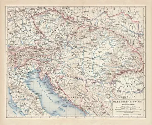
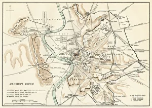
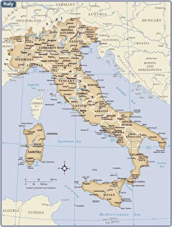
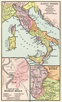
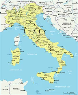
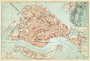
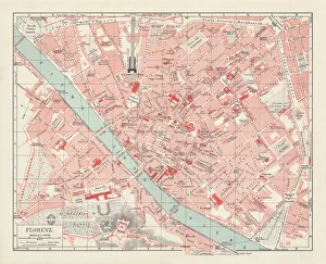
We offer a wide range of Maps of Italy Europe art prints that you can buy. These maps are available in various sizes and styles to suit your preferences. You can choose from antique, vintage, or contemporary designs that showcase the beauty and history of Italy and Europe. The collection includes detailed maps of Italian cities such as Rome, Florence, Venice, Milan, Naples, and many others. You can also find regional maps that highlight the diverse landscapes and cultures across Italy's 20 regions. In addition to Italian maps, Media Storehouse also offers European continent maps that feature neighboring countries such as France, Spain, Germany, Switzerland among others. These prints come in different formats including canvas prints or framed wall art for easy display on your walls. Whether you're looking for decorative pieces for your home or office space or educational resources for schools or libraries; Media Storehouse has got you covered with their extensive selection of Maps of Italy Europe art prints.
+

How do I buy Maps of Italy Europe art prints?

To buy Maps of Italy Europe art prints from Media Storehouse, you can browse our extensive collection online. We offer a variety of sizes and framing options to suit your preferences. Once you have found the print that you like, simply add it to your cart and proceed to checkout. You will be prompted to enter your shipping information and payment details before completing the purchase. We offer high-quality prints on premium paper using state-of-the-art printing technology. Their maps are sourced from reputable archives and collections around the world, ensuring accuracy and authenticity. Whether you are looking for a vintage map of Italy or a contemporary interpretation of Europe's geography, we have something for everyone. With our easy-to-use website and secure checkout process, buying Maps of Italy Europe art prints has never been easier.
+

How much do Maps of Italy Europe art prints cost?

We offer a wide range of Maps of Italy Europe art prints at various price points to suit different budgets. Our collection includes vintage maps, contemporary designs, and everything in between. The cost of our Maps of Italy Europe art prints depends on several factors such as the size, framing options, and materials used for printing. We use high-quality paper and ink to ensure that every print is vibrant and long-lasting. Our you can choose from a variety of sizes ranging from small to large formats depending on their preferences. Whether you're looking for a simple poster or an intricately framed piece, we have something for everyone. Our selection also includes canvas prints which provide a unique texture and depth to your artwork. The cost of our Maps of Italy Europe art prints varies based on individual choices but we strive to provide affordable options without compromising quality.
+

How will my Maps of Italy Europe art prints be delivered to me?

We take great care in ensuring that your Maps of Italy Europe art prints are delivered to you safely and securely. Our delivery process is designed to be hassle-free and convenient for our customers. Once you have placed your order with us, your Maps of Italy Europe art prints will be carefully packaged and dispatched from our warehouse. We use reliable courier services to ensure that your artwork arrives at its destination in perfect condition. We offer a range of delivery options depending on the size and weight of your order, as well as the destination address. You can choose standard or express delivery options at checkout. Our team is committed to providing excellent customer service throughout the entire ordering process. If you have any questions about shipping or delivery, please don't hesitate to contact us via email or phone. We're always happy to help.