Fraud Blocker Skip to main content

Home > Europe > United Kingdom > Northern Ireland > Maps

Maps Collection

Maps of Northern Ireland, United Kingdom and Europe are essential tools for navigating the region

Choose a picture from our Maps Collection for your Wall Art and Photo Gifts

406 items

Background imageMaps Collection: Map of Londonderry, Derry, Donegal, Northern Ireland, Victorian Engraving, 1840

Map of Londonderry, Derry, Donegal, Northern Ireland, Victorian Engraving, 1840
Very Rare, Beautifully Illustrated Antique Engraving of Map of Londonderry, Derry, Donegal, Northern Ireland, Victorian Engraving, 1840. Source: Original edition from my own archives

Background imageMaps Collection: Northern Ireland Road Map

Northern Ireland Road Map
This detailed Northern Ireland road map is ideal for planning travel either for business or pleasure. Motorways, primary routes

Background imageMaps Collection: Map of Ireland 1897

Map of Ireland 1897
Map of Ireland

Background imageMaps Collection: Antique map of Ireland

Antique map of Ireland, 1864

Background imageMaps Collection: Ireland Political Road Map

Ireland Political Road Map
A detailed road map of the island of Ireland colour coded by county/district. The detailed map base consists of a comprehensive road network

Background imageMaps Collection: Old Map of Belfast 1851 by John Tallis

Old Map of Belfast 1851 by John Tallis
The River Lagan dominates the west side of this John Tallis 1851 plan of Belfast with Queens Bridge crossing into the town of Belfast in Northern Ireland. There are six splendid illustrations

Background imageMaps Collection: Antique damaged map of Ireland in the 19th Century

Antique damaged map of Ireland in the 19th Century
Vintage engraving of a Antique damaged map of Ireland in the 19th Century, 1873

Background imageMaps Collection: North of Ireland for Holidays, LMS (NCC), BCDR and GNR poster, 1950

North of Ireland for Holidays, LMS (NCC), BCDR and GNR poster, 1950. Poster produced for the London Midland & Scottish (Northern Counties Commission)

Background imageMaps Collection: Scotland, UK, satellite image

Scotland, UK, satellite image
Scotland, UK. North is at top. Natural colour satellite image showing Scotland in the United Kingdom, with the surrounding territories shaded out

Background imageMaps Collection: Spanish map of England, Scotland and Ireland

Spanish map of England, Scotland and Ireland
A Spanish map of England, Scotland and Ireland and the coast of northern France from the time of the Anglo Spanish War. Joan Martines (1556-1591). Date: 1587

Background imageMaps Collection: Poster for Empire Air Day, 1934

Poster for Empire Air Day, 1934
Shows aerodromes in England, Wales, southern Scotland and Northern Ireland, all of which were open for Empire Air Day. Admission one shilling for adults, sixpence for children

Background imageMaps Collection: Antique Map of Northern Ireland, detail of Londonderry, 19th Century

Antique Map of Northern Ireland, detail of Londonderry, 19th Century
Antique Map of Northern Ireland, detail of Londonderry area, 19th Century

Background imageMaps Collection: The Russo-Turkish War, 1877-78, map of the seat of war in Europe

The Russo-Turkish War, 1877-78, map of the seat of war in Europe
3062101 The Russo-Turkish War, 1877-78, map of the seat of war in Europe.; Private Collection; (add.info.: From The Century Edition of Cassell's History of England, published c. 1900)

Background imageMaps Collection: Plan of London, England c. 1300. From Historical Atlas, published 1923

Plan of London, England c. 1300. From Historical Atlas, published 1923
2603529 Plan of London, England c. 1300. From Historical Atlas, published 1923

Background imageMaps Collection: Map showing the Roman roads in Britain. Illustrated Easy Stories from English History

Map showing the Roman roads in Britain. Illustrated Easy Stories from English History
1000964 Map showing the Roman roads in Britain. Illustrated Easy Stories from English History.; Private Collection

Background imageMaps Collection: English Gulf, South American Pacific Coast, 1685 (manuscript)

English Gulf, South American Pacific Coast, 1685 (manuscript)
7339777 English Gulf, South American Pacific Coast, 1685 (manuscript) by Hack, William (17th Century); 40x50 cm; National Maritime Museum, London

Background imageMaps Collection: Spithead assembly of the fleet 15th to 20th July 1914, 1914 (lithograth)

Spithead assembly of the fleet 15th to 20th July 1914, 1914 (lithograth)
7339486 Spithead assembly of the fleet 15th to 20th July 1914, 1914 (lithograth) by British School, (20th century) ; 38x56 cm; National Maritime Museum, London

Background imageMaps Collection: Plymouth, 1693 (single sheet engraving)

Plymouth, 1693 (single sheet engraving)
7339467 Plymouth, 1693 (single sheet engraving) by Collins, Greenvile (1643-94); 51x64 cm; National Maritime Museum, London

Background imageMaps Collection: Sir William Herschel (1738-1822), c.1795 (oil on panel)

Sir William Herschel (1738-1822), c.1795 (oil on panel)
7337932 Sir William Herschel (1738-1822), c.1795 (oil on panel) by Russell, John (1745-1806); 36.3x31x8 cm; National Maritime Museum, London

Background imageMaps Collection: The track of the Armada around Britain and Ireland, 1590 (print, paper, engraving)

The track of the Armada around Britain and Ireland, 1590 (print, paper, engraving)
7340786 The track of the Armada around Britain and Ireland, 1590 (print, paper, engraving) by Adams, Robert (1540-95) (after); 54.5x79.5 cm; National Maritime Museum, London

Background imageMaps Collection: Map of South East England, 1738 (print)

Map of South East England, 1738 (print)
7340691 Map of South East England, 1738 (print) by Whiston, William (18th century); National Maritime Museum, London, UK; (add.info.: Creator)

Background imageMaps Collection: An Exact Plan of Greenwich Park, c.1700 (canvas)

An Exact Plan of Greenwich Park, c.1700 (canvas)
7340658 An Exact Plan of Greenwich Park, c.1700 (canvas) by Wise, Henry (18th century); National Maritime Museum, London, UK; (add.info.: Creator: Henry Wise ()

Background imageMaps Collection: Map of Islington, Westminster, City and Southwark, 1746 (coloured engraving)

Map of Islington, Westminster, City and Southwark, 1746 (coloured engraving)
7340509 Map of Islington, Westminster, City and Southwark, 1746 (coloured engraving) by Rocque, John (c.1704-d.1762); 51x67 cm; National Maritime Museum, London

Background imageMaps Collection: Chart of the North Sea: Norway to the Dover Straits, c.1700 (coloured engraving)

Chart of the North Sea: Norway to the Dover Straits, c.1700 (coloured engraving)
7340605 Chart of the North Sea: Norway to the Dover Straits, c.1700 (coloured engraving) by British School, (18th Century); National Maritime Museum, London

Background imageMaps Collection: Map of Bay of Biscay and English Channel, 1596 (vellum)

Map of Bay of Biscay and English Channel, 1596 (vellum)
7340489 Map of Bay of Biscay and English Channel, 1596 (vellum) by Hood, Thomas (16th century); 40x53 cm; National Maritime Museum, London

Background imageMaps Collection: England-East Coast. Outer Gabbard to Outer Dowsing, 1941 (engraving)

England-East Coast. Outer Gabbard to Outer Dowsing, 1941 (engraving)
7340584 England-East Coast. Outer Gabbard to Outer Dowsing, 1941 (engraving) by British School, (20th century) ; 99x66 cm; National Maritime Museum, London

Background imageMaps Collection: Orford Ness to Blakeney with the off lying shoals between Smiths Knoll and the other Dowsing

Orford Ness to Blakeney with the off lying shoals between Smiths Knoll and the other Dowsing, 1958 (engraving)
7340579 Orford Ness to Blakeney with the off lying shoals between Smiths Knoll and the other Dowsing, 1958 (engraving) by British School, (20th century) ; National Maritime Museum, London

Background imageMaps Collection: Pas-caert van de Canael, tusschen Engelandt en Vranckryck, van Pleymuyen tot an de Sorlinges

Pas-caert van de Canael, tusschen Engelandt en Vranckryck, van Pleymuyen tot an de Sorlinges
7340065 Pas-caert van de Canael, tusschen Engelandt en Vranckryck, van Pleymuyen tot an de Sorlinges, als mede van Portbimel tot aen Heyssant, 1682 (engraving) by Keulen

Background imageMaps Collection: Pas-caert van Texel tot aen de Hoofden, 1661 (print, paper)

Pas-caert van Texel tot aen de Hoofden, 1661 (print, paper)
7340060 Pas-caert van Texel tot aen de Hoofden, 1661 (print, paper) by Doncker, Hendrick (c.1626-99); 46.5x57.5 cm; National Maritime Museum, London

Background imageMaps Collection: A general chart of the islands of Guernsey and Jersey, Sark, Herm, Jethou and Alderney

A general chart of the islands of Guernsey and Jersey, Sark, Herm, Jethou and Alderney
7340131 A general chart of the islands of Guernsey and Jersey, Sark, Herm, Jethou and Alderney, with Cape la Hague and the Caskets, 1779 (print) by Sayer

Background imageMaps Collection: Plan of the bays of Polkerris and Mevagizey in Cornwall, 1779 (engraving)

Plan of the bays of Polkerris and Mevagizey in Cornwall, 1779 (engraving)
7340128 Plan of the bays of Polkerris and Mevagizey in Cornwall, 1779 (engraving) by British School, (18th Century); 73.5x54 cm; National Maritime Museum, London

Background imageMaps Collection: A general chart of the northern navigation, 1675 (coloured engraving)

A general chart of the northern navigation, 1675 (coloured engraving)
7340043 A general chart of the northern navigation, 1675 (coloured engraving) by Seller, John (1632-97); 43.5x54 cm; National Maritime Museum, London

Background imageMaps Collection: A chart of the coast from Orford Ness to Lowestoff, 1797 (chart)

A chart of the coast from Orford Ness to Lowestoff, 1797 (chart)
7340039 A chart of the coast from Orford Ness to Lowestoff, 1797 (chart) by Diston, John (fl.1797); 50x72 cm; National Maritime Museum, London

Background imageMaps Collection: A new and correct chart of the sea coast, from Orfordness Lights to Prittlewell

A new and correct chart of the sea coast, from Orfordness Lights to Prittlewell, 1797 (technical drawing)
7340038 A new and correct chart of the sea coast, from Orfordness Lights to Prittlewell, 1797 (technical drawing) by Diston, John (fl.1797); 52x73 cm; National Maritime Museum, London

Background imageMaps Collection: Map of Northolt, Harrow and Wembley, 1746 (coloured engraving)

Map of Northolt, Harrow and Wembley, 1746 (coloured engraving)
7340516 Map of Northolt, Harrow and Wembley, 1746 (coloured engraving) by Rocque, John (c.1704-d.1762); 51x67 cm; National Maritime Museum, London

Background imageMaps Collection: Map of Vauxhall, Clapham, Peckham and Dulwich, 1746 (coloured engraving)

Map of Vauxhall, Clapham, Peckham and Dulwich, 1746 (coloured engraving)
7340511 Map of Vauxhall, Clapham, Peckham and Dulwich, 1746 (coloured engraving) by Rocque, John (c.1704-d.1762); 51x67 cm; National Maritime Museum, London

Background imageMaps Collection: Parkefield Gateway to Orford Ness, 1868 (engraving)

Parkefield Gateway to Orford Ness, 1868 (engraving)
7340612 Parkefield Gateway to Orford Ness, 1868 (engraving) by Unknown Artist, (19th century); National Maritime Museum, London, UK; (add.info.: Creator: unknown British Admiralty Chart No. 102)

Background imageMaps Collection: A survey of Fowey Harbour, 1813 (engraving)

A survey of Fowey Harbour, 1813 (engraving)
7340502 A survey of Fowey Harbour, 1813 (engraving) by Austen, Joshua Thomas (19th century); 89x56 cm; National Maritime Museum, London

Background imageMaps Collection: England East Coast: Harwich to Flamborough Head, 1875 (print)

England East Coast: Harwich to Flamborough Head, 1875 (print)
7340598 England East Coast: Harwich to Flamborough Head, 1875 (print) by Wilson, Charles (19th century); 58.5x93 cm; National Maritime Museum, London

Background imageMaps Collection: England East Coast: Yarmouth and Lowestoft Roads, 1859 (engraving)

England East Coast: Yarmouth and Lowestoft Roads, 1859 (engraving)
7340589 England East Coast: Yarmouth and Lowestoft Roads, 1859 (engraving) by Imray, James & Son (19th century); 39x19 cm; National Maritime Museum, London

Background imageMaps Collection: The British Channel with a part of the Atlantic Ocean and of the Coast of Ireland, 1788 (print)

The British Channel with a part of the Atlantic Ocean and of the Coast of Ireland, 1788 (print)
7340084 The British Channel with a part of the Atlantic Ocean and of the Coast of Ireland, 1788 (print) by Sayer, Robert (1724/5-94); 44.2x92.9 cm; National Maritime Museum, London

Background imageMaps Collection: A view of the town & harbour of Halifax, from Dartmouth shore, 1777 (engraving)

A view of the town & harbour of Halifax, from Dartmouth shore, 1777 (engraving)
7340422 A view of the town & harbour of Halifax, from Dartmouth shore, 1777 (engraving) by DesBarres, Joseph Frederick Wallet (1721-1824); 54.5x79 cm; National Maritime Museum, London

Background imageMaps Collection: Angliae, Scotiae, et Hiberniae, sive Britannicar: Insularum descriptio (England)

Angliae, Scotiae, et Hiberniae, sive Britannicar: Insularum descriptio (England, Scotland and Ireland)
7340123 Angliae, Scotiae, et Hiberniae, sive Britannicar: Insularum descriptio (England, Scotland and Ireland, otherwise known as the British Isles)

Background imageMaps Collection: The Spanish and English fleets near Plymouth on 30 - 31 July, 1588, c.1590 (coloured engraving)

The Spanish and English fleets near Plymouth on 30 - 31 July, 1588, c.1590 (coloured engraving)
7340024 The Spanish and English fleets near Plymouth on 30 - 31 July, 1588, c.1590 (coloured engraving) by Adams, Robert (1540-95) (after); 38x50 cm; National Maritime Museum, London

Background imageMaps Collection: Map of Cartagena, 1588 (engraving)

Map of Cartagena, 1588 (engraving)
7340018 Map of Cartagena, 1588 (engraving) by Boazio, Baptista (fl.1588-1606); National Maritime Museum, London, UK; (add.info.: Creator)

Background imageMaps Collection: England east coast entrance to the River Humber surveyed by Staff Captain J

England east coast entrance to the River Humber surveyed by Staff Captain J
7339967 England east coast entrance to the River Humber surveyed by Staff Captain J. Parsons, Royal Navy, 1878-90 (technical drawing) by British School

Background imageMaps Collection: Chart of the River Thames and Estuary, 1790 (coloured engraving)

Chart of the River Thames and Estuary, 1790 (coloured engraving)
7337586 Chart of the River Thames and Estuary, 1790 (coloured engraving) by Stanier, Richard (fl.1790); 43.5x54 cm; National Maritime Museum, London

Background imageMaps Collection: A Representation of the Battell fought betweene the English Fleet... And the Dutch Fleet

A Representation of the Battell fought betweene the English Fleet... And the Dutch Fleet... on the 25th July 1666
7337559 A Representation of the Battell fought betweene the English Fleet... And the Dutch Fleet... on the 25th July 1666


All Professionally Made to Order for Quick Shipping


-

Maps Collection

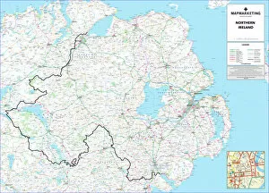
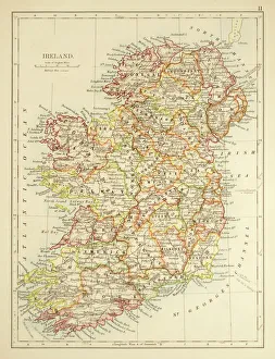
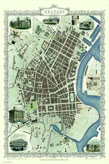
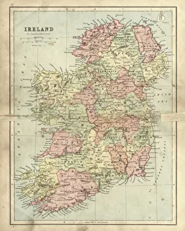
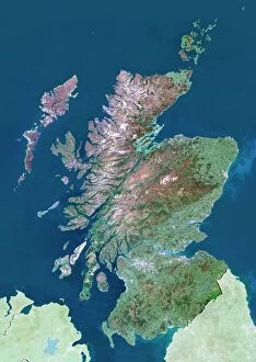
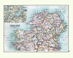
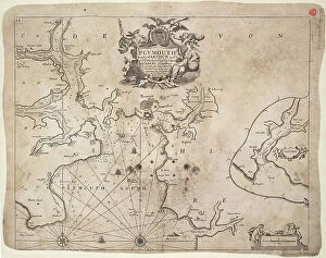
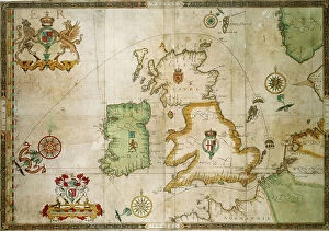
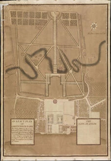
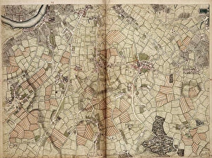
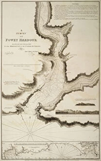
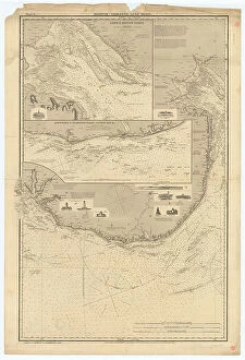
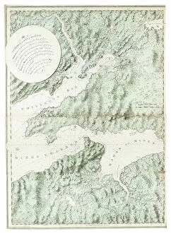
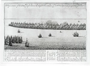
Maps of Northern Ireland, United Kingdom and Europe are essential tools for navigating the region. They provide a detailed overview of the area, including roads, rivers, cities and towns, and are be used to plan trips and explore new places and can also help identify landmarks such as historic sites or natural features like mountains or lakes and can available in various formats such as paper maps, digital maps or online mapping services. These maps provide an invaluable resource for those travelling in the region and allow them to make informed decisions about their journey.
+

Our beautiful pictures are available as Framed Prints, Photos, Wall Art and Photo Gifts

The Maps of Northern Ireland United Kingdom Europe collection from Media Storehouse is a stunning assortment of wall art, framed prints, photo prints, canvas prints, jigsaw puzzles and greeting cards that showcase the beauty and diversity of Northern Ireland. Our collection features an array of maps depicting different regions in Northern Ireland and their unique characteristics. From the rugged coastline to the rolling hillsides dotted with sheep farms, these maps capture the essence of this enchanting land. Each piece in our collection is expertly crafted using high-quality materials to ensure long-lasting durability and exceptional visual appeal. Whether you're looking for a statement piece to adorn your living room or a thoughtful gift for someone special, there's something here for everyone. With its rich history and breathtaking landscapes, Northern Ireland has long been a source of inspiration for artists and photographers alike. The Maps of Northern Ireland United Kingdom Europe collection celebrates this legacy by bringing together some of the most beautiful images from across the region into one stunning collection that will be cherished for years to come.
+

What are Maps of Northern Ireland United Kingdom Europe art prints?

Maps of Northern Ireland United Kingdom Europe art prints are high-quality reproductions of maps that depict the geographical features, landmarks, and boundaries of Northern Ireland, the United Kingdom, and Europe. These prints are created using advanced printing technology to ensure that every detail is captured accurately. These maps are not only useful for navigation but also serve as beautiful pieces of art that can be displayed in homes or offices. They come in a variety of sizes and styles to suit different preferences and decor themes. Whether you're a history buff, geography enthusiast or simply looking for an elegant way to decorate your space, Maps of Northern Ireland United Kingdom Europe art prints offer something for everyone. With their intricate details and vibrant colors, they make great conversation starters while adding character to any room. These art prints provide both aesthetic appeal and practical value making them a must-have for anyone interested in cartography or seeking unique wall decor options.
+

What Maps of Northern Ireland United Kingdom Europe art prints can I buy from Media Storehouse?

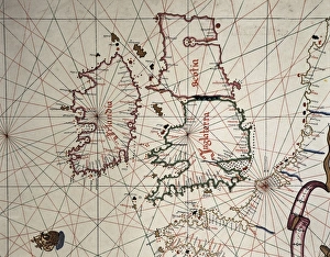
We offer a wide range of Maps of Northern Ireland, United Kingdom and Europe art prints that are perfect for decorating your home or office. These maps come in various sizes and styles, including vintage, modern and antique designs. You can choose from different types of maps such as political, physical or topographical maps. Our collection includes detailed street maps of cities like Belfast, Dublin and London as well as country-wide road atlases. There are also historical maps dating back to the 16th century that show how borders have changed over time. In addition to traditional paper prints, Media Storehouse also offers canvas prints which give a more textured look to the artwork. The canvas is stretched over a wooden frame which makes it ready-to-hang straight out of the box. Whether you're looking for an educational tool or just want to add some visual interest to your walls, we have something for everyone with their extensive selection of Maps of Northern Ireland United Kingdom Europe art prints.
+

How do I buy Maps of Northern Ireland United Kingdom Europe art prints?

To buy Maps of Northern Ireland United Kingdom Europe art prints from Media Storehouse, you can browse our extensive collection online. We offer a wide range of maps in various sizes and styles to suit your preferences. You can search for specific locations or themes using their search function or browse through the categories provided. Once you have found the map(s) you wish to purchase, simply add them to your cart and proceed to checkout. At this stage, you will be prompted to enter your payment and shipping details. We offer high-quality art prints that are perfect for home decor or as gifts for friends and family. Their maps are printed on premium paper using state-of-the-art printing technology, ensuring that they look stunning and last a lifetime. Buying Maps of Northern Ireland United Kingdom Europe art prints from Media Storehouse is easy and convenient, allowing you to bring beautiful artwork into your home with just a few clicks.
+

How much do Maps of Northern Ireland United Kingdom Europe art prints cost?

As a leading provider of art prints, we offer a wide range of maps of Northern Ireland, the United Kingdom and Europe. The cost of these prints varies depending on several factors such as size, framing options, and materials used. However, we strive to offer competitive pricing that is affordable for all our customers. Our maps are printed using high-quality materials that ensure durability and longevity. We use state-of-the-art printing technology to produce vibrant colors and sharp details that capture the essence of each map accurately. Our collection includes antique-style maps as well as modern designs that cater to different tastes. Whether you're looking for a gift or want to decorate your home or office space with beautiful artwork, our selection of maps is sure to impress. With our commitment to quality and affordability, you can be confident in your purchase from Media Storehouse.
+

How will my Maps of Northern Ireland United Kingdom Europe art prints be delivered to me?

We take great care in ensuring that your Maps of Northern Ireland United Kingdom Europe art prints are delivered to you safely and securely. We use high-quality packaging materials to protect your artwork during transit, so it arrives in perfect condition. Your art print will be carefully rolled and placed inside a sturdy cardboard tube for shipping. This ensures that the print is not damaged or creased during transportation. The tube will then be sealed with tape to prevent any moisture or dust from getting inside. We work with trusted courier partners who offer reliable delivery services across the UK and internationally. Once your order has been dispatched, you will receive a tracking number via email so you can keep an eye on its progress. We pride ourselves on providing excellent customer service and delivering high-quality products. If you have any questions about your order or delivery, please don't hesitate to get in touch with our friendly team who are always happy to help.