Fraud Blocker Skip to main content

Home > Europe > United Kingdom > Northern Ireland > Maps

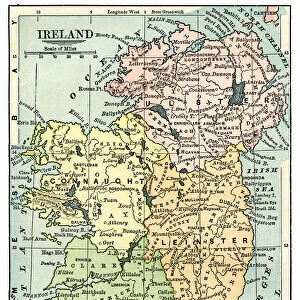
Antique map of Ireland

Antique map of Ireland
Sold 10
In Stock
We accept all major credit cards

Fine Art Storehouse Photo Prints and Wall Art

Antique map of Ireland

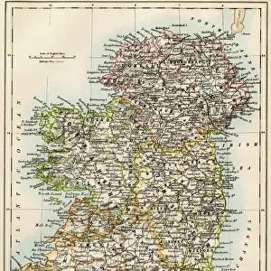
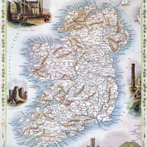
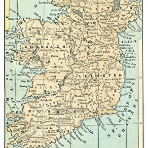
Antique map of Ireland, 1864. Unleash your creativity and transform your space into a visual masterpiece. © duncan1890

duncan1890

Media ID 13666655

1860 1869 Bad Condition Image Created 1860 1869 Irish Culture Navigational Equipment Northern Ireland Republic Of Ireland Retro Revival Styles Traditional Culture Image Created 19th Century Obsolete Retro Styled Victorian Style

FEATURES IN THESE COLLECTIONS

> Europe > Republic of Ireland > Maps

> Europe > Republic of Ireland > Related Images

> Europe > United Kingdom > Maps

> Europe > United Kingdom > Northern Ireland > Maps

> Europe > United Kingdom > Northern Ireland > Posters

> Europe > United Kingdom > Northern Ireland > Related Images

> Fine Art Storehouse > Map > Historical Maps

> Fine Art Storehouse > Map

> Maps and Charts > Ireland

> Maps and Charts > Related Images

SECURE PAYMENTS
We happily accept a wide range of payment options so you can pay for the things you need in the way that is most convenient for you

MADE IN THE UK
Safe Shipping with 30 Day Money Back Guarantee

FREE PERSONALISATION
We are proud to offer a range of customisation including Cropping, Captions, and Filters. Zoom Cropping can be adjusted in the Basket.

EDITORS COMMENTS

This print showcases an antique map of Ireland, dating back to the year 1864. With its retro revival and 19th-century style, this image takes us on a journey through time, immersing us in the rich history and traditional culture of the Emerald Isle. Despite its bad condition due to age, this engraved image holds immense value as a relic from the past. The Victorian-style map depicts both Northern Ireland and the Republic of Ireland, reminding us of their intertwined histories. It serves as a testament to Irish heritage and offers insights into navigational equipment used during that era. Photographed by Duncan1890 for Fine Art Storehouse, this vertical composition beautifully captures every intricate detail of the map. The absence of people allows viewers to focus solely on appreciating the artistry behind it. As we gaze upon this piece, we are transported back in time – a nostalgic reminder of how cultures evolve over centuries. This photograph not only preserves an important part of Irish history but also pays homage to cartography as an art form. With its retro-styled charm and timeless appeal, this antique map print is sure to captivate anyone with an appreciation for history or those seeking a unique addition to their collection.


Framed Prints

Discover the rich history of Ireland with our stunning Antique Map of Ireland print from the Media Storehouse Fine Art Storehouse collection. This exquisite piece, created by the talented artist duncan1890 in 1864, transports you back in time with its intricate details and vibrant colors. Perfectly framed and ready to adorn your home or office, this antique map is not only a beautiful addition to any space but also an educational and conversational piece. Bring a piece of the past into your present with our Antique Map of Ireland Framed Print.


Photo Prints

Discover the captivating history of Ireland with our Antique Map of Ireland print from Duncan1890 at Media Storehouse. This exquisite fine art piece, dating back to 1864, beautifully illustrates the intricate details of Ireland's geography during that time. Each crease, fold, and annotation adds to the map's rich storytelling, making it a stunning addition to any home or office. Bring a piece of the past into your present and transport yourself on a journey through time with our Antique Map of Ireland print. Order now from Media Storehouse's Fine Art Storehouse and let history come alive in your space.


Poster Prints

Discover the rich history of Ireland with our stunning Antique Map of Ireland print from the Media Storehouse collection at Fine Art Storehouse. This beautiful piece, created by the talented artist duncan1890 in 1864, showcases intricate details of the Emerald Isle during a bygone era. Add an elegant touch to your home or office decor with this captivating antique map, perfect for history enthusiasts or anyone who appreciates the beauty of vintage cartography. Bring a piece of the past into your present with our high-quality poster prints, expertly printed on premium paper to ensure lasting vibrancy and detail. Order yours today and transport yourself on a journey through time.


Jigsaw Puzzles

Discover the rich history and intricate details of Ireland with our Antique Map of Ireland jigsaw puzzle from the Media Storehouse collection, featuring the captivating work of artist duncan1890 from Fine Art Storehouse. This beautifully detailed puzzle, based on an authentic antique map from 1864, offers a unique and engaging puzzle-solving experience. Immerse yourself in the intricacies of the map's design, from the winding rivers and rugged coastlines to the charming villages and bustling cities. Bring the past to life in your own home and create a stunning display piece once completed. Perfect for puzzle enthusiasts, history buffs, or anyone in search of a challenging and rewarding pastime.

diamond
Made With High Grade Materials
thumb_up
Professional Quality Finish
package_2
Carefully Packed To Aid Safe Arrival

You May Also Like


Ireland country mapIreland country map
Add to Basket
Ireland map, 1870sIreland map, 1870s
Add to Basket
Map of IrelandMap of Ireland
Add to Basket
Map of Ireland 1897Map of Ireland 1897
Add to Basket
MAP: IRELAND, 1851. An engraved map of Ireland, 1851MAP: IRELAND, 1851. An engraved map of Ireland, 1851
Add to Basket
Ireland map 1875Ireland map 1875
Add to Basket
Pictorial History Map of Ireland 1963Pictorial History Map of Ireland 1963
Add to Basket
Melbourne, Australia: view of Swanston Street. in "Melbourne, Australia: view of Swanston Street. in "
Add to Basket
Ireland Reference MapIreland Reference Map
Add to Basket
Old Map of Ireland 1852 by Henry George CollinsOld Map of Ireland 1852 by Henry George Collins
Add to Basket
Ireland Vector MapIreland Vector Map
Add to Basket
Map of Ireland 1889Map of Ireland 1889
Add to Basket

Gallery Wall Inspiration

Map Of New Holland
Antique map of Britain under the Anglo Saxons
Antique map of Britain under the Ancient Romans
Carte du Tendre: imaginary map by a character in the novel Cl├®lie
Map of Exeter in Devon, England Victorian Engraving, 1840
Map of Anglo-Saxon Kingdoms and the Danelaw, 9th Century
England in the Ninth Century
Map of Devon 1883
Newfoundland map 1884
Map of Middle East - illustration
Antique map of the Roman Empire
Old engraved map of Battle of Naseby (14. 06. 1645)
Map of Cyprus, published in 1880
Apostle Pauls Missionary Journeys, lithograph, published in 1886
Battle Of Waterloo
Map of Ireland 1897
Cornwall map 1884
Sicily map 1895
Antique map of Tasmania
Old map of Australia 1899
Ethnological map of the Austro-Hungarian Empire, lithograph, published in 1897
Map of Whitby
Antique map, Scotland, Isle of Skye, South and North Uist
Earth map according to Herodotus
Antique map of Hadrians wall
Antique map of Ireland
Old Caucasus map

Discover Our Collections


MapMap
View Collection
Republic of Ireland Related ImagesRepublic of Ireland Related Images
View Collection
Northern Ireland Related ImagesNorthern Ireland Related Images
View Collection
MapsMaps
View Collection
MapsMaps
View Collection
Maps and Charts Related ImagesMaps and Charts Related Images
View Collection
IrelandIreland
View Collection
MapsMaps
View Collection
PostersPosters
View Collection
Historical MapsHistorical Maps
View Collection


© Copyright Media Storehouse, All Rights Reserved 2003 - 2024
Facebook     Pinterest     Card Payments     Reviews IO