Canvas Print > Europe > Portugal > Maps
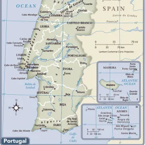
Canvas Print : Map Of Spain And Portugal, Circa. 1760. From "Atlas De Toutes Les Parties Connues Du Globe Terrestre "By Cartographer Rigobert Bonne. Published Geneva Circa. 1760


![]()
Canvas Prints from Design Pics
Map Of Spain And Portugal, Circa. 1760. From "Atlas De Toutes Les Parties Connues Du Globe Terrestre "By Cartographer Rigobert Bonne. Published Geneva Circa. 1760
Map Of Spain And Portugal, Circa. 1760. From " Atlas De Toutes Les Parties Connues Du Globe Terrestre " By Cartographer Rigobert Bonne. Published Geneva Circa. 1760
Design Pics offers Distinctively Different Imagery representing over 1,500 contributors
Media ID 18186429
© Ken Welsh / Design Pics
Cartography Geography Mapmaking Plate Portugal Spain
21"x14" (53x35cm) Canvas Print
Step back in time with our exquisite Canvas Print of the Map of Spain and Portugal, circa 1760. This beautiful vintage map, taken from the "Atlas De Toutes Les Parties Connues Du Globe Terrestre" by renowned cartographer Rigobert Bonne, was published in Geneva around 1760. The intricate details and authentic antique aesthetic make this canvas print an exceptional addition to any room, transporting you back to an era of exploration and discovery. Bring history to life in your home with this stunning, museum-quality piece.
Ready to hang Premium Gloss Canvas Print. Our archival quality canvas prints are made from Polyester and Cotton mix and stretched over a 1.25" (32mm) kiln dried knot free wood stretcher bar. Packaged in a plastic bag and secured to a cardboard insert for transit.
Canvas Prints add colour, depth and texture to any space. Professionally Stretched Canvas over a hidden Wooden Box Frame and Ready to Hang
Estimated Product Size is 53.3cm x 35.6cm (21" x 14")
These are individually made so all sizes are approximate
Artwork printed orientated as per the preview above, with landscape (horizontal) orientation to match the source image.
FEATURES IN THESE COLLECTIONS
> Europe
> Portugal
> Related Images
> Maps and Charts
> Spain
EDITORS COMMENTS
This print showcases a stunning map of Spain and Portugal, dating back to the year 1760. Created by renowned cartographer Rigobert Bonne, this masterpiece is part of his esteemed work "Atlas De Toutes Les Parties Connues Du Globe Terrestre". Published in Geneva during the same era, this map offers a fascinating glimpse into the geography and topography of these two Iberian nations. The intricate details and vibrant colors employed in this engraving are truly remarkable. The skilled craftsmanship involved in its creation is evident as every line and contour has been meticulously etched onto the plate. The horizontal orientation allows for an immersive viewing experience, enabling one to explore every corner of Spain and Portugal with ease. As we delve into this historical artifact, it becomes apparent that it serves not only as a navigational tool but also as a testament to the artistry of mapmaking during that period. This particular print by Ken Welsh captures all these elements flawlessly, preserving its beauty for generations to come. Whether you are an avid historian or simply appreciate fine art, this print will undoubtedly make an exquisite addition to any collection. Its rich history combined with its visual appeal makes it a true treasure worth cherishing.
MADE IN THE UK
Safe Shipping with 30 Day Money Back Guarantee
FREE PERSONALISATION*
We are proud to offer a range of customisation features including Personalised Captions, Color Filters and Picture Zoom Tools
SECURE PAYMENTS
We happily accept a wide range of payment options so you can pay for the things you need in the way that is most convenient for you
* Options may vary by product and licensing agreement. Zoomed Pictures can be adjusted in the Basket.