
Maps Collection
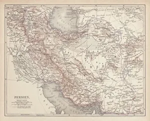
Maps of Iraq Asia are geographical maps that provide a detailed view of the country
Choose a picture from our Maps Collection for your Wall Art and Photo Gifts
84 items


All Professionally Made to Order for Quick Shipping
-
Maps Collection
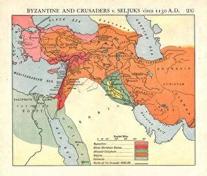
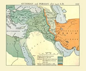
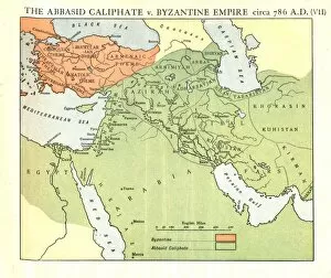
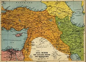
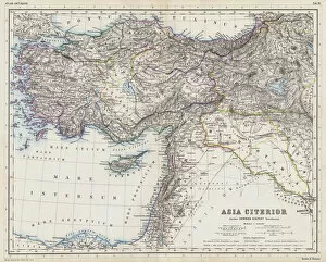
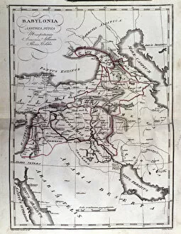
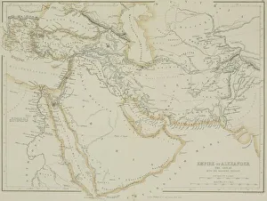
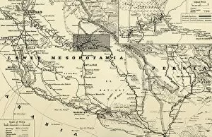
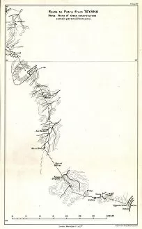
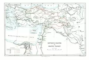
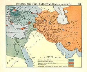
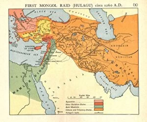
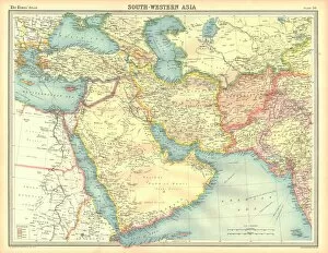
Maps of Iraq Asia are geographical maps that provide a detailed view of the country. They include physical features such as mountains, rivers, and deserts, as well as political boundaries and major cities. They also show the major roads and highways that connect different parts of the country. Additionally, they provide information on population density, climate zones, vegetation types, and other important data points. Maps of Iraq Asia are essential for anyone looking to explore or understand this region better and can be used for navigation purposes or to gain insight into the culture and history of this fascinating part of the world.
+
Our beautiful pictures are available as Framed Prints, Photos, Wall Art and Photo Gifts
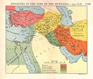
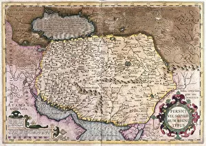
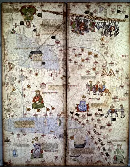
The Maps of Iraq Asia collection from Media Storehouse is a stunning compilation of vintage maps that showcase the historical and geographical significance of Iraq in Asia. Our collection features a range of beautifully crafted maps, including antique world maps, topographical maps, and political boundary maps that depict the evolution of Iraq's borders over time. These high-quality prints are available as wall art or framed prints to add an elegant touch to any home or office space. Each map in our collection tells its own unique story about the region's history and culture. For example, some highlight ancient trade routes while others show how different empires have influenced modern-day borders. Whether you're interested in geography, history, or simply appreciate beautiful artwork, our collection has something for everyone. The Maps of Iraq Asia collection from Media Storehouse is a must-have for anyone who wants to explore the rich cultural heritage and fascinating history of this important region.
+
What are Maps of Iraq Asia art prints?
Maps of Iraq Asia art prints are high-quality reproductions of maps that depict the geography, topography, and political boundaries of Iraq and its surrounding regions in Asia. These prints are created using advanced printing techniques that ensure sharpness, clarity, and durability. These art prints can be used for a variety of purposes such as educational or decorative displays in homes, offices or classrooms. They provide an excellent visual aid for students studying geography or history related to the region. Additionally, they make great gifts for anyone with an interest in cartography or Middle Eastern culture. The Maps of Iraq Asia art prints come in various sizes and styles to suit different preferences. Some feature antique maps from centuries ago while others showcase modern-day satellite imagery. Regardless of the style chosen, these art prints offer a unique perspective on one of the most historically rich regions in the world.
+
What Maps of Iraq Asia art prints can I buy from Media Storehouse?
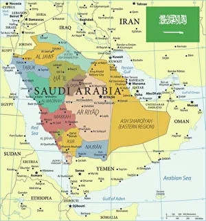
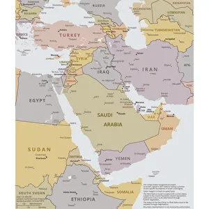
We offer a wide range of Maps of Iraq Asia art prints that are perfect for anyone who is interested in the history and geography of this region. These prints come in various sizes, styles, and designs to suit different tastes and preferences. Some popular options include antique maps that showcase the intricate details of Iraq's cities, regions, and landscapes from centuries ago. Other contemporary designs feature modern cartography techniques that highlight important landmarks such as airports, highways, and tourist attractions. In addition to traditional paper prints, Media Storehouse also offers canvas prints that add a unique texture and depth to your wall decor. Whether you're looking for a bold statement piece or a subtle accent to complement your existing decor, there's sure to be an Iraq Asia map print that fits your style at Media Storehouse.
+
How do I buy Maps of Iraq Asia art prints?
To buy Maps of Iraq Asia art prints from Media Storehouse, you can browse our extensive collection of high-quality prints online. Simply search for "Maps of Iraq Asia" in the search bar on our website and select the print that catches your eye. Once you have found a print that you like, click on it to view more details about the product. From there, you can choose the size and format of your print before adding it to your cart. You will then be prompted to enter your shipping and payment information before completing your purchase. We offer a wide range of printing options including canvas prints, framed prints, and poster prints so you can choose the best option for your needs. With fast shipping times and excellent customer service, buying Maps of Iraq Asia art prints from Media Storehouse is easy and convenient.
+
How much do Maps of Iraq Asia art prints cost?
We offer a wide range of Maps of Iraq Asia art prints at varying prices. The cost depends on the size and type of print you choose. We have options for both framed and unframed prints, as well as canvas and poster prints. Our selection includes vintage maps, modern designs, and everything in between. We take pride in offering high-quality products that are printed using state-of-the-art technology to ensure vibrant colors and sharp details. Our Maps of Iraq Asia art prints make great additions to any home or office decor, whether you're looking for something classic or contemporary. We believe that everyone should be able to enjoy beautiful artwork without breaking the bank. That's why we strive to keep our prices competitive while still maintaining the highest standards of quality. So if you're looking for a stunning Maps of Iraq Asia art print at an affordable price, look no further than Media Storehouse.
+
How will my Maps of Iraq Asia art prints be delivered to me?
We take pride in delivering your Maps of Iraq Asia art prints to you in the safest and most efficient way possible. We use high-quality packaging materials to ensure that your artwork arrives at your doorstep in pristine condition. Our team carefully checks each print before it is dispatched to make sure that there are no defects or damages. We work with trusted courier services who will deliver your order directly to you. You can track the progress of your delivery through our website using the tracking number provided once your order has been shipped. Rest assured that we will do everything we can to ensure a smooth and hassle-free delivery experience for you. Whether you're ordering for personal use or as a gift, we want you to be completely satisfied with our service from start to finish. If you have any questions about our delivery process or need assistance with anything else, please don't hesitate to contact us - we're always happy to help.