Acrylic Blox > Europe > France > Canton > Nord
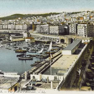
Acrylic Blox : Le Sahel d'Alger et la Mitidja; Afrique du nord, 1914. Creator: Unknown


![]()
Mounted Prints from Heritage Images
Le Sahel d'Alger et la Mitidja; Afrique du nord, 1914. Creator: Unknown
Le Sahel d'Alger et la Mitidja; Afrique du nord, 1914. From "Grande Geographie Bong Illustree", 1914
Heritage Images features heritage image collections
Media ID 36294695
© The Print Collector/Heritage Images
Algeria Algerian Algiers El Djazair Algeria Cartography Map Making Mapmaking Mediterranean Sea North Africa North African Plain
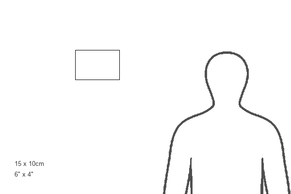
6"x4" (15x10cm) Acrylic Blox
Your photographic print is held in place by magnets and a micro thin sheet of metal covering the back of a 20mm piece of clear acrylic. Your print is held in place with magnets so can easily be replaced if needed.
Streamlined, one sided modern and attractive table top print
Estimated Product Size is 15.2cm x 10.2cm (6" x 4")
These are individually made so all sizes are approximate
Artwork printed orientated as per the preview above, with landscape (horizontal) orientation to match the source image.
FEATURES IN THESE COLLECTIONS
> Africa
> Algeria
> Related Images
> Animals
> Mammals
> Muridae
> Plains Mouse
> Europe
> France
> Canton
> Nord
> Maps and Charts
> Related Images
EDITORS COMMENTS
Le Sahel d'Alger et la Mitidja; Afrique du Nord, 1914" is a captivating print depicting a map of the Algerian coastline and the Mitidja plain in North Africa. The map, created in 1914, is an intriguing glimpse into the geographical knowledge of the early 20th century. The print, published in "Grande Geographie Bong Illustree," showcases the Bay of Algiers and the Mediterranean Sea, with Algiers, the largest city in Algeria and the former capital of French Algeria, prominently displayed. The Sahel, a narrow strip of arid land along the northwestern coast of Africa, is also highlighted, as is the Mitidja plain, an agricultural region located to the east of Algiers. The map is a testament to the advancements in cartography during the 1910s, with precise labeling of geographical features, including towns, rivers, and mountains. The intricate detailing of the coastline, with its bays, capes, and inlets, is particularly noteworthy. The use of engraving techniques results in a crisp, clear image that invites close examination. The print offers a fascinating glimpse into the history of Algeria and North Africa during a time when European powers were asserting their influence in the region. The French colonial rule over Algeria, which began in 1830, had reached its zenith by the early 1900s, and the map reflects the extensive knowledge of the territory that the French had gained during their occupation. Today, "Le Sahel d'Alger et la Mitidja; Afrique du Nord, 1914" serves as a reminder of the rich history and cultural diversity of North Africa, and the ongoing importance of geographical knowledge in understanding the world around us.
MADE IN THE UK
Safe Shipping with 30 Day Money Back Guarantee
FREE PERSONALISATION*
We are proud to offer a range of customisation features including Personalised Captions, Color Filters and Picture Zoom Tools
SECURE PAYMENTS
We happily accept a wide range of payment options so you can pay for the things you need in the way that is most convenient for you
* Options may vary by product and licensing agreement. Zoomed Pictures can be adjusted in the Basket.