Home > Europe > France > Canton > Bas Rhin
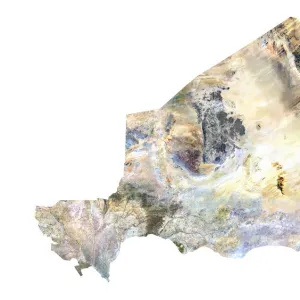
Macedonia, Satellite Image

![]()
Wall Art and Photo Gifts from Universal Images Group (UIG)
Macedonia, Satellite Image
Satellite view of Macedonia. This image was compiled from data acquired by LANDSAT satellite
Universal Images Group (UIG) manages distribution for many leading specialist agencies worldwide
Media ID 9618205
© Planet Observer
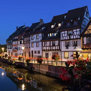
Alsace Bas Rhin Geographical Border Relief Map Satellite View
FEATURES IN THESE COLLECTIONS
> Aerial Photography
> North Macedonia
> Europe
> France
> Canton
> Bas Rhin
> Europe
> France
> Canton
> Rhin
> Universal Images Group (UIG)
> Universal Images Group
> Satellite and Aerial
> Planet Observer 6
EDITORS COMMENTS
This stunning print showcases the breathtaking beauty of Macedonia, as seen from a satellite's perspective. Captured by the LANDSAT satellite, this image offers a unique and detailed view of the country's topography. The vibrant colors and intricate details bring to life the diverse landscapes that define Macedonia. From lush green valleys to rugged mountain ranges, this photograph highlights the remarkable physical geography of Macedonia. The relief map reveals its geographical borders with precision, allowing viewers to appreciate how nature has sculpted this land over time. With no people in sight, this image invites us to immerse ourselves in the untouched wilderness of Macedonia. It serves as a reminder of our planet's vastness and reminds us that there are still hidden corners waiting to be explored. As we gaze upon this vertical composition, we can't help but marvel at how technology has enabled us to capture such awe-inspiring images from space. This photograph is not just a work of art; it is also an invaluable tool for cartographers and researchers studying the region's landscape and environment. Whether you have a passion for photography or simply appreciate the wonders of our world, this print from Universal Images Group (UIG) will transport you on an imaginary journey through Macedonia's natural wonders.
MADE IN THE UK
Safe Shipping with 30 Day Money Back Guarantee
FREE PERSONALISATION*
We are proud to offer a range of customisation features including Personalised Captions, Color Filters and Picture Zoom Tools
SECURE PAYMENTS
We happily accept a wide range of payment options so you can pay for the things you need in the way that is most convenient for you
* Options may vary by product and licensing agreement. Zoomed Pictures can be adjusted in the Basket.