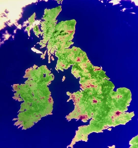
Coloured satellite image of the British Isles
![]()

Wall Art and Photo Gifts from Science Photo Library
Coloured satellite image of the British Isles
The British Isles seen from space. Coloured satellite image of the British Isles, made by the NOa 8 weather satellite in visible light. Crimson areas of this image show cities (such as London and Birmingham) or upland areas such as the Pennines and the Scotish Highlands. The only clouds visible are at top left, along with a few straight vapour trails from high-flying aircraft. The image was made at 08.22 GMT on 23rd April 1984
Science Photo Library features Science and Medical images including photos and illustrations
Media ID 6350041
© UNIVERSITY OF DUNDEE/SCIENCE PHOTO LIBRARY
British Isles Earth Science Eire From Space Great Britain Ireland Sciences
EDITORS COMMENTS
This print showcases a coloured satellite image of the British Isles as seen from space. Taken by the NOa 8 weather satellite in visible light, it offers a mesmerizing perspective of this beautiful region. The vibrant crimson areas on the image represent bustling cities like London and Birmingham, as well as majestic upland areas such as the Pennines and Scottish Highlands. The photograph captures a moment in time at 08:22 GMT on April 23rd, 1984. It reveals an astonishing level of detail with only a few clouds visible at the top left corner, accompanied by straight vapour trails left behind by high-flying aircraft. This snapshot serves as a testament to both human activity and natural wonders coexisting within this picturesque landscape. Through this stunning visual representation, viewers can appreciate the intricate tapestry that makes up the United Kingdom, Great Britain, Ireland (Eire), and their surrounding territories. As we gaze upon this remarkable image taken from space, we are reminded of our place within Earth's vast ecosystem and how science continues to unveil its mysteries. This awe-inspiring print is brought to you by Science Photo Library—an invaluable resource for those seeking to explore Earth science through breathtaking visuals. Let your imagination soar as you delve into this extraordinary portrayal of our beloved British Isles.
MADE IN THE UK
Safe Shipping with 30 Day Money Back Guarantee
FREE PERSONALISATION*
We are proud to offer a range of customisation features including Personalised Captions, Color Filters and Picture Zoom Tools
SECURE PAYMENTS
We happily accept a wide range of payment options so you can pay for the things you need in the way that is most convenient for you
* Options may vary by product and licensing agreement. Zoomed Pictures can be adjusted in the Basket.

