Fraud Blocker Skip to main content

Earth Science Collection

Exploring the wonders of Earth through the lens of science and art

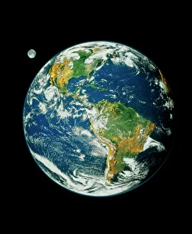
Background imageEarth Science Collection: Whole Earth (Blue Marble 2000)

Whole Earth (Blue Marble 2000)
Whole Earth. Composite satellite image of Earth centred on the Americas. This is Blue Marble 2000, one of the most detailed Earth images ever made

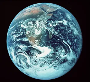
Background imageEarth Science Collection: Apollo 17 photograph of whole earth

Apollo 17 photograph of whole earth
Home planet. Classic photograph of the Earth, taken from Apollo 17 as it made its way to the Moon in December 1972. The continent of Africa fills the upper left quadrant, with Arabia at top centre

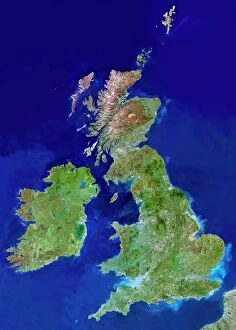
Background imageEarth Science Collection: British Isles, satellite image

British Isles, satellite image
UK and Ireland. Satellite image of the UK and the Republic of Ireland (Eire). North is at top. Water is blue, vegetation is green, dry or barren areas are brown, and snow and ice are white

Background imageEarth Science Collection: Durers world map, 1515

Durers world map, 1515. Albrecht Durer (1471- 1528) was a German artist. His skillful use of perspective and mathematical proportions made him one of the outstanding artistic figures of the early

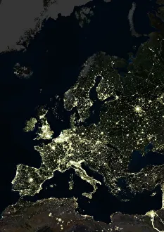
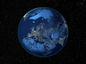
Background imageEarth Science Collection: Europe at night, satellite image

Europe at night, satellite image. City lights (yellow) of increasing intensity show areas of increasing population, with areas of few lights being more sparsely populated

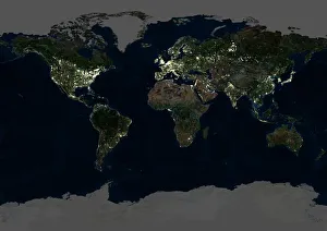
Background imageEarth Science Collection: Whole Earth at night, satellite image

Whole Earth at night, satellite image
Whole Earth map at night, satellite image. Here, Africa is seen at centre. City lights (yellow) of increasing intensity show areas of increasing population

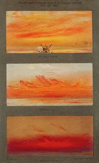
Background imageEarth Science Collection: Krakatoa sunsets, 1883 artworks

Krakatoa sunsets, 1883 artworks
Krakatoa sunsets. Artwork of the spectacular red and orange sunsets caused in London, England, by the August 1883 eruption of Krakatoa, a volcano thousands of kilometres away in Indonesia

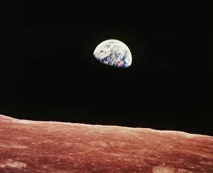
Background imageEarth Science Collection: Earthrise as seen from above surface of the moon

Earthrise as seen from above surface of the moon
Earthrise as seen from above the surface of the Moon, photographed by astronauts on board the Apollo 8 spacecraft as it orbited the Moon in 1968

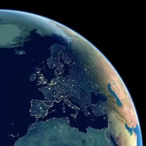
Background imageEarth Science Collection: Europe at night, satellite image

Europe at night, satellite image. City lights (yellow) show areas of dense population. There are few lights in North Africa (bottom) and the Arctic (top) since they are more sparsely populated

Background imageEarth Science Collection: 16th Century Plan of Florence

16th Century Plan of Florence
16th century plan of Florence, Italy. Detail from the map of Etruria (Tuscany and Northern Lazio), in the Gallery of Maps in the Vatican Museum.The Gallery of Maps holds maps which were commissioned

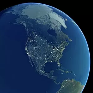
Background imageEarth Science Collection: North America at night, satellite image

North America at night, satellite image
Africa at night. Satellite image of the Earth at night, set against a background of stars, centred on the continent of Africa. North is at top. City lights (yellow) show areas of dense population

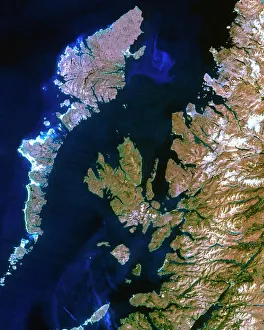
Background imageEarth Science Collection: True-colour satellite image of northwest Scotland

True-colour satellite image of northwest Scotland

Background imageEarth Science Collection: 17th century map of Europe

17th century map of Europe

Background imageEarth Science Collection: Soil triangle diagram

Soil triangle diagram. This diagram is used to work out the type of soil in an area. A sample of soil is left to settle in water. Larger particles settle out of suspension faster than smaller ones

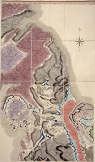
Background imageEarth Science Collection: First geological map of Britain, 1815 C016 / 5683

First geological map of Britain, 1815 C016 / 5683
First geological map of Britain, detail of the north east coast (figure 8). This map was published in 1815 by British geologist William Smith (1769-1839)

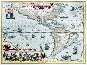
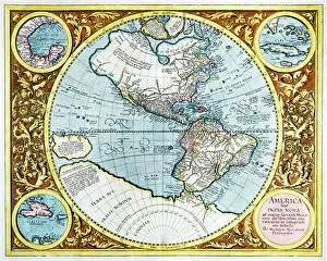
Background imageEarth Science Collection: 17th century map of the New World

17th century map of the New World
Western Hemisphere, 17th century Dutch map. This shows the New World that was being discovered by Europeans exploring the Western Hemisphere of the Earth

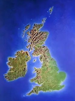
Background imageEarth Science Collection: Relief map of the United Kingdom and Eire

Relief map of the United Kingdom and Eire, lit from the east

Background imageEarth Science Collection: Aquamarine crystal

Aquamarine crystal. Aquamarine is a transparent blue or blue-green variety of beryl (beryllium aluminium silicate). The colour is due to trace amounts of iron within the crystal structure

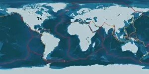
Background imageEarth Science Collection: Earths tectonic plates

Earths tectonic plates. Global map showing the boundaries of the tectonic plates that make up the Earths crust. The eight major plates are the: African Plate, Antarctic Plate, Indian Plate

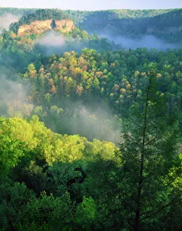
Background imageEarth Science Collection: KENTUCKY. USA. Fog at sunrise, Red River Gorge. Daniel Boone National Forest

KENTUCKY. USA. Fog at sunrise, Red River Gorge. Daniel Boone National Forest

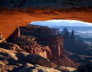
Background imageEarth Science Collection: CANYONLANDS NATIONAL PARK, UTAH. USA. View through Mesa Arch at sunrise. Island in the Sky

CANYONLANDS NATIONAL PARK, UTAH. USA. View through Mesa Arch at sunrise. Island in the Sky

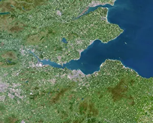
Background imageEarth Science Collection: Firth of Forth, UK, satellite image

Firth of Forth, UK, satellite image. The Firth of Forth is the major estuary of the River Forth in Scotland. The grey area at centre is the city of Edinburgh

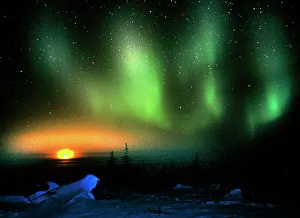
Background imageEarth Science Collection: Aurora borealis display with setting Moon

Aurora borealis display with setting Moon
Aurora. Green aurora borealis (northern lights) display over a field of ice with a setting Moon. Aurorae are caused by charged particles from the Sun stimulating gas molecules in the Earths

Background imageEarth Science Collection: Barbados, satellite image

Barbados, satellite image
Barbados. Landsat image of the island of Barbados in the Caribbean sea. North is at top. Barbados has a total land area of about 430 square kilometres

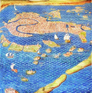
Background imageEarth Science Collection: 16th century map of Venice

16th century map of Venice showing the lagoon. Venice is a coastal city in the north-east of Italy. The main bulk of Venice is in the upper frame of the image

Background imageEarth Science Collection: Earth from space

Earth from space. Computer artwork of a gibbous Earth, seen from space

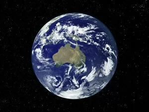
Background imageEarth Science Collection: Australia, satellite image

Australia, satellite image
Australia. Satellite image of the Earth, set against a background of stars, centred on the island continent of Australia. North is at top. Clouds (white) are seen in the atmosphere

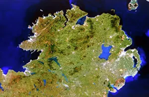
Background imageEarth Science Collection: True-colour satellite image of Ulster, Ireland

True-colour satellite image of Ulster, Ireland
Northern Ireland. Satellite image of Northern Ireland, also known as Ulster. The colours approximate to natural tones. North is at top

Background imageEarth Science Collection: Australia, satellite image

Australia, satellite image. North is at top. Australia is the worlds smallest continent. It is located in the southern hemisphere, southeast of Asia

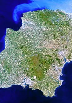
Background imageEarth Science Collection: True-colour satellite image of southwest England

True-colour satellite image of southwest England
Devon, southwest England. True-colour satellite image of the county of Devon in southwest England, Great Britain. North is at top

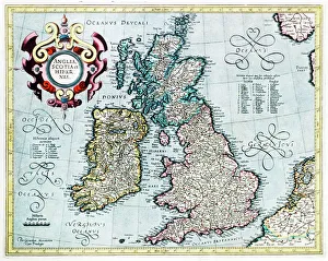
Background imageEarth Science Collection: 16th century map of the British Isles

16th century map of the British Isles
British Isles, 16th century Dutch map. This shows England, Scotland, Wales and Ireland, though Ireland is not yet accurately mapped. Published in 1595, from work by Gerard Mercator

Background imageEarth Science Collection: 16th century world map

16th century world map made by Pierre Desceliers in 1546 on a commission by King Francis I for Henri II of France. Most noticeable is that the Northern hemisphere is upside-down

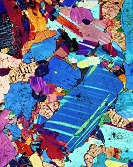
Background imageEarth Science Collection: Polarised LM of a thin section of gabbro rock

Polarised LM of a thin section of gabbro rock
Gabbro. Polarised light micrograph of a thin section of gabbro, an igneous rock. Gabbro is coarse-grained, containing the minerals olivine and plagioclase feldspar

Background imageEarth Science Collection: Geological map, South-East England, 1830s

Geological map, South-East England, 1830s. This map, dating from between 1830 and 1833, shows the denudation of The Weald

Background imageEarth Science Collection: Aurora borealis and Moon

Aurora borealis and Moon over mountains and trees by a river. This coloured light display (the northern lights) is visible in the night sky at high latitudes

Background imageEarth Science Collection: South America at night, satellite image

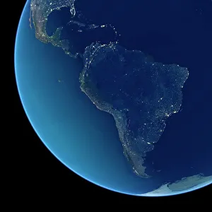
South America at night, satellite image
South America at night. Satellite image of the Earth at night, set against a background of stars, centred on the continent of South America. North is at top

Background imageEarth Science Collection: India at night, satellite image

India at night, satellite image
India at night, satellite view. This image is a composite showing the change in illumination over India from 1992-2003. Satellite data from 2003 is coloured red

Background imageEarth Science Collection: South America at night, satellite image

South America at night, satellite image. City lights (yellow) show areas of dense population, particularly in North America (top left) and South Americas coasts

Background imageEarth Science Collection: North America at night, satellite image

North America at night, satellite image. City lights (yellow) show areas of dense population, particularly in North America (upper centre)

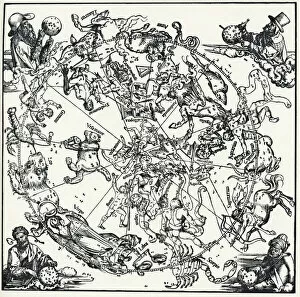
Background imageEarth Science Collection: Durers Celestial Globe, 1515

Durers Celestial Globe, 1515. This shows the northern hemisphere, and was prepared in conjunction with the astronomer Stabius

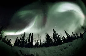
Background imageEarth Science Collection: Aurora borealis

Aurora borealis seen over trees through a fish-eye lens, with an observer at far right. This light display (the northern lights) is seen in the night sky at high latitudes

Background imageEarth Science Collection: 17th century map of the New World

17th century map of the New World

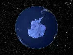
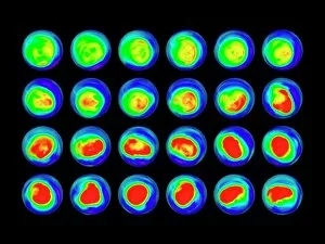
Background imageEarth Science Collection: Water vapour maps of Antarctica, 2004

Water vapour maps of Antarctica, 2004
Water vapour maps of Antarctica. Satellite images of the increase in water vapour over Antarctica from 13 August to 14 October 2004 (the austral spring)

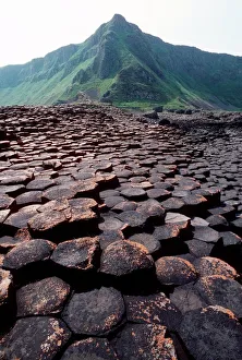
Background imageEarth Science Collection: Giants Causeway

Giants Causeway. Columns of basalt rock at the Giants Causeway, in County Antrim, Northern Ireland. This site has been designated a World Heritage Site

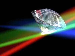
Background imageEarth Science Collection: Diamond, computer artwork

Diamond, computer artwork
Cut and polished diamond, computer artwork. Diamond is a naturally occurring form of carbon that has crystallised under great pressure

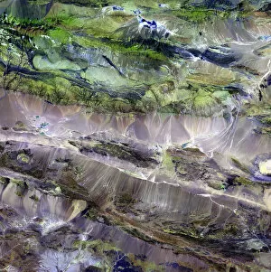
Background imageEarth Science Collection: Steppe-desert border, satellite image

Steppe-desert border, satellite image. North is at top. Arid areas of desert rock are brown, while grassy steppe areas are green. A small area of desert sands (yellow) is seen at far centre right

Background imageEarth Science Collection: Europe at night

Europe at night, satellite image. North is towards top left. Yellow lights mark the major cities. The Mediterranean coast is densely populated, as is the mainland of Britain

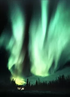
Background imageEarth Science Collection: Aurora borealis

Aurora borealis. This coloured atmospheric light display (the northern lights) is visible in the night sky at high latitudes


All Professionally Made to Order for Quick Shipping

Exploring the wonders of Earth through the lens of science and art. 🌍✨ From the iconic 'Blue Marble 2000' image capturing our Whole Earth's beauty, to Apollo 17's breathtaking photograph showcasing our planet from above, Earth Science invites us to marvel at its grandeur. Satellite images like the British Isles or Europe at night reveal how human activity illuminates our world after sunset, while the captivating view of Whole Earth at night reminds us of our interconnectedness under a starry sky. Inspired by nature's phenomena, artists captured Krakatoa sunsets in 1883 artworks, reminding us of both its destructive power and mesmerizing beauty. Dürer's intricate world map from 1515 offers a glimpse into early cartography and humanity's quest for knowledge. The awe-inspiring 'Earthrise' photo taken from above the moon surface serves as a reminder that we are all inhabitants on this pale blue dot floating in space. Meanwhile, historical maps like the 16th Century Plan of Florence or 17th century map of Europe allow us to trace back centuries-old perspectives on geography. Delving deeper into understanding our environment, soil triangle diagrams provide insights into soil composition and its impact on agriculture and ecosystems. Earth Science takes us on an incredible journey across time and space – revealing not only the physical aspects but also fostering appreciation for our planet’s diversity and fragility.