Fraud Blocker Skip to main content

Africa Collection

Africa, a continent of rich history and diverse landscapes

Background imageAfrica Collection: Africa Political Map

Africa Political Map
The Map Marketing Africa Political Map is an exceptionally clear map of the whole of Africa Including the Saudi Arabian Peninsula, Turkey, Iran and the southern Mediterranean countries

Background imageAfrica Collection: Political Map of Africa

Political Map of Africa
Vector Illustration of the policital map of Africa Reference map as created by the US Central Intelligence Agency

Background imageAfrica Collection: A production portrait from Ice Cold In Alex (1958)

A production portrait from Ice Cold In Alex (1958)
Harry Andrews, Anthony Quayle, Sylvia Syms and John Mills in a production still image taken during the final sequence of Jack Lee Thompsons classic War title

Background imageAfrica Collection: EXPL2A-00352

EXPL2A-00352
The Hereford Mappa Mundi of 1280 - Jerusalem is at the center, Europe lower left, Africa lower right. Printed color halftone reproduction 19th century

Background imageAfrica Collection: Humpback whale (Megaptera novaeangliae) breaching, near Hout Bay, South Africa

Humpback whale (Megaptera novaeangliae) breaching, near Hout Bay, South Africa

Background imageAfrica Collection: African elephant herd walking {Loxodonta africana} Amboseli, Kenya

African elephant herd walking {Loxodonta africana} Amboseli, Kenya

Background imageAfrica Collection: Al-Idrisis world map, 1154

Al-Idrisis world map, 1154
Al-Idrisis world map. This world map, known as the Tabula Rogeriana, dates from 1154, and is orientated with North at bottom

Background imageAfrica Collection: Babar, king of the elephants, and Celeste playing tennis at Celesteville

Babar, king of the elephants, and Celeste playing tennis at Celesteville. Illustration from one of Jean de Brunhoffs
BABAR THE ELEPHANT, 1930s. Babar, king of the elephants, and Celeste playing tennis at Celesteville. Illustration from one of Jean de Brunhoffs Babar books, 1930s

Background imageAfrica Collection: Sir Henry Morton Stanley And His Men Crossing A Hazardous Forest Clearing During His Emin Pasha

Sir Henry Morton Stanley And His Men Crossing A Hazardous Forest Clearing During His Emin Pasha Relief Expedition In Africa, 1886 To 1889. From In Darkest Africa By Henry M. Stanley Published 1890

Background imageAfrica Collection: Gemsbok (Oryx gazella) in sand dunes, Namibia

Gemsbok (Oryx gazella) in sand dunes, Namibia. Finalist in the Mammals Category of the Wildlife Photographer of the Year Awards (WPOY) Competition 2015

Background imageAfrica Collection: Continental drift after 250 million years

Continental drift after 250 million years, showing the supercontinent of Pangea Ultima, which was named for the ancient supercontinent of Pangea

Background imageAfrica Collection: Orteliuss map of Ottoman Empire, 1570

Orteliuss map of Ottoman Empire, 1570
Orteliuss map of the Ottoman Empire. This map is from the 1570 first edition of Theatrum orbis terrarum ( Theatre of the World )

Background imageAfrica Collection: 19th Century Moroccan wall feature

19th Century Moroccan wall feature. Photographed in the the Marrakech Museum, Dar Menebhi Palace, Morocco

Background imageAfrica Collection: Apollo 17 photograph of whole earth

Apollo 17 photograph of whole earth
Home planet. Classic photograph of the Earth, taken from Apollo 17 as it made its way to the Moon in December 1972. The continent of Africa fills the upper left quadrant, with Arabia at top centre

Background imageAfrica Collection: Mount Kilimanjaro Sunset

Mount Kilimanjaro Sunset
Mount Kilimanjaro at sunset, from the Amboseli National Park, Kenya. AFP PHOTO GERARD VANDENBERGHE / AFP PHOTO / GERARD VANDENBERGHE

Background imageAfrica Collection: British Empire world map, 19th century

British Empire world map, 19th century
British Empire world map. This world map shows the 19th-century British Empire (pink) and its indigenous peoples. Five illustrations (clockwise from upper left) show the people of Australia

Background imageAfrica Collection: Roman Republic and Carthage during the Second Punic War (218-201-BC)

Roman Republic and Carthage during the Second Punic War (218-201-BC)
Ancient map of the Roman Republic and Carthage during the Second Punic War (218 to 201 BC). Legend in Latin language. Steel engraving with hand colored borderlines, published in 1861

Background imageAfrica Collection: 17th century world map

17th century world map
World map, published around 1664 in Amsterdam, the Netherlands, by Dutch mapmaker Joan Blaeu (c.1599- 1673). The Latin title is Nova et Accuratissima Totius Terrarum Orbis Tabula

Background imageAfrica Collection: Map of the Roman Empire

Map of the Roman Empire
Map showing the extent of the Roman Empire. Hand-colored woodcut of a 19th-century illustration

Background imageAfrica Collection: Whole Earth at night, satellite image

Whole Earth at night, satellite image
Whole Earth map at night, satellite image. Here, Africa is seen at centre. City lights (yellow) of increasing intensity show areas of increasing population

Background imageAfrica Collection: Shoebill stork (Balaeniceps rex) in the swamps of Mabamba, Lake Victoria, Uganda

Shoebill stork (Balaeniceps rex) in the swamps of Mabamba, Lake Victoria, Uganda

Background imageAfrica Collection: Map of Africa

Map of Africa
http://csaimages.com/images/istockprofile/csa_vector_dsp.jpg

Background imageAfrica Collection: Aardvark (Orycteropus afer), young individual walking, Nambia

Aardvark (Orycteropus afer), young individual walking, Nambia. Captive, rescued individual

Background imageAfrica Collection: Laetoli fossil footprints

Laetoli fossil footprints. Artwork showing the Laetoli footprints that were preserved in volcanic ash deposits around 3.5 million years ago. They were discovered in 1976 in Laetoli, Tanzania

Background imageAfrica Collection: Oronce Fines world map, 1531

Oronce Fines world map, 1531
Oronce Fines world map. Map of the worlds northern and southern hemispheres by the French mathematician and cartographer Oronce Fine (1494-1555)

Background imageAfrica Collection: Tenerife, satellite image

Tenerife, satellite image. Satellite image of Tenerife showing Mount Teide (lower centre). Vegetation is green, and water is blue

Background imageAfrica Collection: Sir David Attenborough with mountain gorillas on location for BBC series Life on Earth, Rwanda

Sir David Attenborough with mountain gorillas on location for BBC series Life on Earth, Rwanda, Africa 1978

Background imageAfrica Collection: RF - Hawksbill sea turtle (Eretmochelys imbricata) swimming over a coral reef

RF - Hawksbill sea turtle (Eretmochelys imbricata) swimming over a coral reef. Whilst a Predatory bandcheek wrasse (Oxycheilinus digrammus)

Background imageAfrica Collection: Rorkes Drift

Rorkes Drift
The Defence of Rorkes Drift during the Zulu War, 22nd January 1879. A painting by Lady Elizabeth Butler, specially commissioned by Queen Victoria to commemorate the bravery of the soldiers who fought

Background imageAfrica Collection: Map of Cape Colony, South Africa

Map of Cape Colony, South Africa
South Africa when a British colony, 1870s. Printed color lithograph of a 19th-century illustration

Background imageAfrica Collection: White pelicans at Walvis Bay in Namibia

White pelicans at Walvis Bay in Namibia
Two white pelicans at peace near the seashore at Walvis Bay in Namibia

Background imageAfrica Collection: Antique map of South Africa, 1884, 19th Century

Antique map of South Africa, 1884, 19th Century
Vintage engraving of Antique map of South Africa, 1884, 19th Century

Background imageAfrica Collection: Francois Pienaar

Francois Pienaar South Africa Rugby Union 31 October 1994 Date: 31 October 1994

Background imageAfrica Collection: Dugong (Dugong dugon) male feeding on a seagrass meadow (Halophila stipulacea)

Dugong (Dugong dugon) male feeding on a seagrass meadow (Halophila stipulacea), accompanied by a young Golden trevally (Gnathanodon speciosus). Marsa Nabaa, Marsa Alam, Egypt. Red Sea

Background imageAfrica Collection: Hawksbill turtle (Eretmochelys imbricata) swimming underwater, Nosy Be, North Madagascar

Hawksbill turtle (Eretmochelys imbricata) swimming underwater, Nosy Be, North Madagascar

Background imageAfrica Collection: Lycaon pictus is a large canid found only in Africa, especially in savannas

Lycaon pictus is a large canid found only in Africa, especially in savannas and other lightly wooded areas

Background imageAfrica Collection: 16th century world map

16th century world map
World map, published around 1565 in Venice, Italy, by Italian mapmaker Ferando Bertelli. The title of the map: Universale Descrittione di Tutta la Terra Conosciuta Fin Qui

Background imageAfrica Collection: General Map of British South Africa, 1900. Creator: Unknown

General Map of British South Africa, 1900. Creator: Unknown
General Map of British South Africa, 1900. From " South Africa and the Transvaal War, Vol. I", by Louis Creswicke. [T. C. & E. C. Jack, Edinburgh, 1900]

Background imageAfrica Collection: RF - Lion (Panthera leo) head portrait at night, Zimanga private game reserve, KwaZulu-Natal

RF - Lion (Panthera leo) head portrait at night, Zimanga private game reserve, KwaZulu-Natal, South Africa. (This image may be licensed either as rights managed or royalty free.)

Background imageAfrica Collection: Victoria Falls: The Leaping Water, pub. 1864. Creator: Thomas Baines (1820-75)

Victoria Falls: The Leaping Water, pub. 1864. Creator: Thomas Baines (1820-75)
Victoria Falls: The Leaping Water, from Explorations in South West Africa, pub. 1864 (colour lithograph). made in collaboration with James Chapman (1831-1872)

Background imageAfrica Collection: Shoebill stork (Balaeniceps rex) portrait. Swamps of Mabamba, Lake Victoria, Uganda

Shoebill stork (Balaeniceps rex) portrait. Swamps of Mabamba, Lake Victoria, Uganda

Background imageAfrica Collection: Giant pangolin (Manis gigantea) walking along ground, Tanzania

Giant pangolin (Manis gigantea) walking along ground, Tanzania

Background imageAfrica Collection: African Wild Dog (Lycaon pictus) pack passing infront of large African elephant (Loxodonta africana)

African Wild Dog (Lycaon pictus) pack passing infront of large African elephant (Loxodonta africana) Mana Pools National Park, Zimbabwe October 2012

Background imageAfrica Collection: World map from 1520

World map from 1520
Western hemisphere of the Johannes SchAoner globe from 1520. expedition

Background imageAfrica Collection: The Devil Presenting St Augustin with the Book of Vices, c1455-1498. Artist: Michael Pacher

The Devil Presenting St Augustin with the Book of Vices, c1455-1498. Artist: Michael Pacher
The Devil Presenting St Augustin with the Book of Vices, c1455-1498. One of the four great doctors of the early Christian Church

Background imageAfrica Collection: Antique map of Africa in the 19th Century, 1873

Antique map of Africa in the 19th Century, 1873
Vintage engraving of a Victorian Antique map of Africa in the 19th Century, 1873

Background imageAfrica Collection: Map of the world according to Strabo

Map of the world according to Strabo 63 B.C

Background imageAfrica Collection: Africa Political Map

Africa Political Map
Antique illustration of a Africa Political Map from 1893


All Professionally Made to Order for Quick Shipping

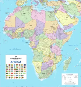
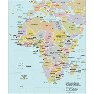
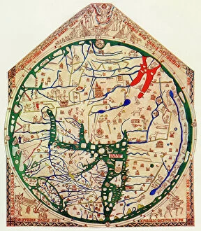
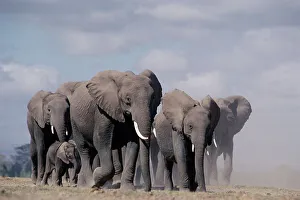
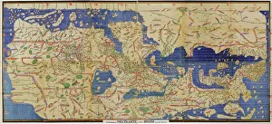
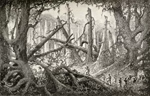
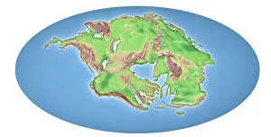
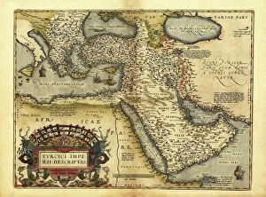
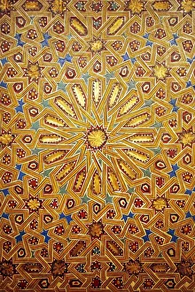
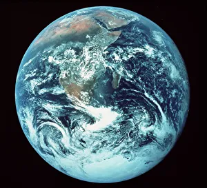
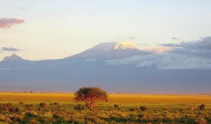
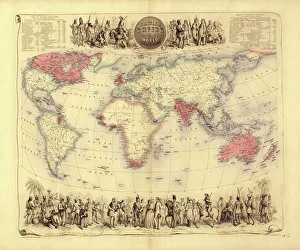
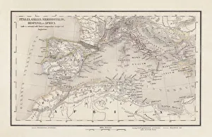
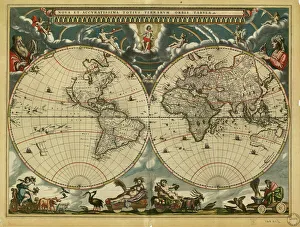
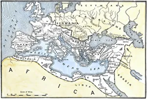
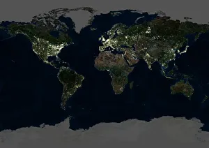
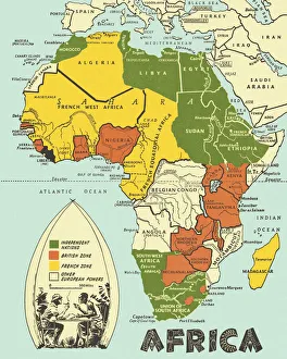
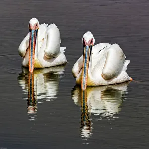
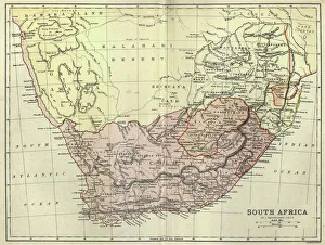
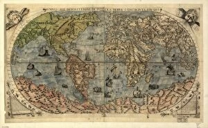
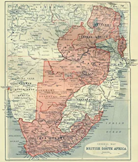
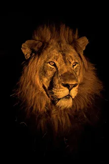
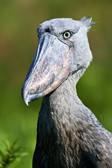
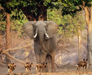
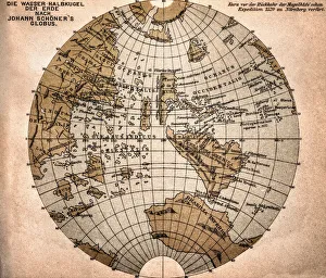
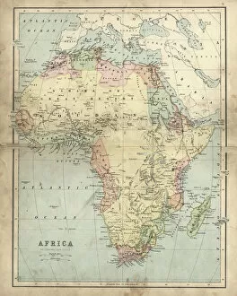
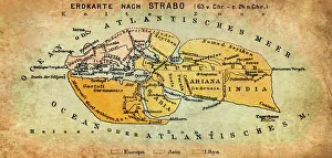
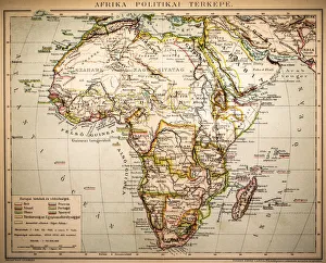
Africa, a continent of rich history and diverse landscapes. From the ancient Al-Idrisis world map in 1154 to the modern Africa Political Map, this land has witnessed countless changes over time. Babar, king of the elephants, and Celeste playing tennis at Celesteville remind us of the enchanting stories that have emerged from this vibrant continent. In Ice Cold In Alex (1958), we catch a glimpse of Africa's cinematic allure. But beyond its cultural contributions, it also holds geological significance with continental drift shaping its landscape over 250 million years. The stunning image of Gemsbok gracefully navigating Namibia's sand dunes showcases the remarkable wildlife found on this vast land. And who can forget the breathtaking Mount Kilimanjaro Sunset? A sight that leaves visitors in awe. Even from space, Africa captivates our attention as seen in Apollo 17's photograph capturing the whole earth. The White pelicans at Walvis Bay in Namibia add to its natural beauty and diversity. Let us not forget Africa's historical context as depicted by the British Empire world map from the 19th century. It serves as a reminder of colonialism's impact on this great continent. Africa is more than just a place; it is an intricate tapestry woven with tales of triumphs and struggles, captivating landscapes, and diverse cultures. This caption only scratches the surface of what makes Africa truly special – an ever-evolving mosaic waiting to be explored and understood by all who seek its treasures.