Postcard > Europe > United Kingdom > Northern Ireland > County Tyrone > Cookstown
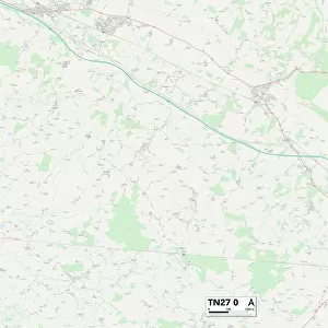
Postcard : Rother TN33 9 Map


![]()
Cards from Map Marketing
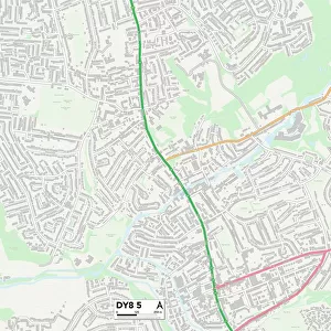
Rother TN33 9 Map
Postcode Sector Map of Rother TN33 9
Media ID 19982512
Battle Road Bexhill Road Blacksmiths Lane Chapel Hill Church Lane Church Road Combe Lane Craig Close Crouch Lane Downs View Farthing Lane Forge Lane High Street Honey Lane Kiln Lane Lower Street Manchester Road Middle Close Mill Lane Millfield Netherfield Netherfield Road Rother Skinners Lane Smith Close Station Road Straight Lane The Forge The Green The Pound Watermill Lane Woodland Way Crowhurst
Postcards (8 pack of A6)
Set of 8, A6 Postcards, featuring the same image on all cards in a set. Printed on 350gsm premium white satin card, the back of the postcard includes space to write messages and an area for the address and stamp. Size of each postcard is 15cm x 10.6cm.
Photo postcards are a great way to stay in touch with family and friends.
Estimated Product Size is 15cm x 10.6cm (5.9" x 4.2")
These are individually made so all sizes are approximate
Artwork printed orientated as per the preview above, with landscape (horizontal) or portrait (vertical) orientation to match the source image.
FEATURES IN THESE COLLECTIONS
> Map Marketing
> Postcode Sector Maps
> TN - Tunbridge Wells
> Arts
> Artists
> C
> Craig Craig
> Europe
> United Kingdom
> England
> Manchester
> Manchester
> Europe
> United Kingdom
> Northern Ireland
> County Tyrone
> Cookstown
> Historic
> Battles
> Related Images
> Maps and Charts
> Related Images
MADE IN THE UK
Safe Shipping with 30 Day Money Back Guarantee
FREE PERSONALISATION*
We are proud to offer a range of customisation features including Personalised Captions, Color Filters and Picture Zoom Tools
SECURE PAYMENTS
We happily accept a wide range of payment options so you can pay for the things you need in the way that is most convenient for you
* Options may vary by product and licensing agreement. Zoomed Pictures can be adjusted in the Basket.