Fraud Blocker Skip to main content

Kiln Lane Collection

Kiln Lane: Exploring the Hidden Gems of Rural England Nestled in the picturesque South Hams region

Background imageKiln Lane Collection: South Hams TQ7 2 Map

South Hams TQ7 2 Map
Postcode Sector Map of South Hams TQ7 2

Background imageKiln Lane Collection: Wealden TN22 5 Map

Wealden TN22 5 Map
Postcode Sector Map of Wealden TN22 5

Background imageKiln Lane Collection: Malvern Hills WR13 5 Map

Malvern Hills WR13 5 Map
Postcode Sector Map of Malvern Hills WR13 5

Background imageKiln Lane Collection: Sevenoaks TN11 8 Map

Sevenoaks TN11 8 Map
Postcode Sector Map of Sevenoaks TN11 8

Background imageKiln Lane Collection: Hampshire RG26 5 Map

Hampshire RG26 5 Map
Postcode Sector Map of Hampshire RG26 5

Background imageKiln Lane Collection: South Oxfordshire OX14 4 Map

South Oxfordshire OX14 4 Map
Postcode Sector Map of South Oxfordshire OX14 4

Background imageKiln Lane Collection: Wrexham LL12 9 Map

Wrexham LL12 9 Map
Postcode Sector Map of Wrexham LL12 9

Background imageKiln Lane Collection: Epsom and Ewell KT17 1 Map

Epsom and Ewell KT17 1 Map
Postcode Sector Map of Epsom and Ewell KT17 1

Background imageKiln Lane Collection: Kirklees HD8 9 Map

Kirklees HD8 9 Map
Postcode Sector Map of Kirklees HD8 9

Background imageKiln Lane Collection: West Lancashire WN8 8 Map

West Lancashire WN8 8 Map
Postcode Sector Map of West Lancashire WN8 8

Background imageKiln Lane Collection: Ashford TN26 3 Map

Ashford TN26 3 Map
Postcode Sector Map of Ashford TN26 3

Background imageKiln Lane Collection: Rother TN33 9 Map

Rother TN33 9 Map
Postcode Sector Map of Rother TN33 9

Background imageKiln Lane Collection: Eastleigh SO50 6 Map

Eastleigh SO50 6 Map
Postcode Sector Map of Eastleigh SO50 6

Background imageKiln Lane Collection: Somerset TA23 0 Map

Somerset TA23 0 Map
Postcode Sector Map of Somerset TA23 0

Background imageKiln Lane Collection: Swindon SN2 2 Map

Swindon SN2 2 Map
Postcode Sector Map of Swindon SN2 2

Background imageKiln Lane Collection: Winchester SO24 9 Map

Winchester SO24 9 Map
Postcode Sector Map of Winchester SO24 9

Background imageKiln Lane Collection: Winchester SO21 2 Map

Winchester SO21 2 Map
Postcode Sector Map of Winchester SO21 2

Background imageKiln Lane Collection: High Peak SK13 1 Map

High Peak SK13 1 Map
Postcode Sector Map of High Peak SK13 1

Background imageKiln Lane Collection: South Buckinghamshire SL2 3 Map

South Buckinghamshire SL2 3 Map
Postcode Sector Map of South Buckinghamshire SL2 3

Background imageKiln Lane Collection: Bracknell Forest RG12 1 Map

Bracknell Forest RG12 1 Map
Postcode Sector Map of Bracknell Forest RG12 1

Background imageKiln Lane Collection: South Oxfordshire RG9 4 Map

South Oxfordshire RG9 4 Map
Postcode Sector Map of South Oxfordshire RG9 4

Background imageKiln Lane Collection: St. Helens WA10 6 Map

St. Helens WA10 6 Map
Postcode Sector Map of St. Helens WA10 6

Background imageKiln Lane Collection: Hampshire PO7 4 Map

Hampshire PO7 4 Map
Postcode Sector Map of Hampshire PO7 4

Background imageKiln Lane Collection: Mid Sussex RH16 2 Map

Mid Sussex RH16 2 Map
Postcode Sector Map of Mid Sussex RH16 2

Background imageKiln Lane Collection: Berkshire RG31 5 Map

Berkshire RG31 5 Map
Postcode Sector Map of Berkshire RG31 5

Background imageKiln Lane Collection: Windsor and Maidenhead SL5 0 Map

Windsor and Maidenhead SL5 0 Map
Postcode Sector Map of Windsor and Maidenhead SL5 0

Background imageKiln Lane Collection: Bracknell Forest SL4 2 Map

Bracknell Forest SL4 2 Map
Postcode Sector Map of Bracknell Forest SL4 2

Background imageKiln Lane Collection: Test Valley SO51 0 Map

Test Valley SO51 0 Map
Postcode Sector Map of Test Valley SO51 0

Background imageKiln Lane Collection: Wiltshire SP5 2 Map

Wiltshire SP5 2 Map
Postcode Sector Map of Wiltshire SP5 2

Background imageKiln Lane Collection: South Oxfordshire OX44 9 Map

South Oxfordshire OX44 9 Map
Postcode Sector Map of South Oxfordshire OX44 9

Background imageKiln Lane Collection: South Oxfordshire OX33 1 Map

South Oxfordshire OX33 1 Map
Postcode Sector Map of South Oxfordshire OX33 1

Background imageKiln Lane Collection: South Northamptonshire NN12 8 Map

South Northamptonshire NN12 8 Map
Postcode Sector Map of South Northamptonshire NN12 8

Background imageKiln Lane Collection: Daventry NN11 2 Map

Daventry NN11 2 Map
Postcode Sector Map of Daventry NN11 2

Background imageKiln Lane Collection: Rochdale OL16 3 Map

Rochdale OL16 3 Map
Postcode Sector Map of Rochdale OL16 3

Background imageKiln Lane Collection: Oxford OX3 8 Map

Oxford OX3 8 Map
Postcode Sector Map of Oxford OX3 8

Background imageKiln Lane Collection: Berkshire RG7 3 Map

Berkshire RG7 3 Map
Postcode Sector Map of Berkshire RG7 3

Background imageKiln Lane Collection: Berkshire RG7 1 Map

Berkshire RG7 1 Map
Postcode Sector Map of Berkshire RG7 1

Background imageKiln Lane Collection: Crawley RH6 8 Map

Crawley RH6 8 Map
Postcode Sector Map of Crawley RH6 8

Background imageKiln Lane Collection: Mole Valley RH3 7 Map

Mole Valley RH3 7 Map
Postcode Sector Map of Mole Valley RH3 7

Background imageKiln Lane Collection: Lincoln LN11 0 Map

Lincoln LN11 0 Map
Postcode Sector Map of Lincoln LN11 0

Background imageKiln Lane Collection: Bedford MK45 4 Map

Bedford MK45 4 Map
Postcode Sector Map of Bedford MK45 4

Background imageKiln Lane Collection: Wrexham LL13 0 Map

Wrexham LL13 0 Map
Postcode Sector Map of Wrexham LL13 0

Background imageKiln Lane Collection: Lancaster LA2 8 Map

Lancaster LA2 8 Map
Postcode Sector Map of Lancaster LA2 8

Background imageKiln Lane Collection: Suffolk Coastal IP12 3 Map

Suffolk Coastal IP12 3 Map
Postcode Sector Map of Suffolk Coastal IP12 3

Background imageKiln Lane Collection: Waverley GU10 3 Map

Waverley GU10 3 Map
Postcode Sector Map of Waverley GU10 3

Background imageKiln Lane Collection: South Lakeland LA12 0 Map

South Lakeland LA12 0 Map
Postcode Sector Map of South Lakeland LA12 0

Background imageKiln Lane Collection: Wycombe HP27 0 Map

Wycombe HP27 0 Map
Postcode Sector Map of Wycombe HP27 0

Background imageKiln Lane Collection: Calderdale HX7 7 Map

Calderdale HX7 7 Map
Postcode Sector Map of Calderdale HX7 7


All Professionally Made to Order for Quick Shipping

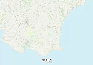
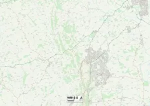
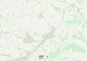
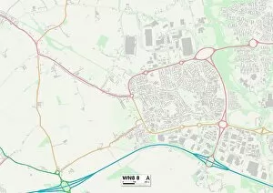
Kiln Lane: Exploring the Hidden Gems of Rural England Nestled in the picturesque South Hams region, a charming countryside lane that offers a delightful escape from the hustle and bustle of city life. With its idyllic surroundings and tranquil atmosphere, this hidden gem has become a favorite destination for nature lovers and adventure seekers alike. Located on the map at TQ7 2, Kiln Lane serves as a gateway to some of England's most stunning landscapes. From Wealden (TN22 5) to Malvern Hills (WR13 5), each location boasts its own unique charm and natural beauty. Whether you're hiking through rolling hills or exploring ancient woodlands, there's something here for everyone. Venturing further north towards Wrexham (LL12 9) reveals another side of Kiln Lane's allure. Surrounded by lush greenery and dotted with quaint villages, this area offers endless opportunities for peaceful walks or cycling adventures. The nearby Kirklees (HD8 9) adds historical intrigue with its rich heritage sites waiting to be discovered. Heading westward into West Lancashire (WN8 8), Kiln Lane takes you through enchanting countryside vistas that will leave you breathless. As you meander along this scenic route, make sure to stop by Ashford (TN26 3). This charming village is known for its traditional architecture and warm hospitality – an ideal spot to relax and soak up the local culture. Continuing your journey eastwards brings you to Rother (TN33 9), where time seems to stand still amidst unspoiled landscapes teeming with wildlife. Further south lies Eastleigh (SO50 6), offering a perfect blend of rural tranquility and modern amenities – an oasis away from everyday stresses. For those seeking history and heritage, Staffordshire's ST13 8 awaits exploration just beyond Kiln Lane's borders.