Fraud Blocker Skip to main content

Postcard > Fine Art Storehouse > Map

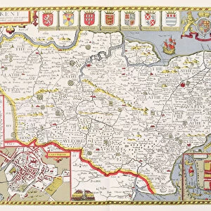
Postcard : Map of Kent and Neighborhoods, England Victorian Engraving, 1840

Map of Kent and Neighborhoods, England Victorian Engraving, 1840


-
+
£12.48

We accept all major credit cards


Framed Photos
Photo Prints
Jigsaw Puzzles
Poster Prints
Canvas Prints
Fine Art Prints
Mounted Prints
Metal Prints
Cards
Home Decor


Fine Art Storehouse

Cards from Fine Art Storehouse

Map of Kent and Neighborhoods, England Victorian Engraving, 1840

Very Rare, Beautifully Illustrated Antique Engraving of Map of Kent and Neighborhoods, England Victorian Engraving, 1840 from Our Own Country, Great Britain, Descriptive, Historical, Pictorial. Published in 1880. Copyright has expired on this artwork. Digitally restored

Unleash your creativity and transform your space into a visual masterpiece!

bauhaus1000

Media ID 14719339

© This content is subject to copyright


Postcards (8 pack of A6)

Set of 8, A6 Postcards, featuring the same image on all cards in a set. Printed on 350gsm premium white satin card, the back of the postcard includes space to write messages and an area for the address and stamp. Size of each postcard is 15cm x 10.6cm.

Photo postcards are a great way to stay in touch with family and friends.

Estimated Product Size is 15cm x 10.6cm (5.9" x 4.2")

These are individually made so all sizes are approximate

Artwork printed orientated as per the preview above, with landscape (horizontal) or portrait (vertical) orientation to match the source image.


FEATURES IN THESE COLLECTIONS

> Fine Art Storehouse > Map > Historical Maps

> Fine Art Storehouse > Map


MADE IN THE UK
Safe Shipping with 30 Day Money Back Guarantee

FREE PERSONALISATION*
We are proud to offer a range of customisation features including Personalised Captions, Color Filters and Picture Zoom Tools

SECURE PAYMENTS
We happily accept a wide range of payment options so you can pay for the things you need in the way that is most convenient for you

* Options may vary by product and licensing agreement. Zoomed Pictures can be adjusted in the Basket.


globe_uk
Made in UK
thumb_up
Professional quality finish
diamond
Made with high-grade materials
inventory_2
Carefully packed to aid safe arrival


Related Images


Map of the world with annotations by Darwin J970111
Medieval Europe at the start of the Crusades
Greeting Card from Ocean City, Maryland. ca. 1944, Ocean City, Maryland, USA, Ocean City, Marylands eight million dollar resort seaport, was founded July 4th, 1875, by a tiny group of five Eastern Shore business men and has grown to accommodate fifty thousand vacationists. Its rise to national fame came in 1933, when a severe storm cut a natural inlet between the Atlantic Ocean and the Sinepuxent Bay
Horticulture student with Victoria cruziana
Map, County of Kent, 1839, 19th century engraving
Kent, engraved by Jodocus Hondius (1563-1612) from John Speeds Theatre of the
Antique map of Britain under the Anglo Saxons
Kent Historical John Speed 1610 Map

+

Shipping

+

Choices

+

Reviews

+

Guaranteed