Postcard > Arts > Artists > A > Battista Agnese
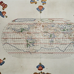
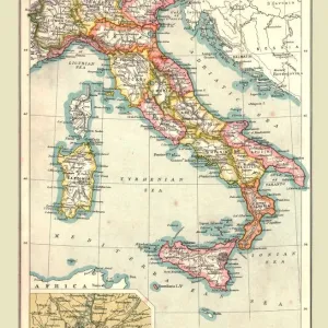
Postcard : Italy, from an Atlas of the World in 33 Maps, Venice, 1st September 1553 (ink on vellum)
")
")


![]()
Cards from Fine Art Finder
Italy, from an Atlas of the World in 33 Maps, Venice, 1st September 1553 (ink on vellum)
XOT330948 Italy, from an Atlas of the World in 33 Maps, Venice, 1st September 1553 (ink on vellum) by Agnese, Battista (1514-64); Museo Correr, Venice, Italy; Italian, out of copyright
Media ID 12852660
© www.bridgemanart.com
Adriatic Chart Compass Corsica Croatia Ionian Mapping Mediterranean Sea Portolan Sardinia Sicily Italian Peninsula
Postcards (8 pack of A6)
Set of 8, A6 Postcards, featuring the same image on all cards in a set. Printed on 350gsm premium white satin card, the back of the postcard includes space to write messages and an area for the address and stamp. Size of each postcard is 15cm x 10.6cm.
Photo postcards are a great way to stay in touch with family and friends.
Estimated Product Size is 15cm x 10.6cm (5.9" x 4.2")
These are individually made so all sizes are approximate
Artwork printed orientated as per the preview above, with landscape (horizontal) or portrait (vertical) orientation to match the source image.
FEATURES IN THESE COLLECTIONS
> Fine Art Finder
> Artists
> Battista Agnese
> Fine Art Finder
> Maps (celestial & Terrestrial)
> Arts
> Artists
> A
> Battista Agnese
> Europe
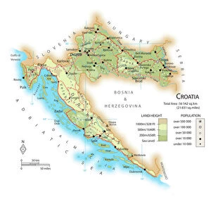
> Croatia
> Related Images
> Europe
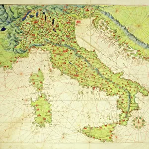
> Italy
> Related Images
> Europe
> Italy
> Sardinia
> Related Images
> Europe
> Italy
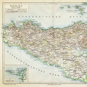
> Sicily
> Related Images
> Europe
> Italy
> Veneto
> Venice
EDITORS COMMENTS
This print showcases a remarkable piece of history, an ink on vellum map titled "Italy, from an Atlas of the World in 33 Maps". Created by the talented Italian cartographer Agnese Battista in Venice on September 1st, 1553, this masterpiece is now housed at the Museo Correr in Venice, Italy. The intricate details and precision displayed in this map are truly awe-inspiring. It depicts not only the Italian peninsula but also Sicily, Sardinia, Corsica, and various bodies of water such as the Mediterranean Sea, Adriatic Sea, and Ionian Sea. The accuracy with which Agnese portrayed these geographical features highlights his exceptional skill as a cartographer during that era. One cannot help but marvel at how this ancient map was meticulously crafted using traditional techniques like portolan charts and compasses. Each stroke of ink on vellum tells a story of exploration and discovery during a time when maps were invaluable tools for navigation. As we gaze upon this historical artifact through our modern lens, it serves as a reminder of how far we have come in terms of mapping technology. Yet it also evokes nostalgia for simpler times when cartography was both an art form and scientific endeavor. This print offers us a glimpse into the past while celebrating Agnese Battista's contribution to the world of cartography. It stands as a testament to human curiosity about our surroundings and our eternal quest to understand our place within them.
MADE IN THE UK
Safe Shipping with 30 Day Money Back Guarantee
FREE PERSONALISATION*
We are proud to offer a range of customisation features including Personalised Captions, Color Filters and Picture Zoom Tools
SECURE PAYMENTS
We happily accept a wide range of payment options so you can pay for the things you need in the way that is most convenient for you
* Options may vary by product and licensing agreement. Zoomed Pictures can be adjusted in the Basket.