
Counties Collection
"Exploring the rich tapestry of counties through captivating maps and historical landmarks" Scotland Road Map


All Professionally Made to Order for Quick Shipping
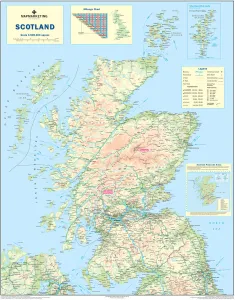
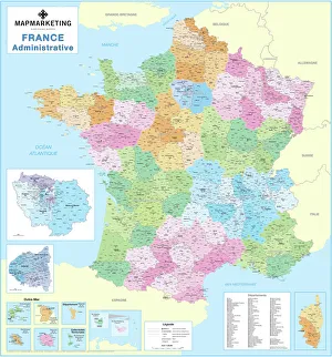
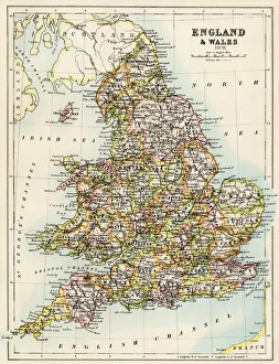
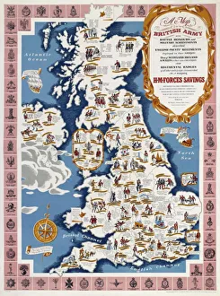
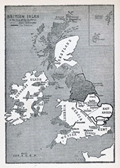
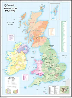
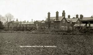
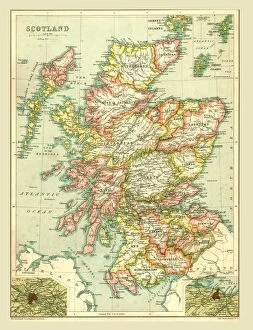
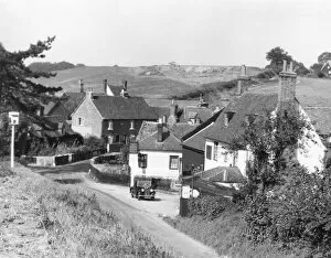
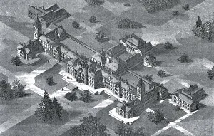
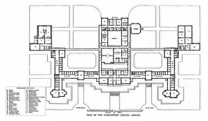
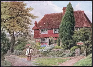
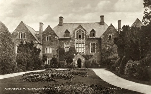
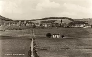
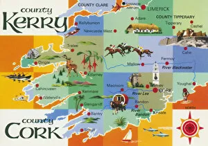
"Exploring the rich tapestry of counties through captivating maps and historical landmarks" Scotland Road Map: Uncover the enchanting beauty of Scotland's diverse counties, from the stunning Highlands to the vibrant cities. WW2 Poster - Map of the British Army: Discover how county boundaries played a crucial role in strategizing during World War II, as depicted on this historic map. France Administrative Political Map: Delve into France's intricate administrative divisions, showcasing its unique system of departments and regions. Map of England, 1800s: Step back in time with this vintage map, tracing the evolution of England's counties throughout centuries of history. Children's Political British Isles Map: Introduce young minds to geography with this playful yet informative map highlighting Britain's counties and their capital cities. Viking Britain Map: Embark on a journey through time as you explore how Viking invaders shaped the borders and settlements within Britain's ancient counties. Ireland Political Road Map: Navigate your way across Ireland using this detailed road map that showcases its distinct political divisions known as counties. Maps / Australia Post-1876: Witness Australia's transformation post-1876 through an array of maps depicting evolving county lines and territorial changes over time. Carmarthen County Lunatic Asylum, South Wales: Reflect upon a darker chapter in history at Carmarthen County Lunatic Asylum, once home to those suffering from mental illness in South Wales' county system. Guiltcross Union Workhouse, Kenninghall, Norfolk: Gain insight into social welfare practices by exploring Guiltcross Union Workhouse—a testament to Norfolk County’s efforts to support its most vulnerable residents in times past. Map of Scotland 1902 (Creator Unknown): Unearth hidden gems within Scotland’s picturesque landscapes as you trace your way along its fascinating county boundaries captured on this century-old map. England / Wareside.