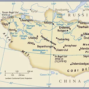
Photographic Print > Asia > Mongolia > Maps
Photographic Print : Lenguages of the world map 1895


![]()
Photo Prints from Fine Art Storehouse
Lenguages of the world map 1895
Meyers Konversations-Lexikon. Ein Nachschlagewerk des allgemeinen Wissens, 5th edition 17 volumes Bibliographisches Institut - Leipzig 1895-1897
Unleash your creativity and transform your space into a visual masterpiece!
THEPALMER
Media ID 13609315
© This content is subject to copyright
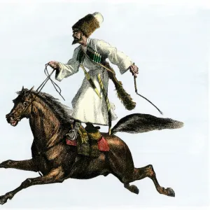
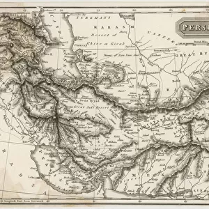
Chinese India Indigenous Culture Iran Iranian Language Mongolian Culture Spread Tribes Turkey Middle East Turkish China East Asia Mongolian
10"x8" (25x20cm) Photo Print
Step back in time with our exquisite reproduction of 'Languages of the World Map 1895' by THEPALMER from our Media Storehouse Fine Art Collection. This vintage map, originally published in the fifth edition of Meyers Konversations-Lexikon, showcases the diverse linguistic landscape of the late 19th century. Each detail, from the intricate labeling of languages to the beautiful illustrations of flags, is meticulously preserved in this stunning print. Elevate your home or office decor with this captivating piece of historical cartography.
Printed on archival quality paper for unrivalled stable artwork permanence and brilliant colour reproduction with accurate colour rendition and smooth tones. Printed on professional 234gsm Fujifilm Crystal Archive DP II paper. 10x8 for landscape images, 8x10 for portrait images.
Our Photo Prints are in a large range of sizes and are printed on Archival Quality Paper for excellent colour reproduction and longevity. They are ideal for framing (our Framed Prints use these) at a reasonable cost. Alternatives include cheaper Poster Prints and higher quality Fine Art Paper, the choice of which is largely dependant on your budget.
Estimated Product Size is 25.4cm x 20.3cm (10" x 8")
These are individually made so all sizes are approximate
Artwork printed orientated as per the preview above, with landscape (horizontal) or portrait (vertical) orientation to match the source image.
FEATURES IN THESE COLLECTIONS
> Fine Art Storehouse
> Map
> Historical Maps
> Asia
> India
> Related Images
> Asia
> Iran
> Related Images
> Asia
> Mongolia
> Related Images
> Asia
> Related Images
> Asia
> Turkey
> Related Images
EDITORS COMMENTS
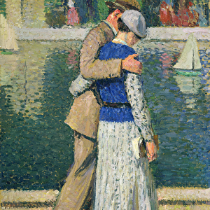
This print showcases the "Languages of the World Map 1895" sourced from Meyers Konversations-Lexikon. The map, featured in the 5th edition spanning across 17 volumes, was published by Bibliographisches Institut in Leipzig between 1895 and 1897. It offers a fascinating glimpse into the linguistic diversity of different regions during that era. The horizontal composition beautifully depicts various languages spoken around the globe, including Indian, Chinese, German, Iranian, Mongolian, Slavic, Turkish and more. The intricate engraving and etching techniques used to create this antique illustration add an air of authenticity to its appearance. As we explore this historical map further, it becomes evident that it not only represents language but also sheds light on indigenous cultures and physical geography. China in East Asia is prominently displayed alongside India and Iran in Turkey's Middle East region. This comprehensive portrayal allows us to appreciate how language played a crucial role in connecting people across vast territories. "The Languages of the World Map 1895" serves as a valuable artifact showcasing our rich linguistic heritage while simultaneously highlighting cultural interactions among diverse tribes and communities. Its presence reminds us of our shared human experience despite geographical boundaries. THEPALMER has skillfully captured this remarkable piece from Fine Art Storehouse for all enthusiasts who appreciate cartography's artistic beauty intertwined with historical significance.
MADE IN THE UK
Safe Shipping with 30 Day Money Back Guarantee
FREE PERSONALISATION*
We are proud to offer a range of customisation features including Personalised Captions, Color Filters and Picture Zoom Tools
SECURE PAYMENTS
We happily accept a wide range of payment options so you can pay for the things you need in the way that is most convenient for you
* Options may vary by product and licensing agreement. Zoomed Pictures can be adjusted in the Basket.