Fine Art Print > Asia > Mongolia > Maps
Fine Art Print : Lenguages of the world map 1895
![]()

Fine Art Prints from Fine Art Storehouse
Lenguages of the world map 1895
Meyers Konversations-Lexikon. Ein Nachschlagewerk des allgemeinen Wissens, 5th edition 17 volumes Bibliographisches Institut - Leipzig 1895-1897
Unleash your creativity and transform your space into a visual masterpiece!
THEPALMER
Media ID 13609315
© This content is subject to copyright
Chinese India Indigenous Culture Iran Iranian Language Mongolian Culture Spread Tribes Turkey Middle East Turkish China East Asia Mongolian
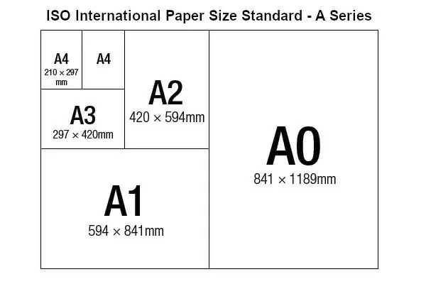
A2 (42x59cm) Fine Art Print
Discover the captivating allure of the past with our exquisite Fine Art Print of "Languages of the World Map 1895" by THEPALMER, from our Media Storehouse collection. This stunning vintage map, originally published in the renowned Meyers Konversations-Lexikon, showcases the intricate detail and rich history of the world's languages as they were known in 1895. Transport yourself back in time and adorn your walls with this magnificent piece of cartographic history.
Our Fine Art Prints are printed on 100% acid free, PH neutral paper with archival properties. This printing method is used by museums and art collections to exhibit photographs and art reproductions. Hahnemühle certified studio for digital fine art printing. Printed on 308gsm Photo Rag Paper.
Our fine art prints are high-quality prints made using a paper called Photo Rag. This 100% cotton rag fibre paper is known for its exceptional image sharpness, rich colors, and high level of detail, making it a popular choice for professional photographers and artists. Photo rag paper is our clear recommendation for a fine art paper print. If you can afford to spend more on a higher quality paper, then Photo Rag is our clear recommendation for a fine art paper print.
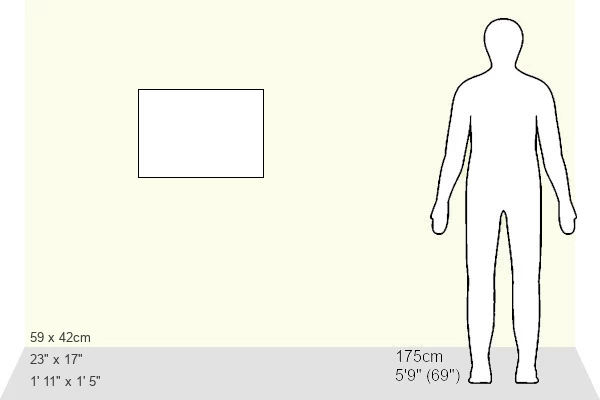
Estimated Image Size (if not cropped) is 54.9cm x 42cm (21.6" x 16.5")
Estimated Product Size is 59.4cm x 42cm (23.4" x 16.5")
These are individually made so all sizes are approximate
Artwork printed orientated as per the preview above, with landscape (horizontal) orientation to match the source image.
FEATURES IN THESE COLLECTIONS
> Asia
> India
> Related Images
> Asia
> Iran
> Related Images
> Asia
> Mongolia
> Related Images
> Asia
> Related Images
> Asia
> Turkey
> Related Images
> Fine Art Storehouse
> Map
> Historical Maps
EDITORS COMMENTS
This print showcases the "Languages of the World Map 1895" sourced from Meyers Konversations-Lexikon. The map, featured in the 5th edition spanning across 17 volumes, was published by Bibliographisches Institut in Leipzig between 1895 and 1897. It offers a fascinating glimpse into the linguistic diversity of different regions during that era. The horizontal composition beautifully depicts various languages spoken around the globe, including Indian, Chinese, German, Iranian, Mongolian, Slavic, Turkish and more. The intricate engraving and etching techniques used to create this antique illustration add an air of authenticity to its appearance. As we explore this historical map further, it becomes evident that it not only represents language but also sheds light on indigenous cultures and physical geography. China in East Asia is prominently displayed alongside India and Iran in Turkey's Middle East region. This comprehensive portrayal allows us to appreciate how language played a crucial role in connecting people across vast territories. "The Languages of the World Map 1895" serves as a valuable artifact showcasing our rich linguistic heritage while simultaneously highlighting cultural interactions among diverse tribes and communities. Its presence reminds us of our shared human experience despite geographical boundaries. THEPALMER has skillfully captured this remarkable piece from Fine Art Storehouse for all enthusiasts who appreciate cartography's artistic beauty intertwined with historical significance.
MADE IN THE UK
Safe Shipping with 30 Day Money Back Guarantee
FREE PERSONALISATION*
We are proud to offer a range of customisation features including Personalised Captions, Color Filters and Picture Zoom Tools
SECURE PAYMENTS
We happily accept a wide range of payment options so you can pay for the things you need in the way that is most convenient for you
* Options may vary by product and licensing agreement. Zoomed Pictures can be adjusted in the Basket.


