
Maps Collection
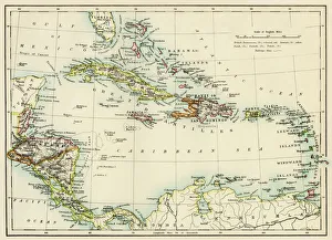
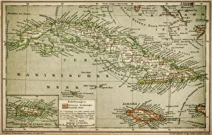
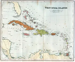
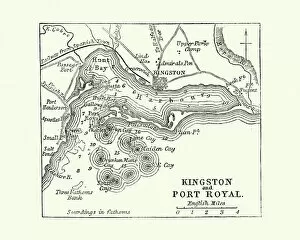
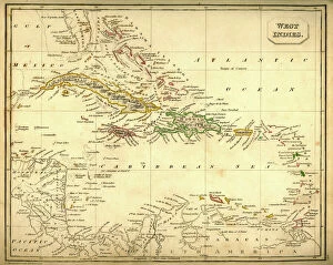
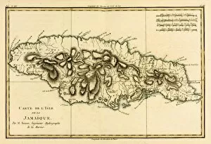
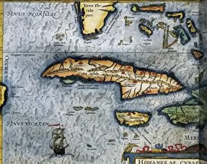
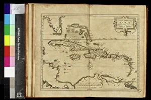
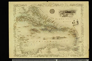
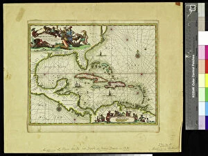
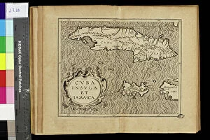
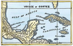
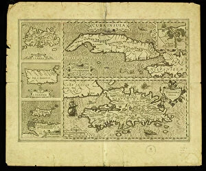
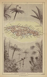
Jamaica is an island nation located in the Caribbean Sea, south of Cuba and west of Haiti
Choose a picture from our Maps Collection for your Wall Art and Photo Gifts
199 items


All Professionally Made to Order for Quick Shipping
-
Maps Collection
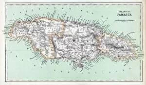
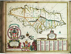
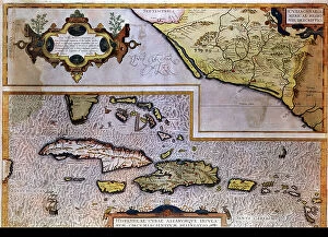
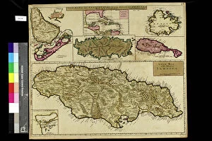
Jamaica is an island nation located in the Caribbean Sea, south of Cuba and west of Haiti, and is the third-largest island in the Greater Antilles region and has a population of approximately 2.9 million people. Jamaica is known for its lush tropical landscape, white-sand beaches, vibrant culture, and rich history. The country's topography consists mostly of mountains with some coastal plains and valleys. Its highest point is Blue Mountain Peak at 7402 feet above sea level. Jamaica has a long history as an important trading post between Europe and the Americas, making it a major hub for commerce throughout its history. Today it continues to be an important tourist destination due to its stunning natural beauty and unique culture that blends African, European, Indian, Chinese, Middle Eastern influences into one dynamic mix that makes Jamaica truly unique among Caribbean nations.
+
Our beautiful pictures are available as Framed Prints, Photos, Wall Art and Photo Gifts
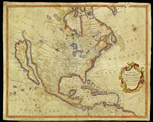
Media Storehouse offers a collection of maps of Jamaica North America that are perfect for wall art and framed prints. Our collection includes vintage maps dating back to the 18th century, as well as more modern designs. These maps showcase the geography, topography, and political boundaries of Jamaica in great detail. The Maps of Jamaica North America collection is an excellent resource for historians, cartographers, and anyone interested in Jamaican history or geography. The detailed depictions provide insight into how the island has changed over time and how it fits into the larger context of North America. The high-quality prints are available in various sizes to suit different spaces and preferences. They make great additions to homes, offices, schools, libraries or any other space where historical or geographical knowledge is appreciated. Overall our collection provides a unique opportunity to explore Jamaica's past through its cartographic representation while adding aesthetic value to any room they adorn.
+
What are Maps of Jamaica North America art prints?
Maps of Jamaica North America art prints are high-quality reproductions of antique and contemporary maps depicting the island nation of Jamaica. These prints showcase the intricate details, vibrant colors, and historical significance of various maps that have been created over time by cartographers and artists. These art prints offer a unique way to explore the geography, topography, landmarks, and cultural heritage of Jamaica. They can be used for educational purposes in classrooms or as decorative pieces in homes or offices. Some popular examples include vintage maps from the 18th century that show plantations, ports, and towns; modern road maps with tourist attractions highlighted; or satellite images that reveal natural features like mountains and rivers. Whether you are a history buff interested in tracing the evolution of Jamaican cartography or simply looking for an eye-catching piece to adorn your walls, Maps of Jamaica North America art prints provide a fascinating glimpse into this beautiful Caribbean country.
+
What Maps of Jamaica North America art prints can I buy from Media Storehouse?
We offer a wide range of Maps of Jamaica North America art prints that you can buy. These maps are available in different sizes and styles, including vintage, antique, and modern designs. You can choose from a variety of map types such as topographical, political, physical or satellite imagery. The collection includes detailed maps showing the cities and towns of Jamaica along with their major landmarks and attractions. Some maps also highlight the country's natural features like rivers, mountains, forests and beaches. Whether you're looking for a decorative piece to hang on your wall or an educational tool for your classroom or office space, we have something to suit every taste and need. Their high-quality prints are produced using state-of-the-art printing technology to ensure vibrant colors and sharp details. So if you want to explore the beauty of Jamaica through its geography or simply add some Caribbean flair to your decor, check out our selection of Maps of Jamaica North America art prints today.
+
How do I buy Maps of Jamaica North America art prints?
To buy Maps of Jamaica North America art prints from Media Storehouse, you can browse our extensive collection of high-quality prints online. Simply search for "Maps of Jamaica North America" in the search bar on our website and select the print that you like best. Once you have found your desired print, choose the size and framing options that suit your preferences. We offer a range of framing options to complement your chosen print, including black or white frames, canvas wraps, and unframed prints. You can also choose between different paper types such as glossy or matte finishes. When purchasing your Maps of Jamaica North America art print from Media Storehouse, be sure to check out any current promotions or discounts they may be offering. Additionally, keep an eye out for new arrivals and featured collections for more inspiration on decorating your home with beautiful artwork.
+
How much do Maps of Jamaica North America art prints cost?
The cost of Maps of Jamaica North America art prints varies depending on the size, quality, and type of print. There are different options available such as canvas prints, framed prints, and poster prints. The price range can start from a few dollars for small poster prints to hundreds or even thousands of dollars for large canvas or framed prints. The cost also depends on where you purchase the print from as different retailers may have varying prices. We offer a wide selection of Maps of Jamaica North America art prints at competitive prices. We offer high-quality reproductions that capture every detail and color accurately. Whether you're looking for a vintage map or a contemporary design, they have something to suit all tastes and budgets. Our collection includes maps in various sizes and formats so that you can choose what best suits their needs without breaking the bank.
+
How will my Maps of Jamaica North America art prints be delivered to me?
Your Maps of Jamaica North America art prints will be delivered to you in a safe and secure manner by Media Storehouse. The company takes great care in packaging your order to ensure that it arrives at your doorstep undamaged. Your art prints will be rolled up and placed inside a sturdy cardboard tube, which is then sealed with tape to prevent any moisture or dust from entering. Media Storehouse uses reliable shipping carriers who offer tracking services so that you can monitor the progress of your delivery. Once your order has been dispatched, you will receive an email notification containing the tracking information. Rest assured that Media Storehouse values customer satisfaction and strives to provide excellent service throughout the entire ordering process. You can expect your Maps of Jamaica North America art prints to arrive promptly and in pristine condition, ready for framing or display as desired.