Home > North America > Jamaica > Maps
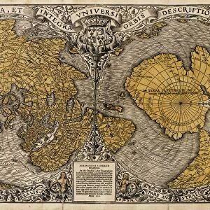
ORTELIUS, Abraham (1527-1598). Theatrum Orbis
. Theatrum Orbis")
![]()
Wall Art and Photo Gifts from Mary Evans Picture Library
ORTELIUS, Abraham (1527-1598). Theatrum Orbis
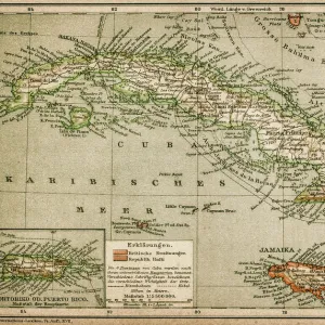
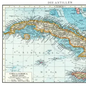
ORTELIUS, Abraham (1527-1598). Theatrum Orbis Terrarum. 1570. It is considered to be the first modern atlas. Map of the Caribbean Sea with Cuba, Cayman Islands, Jamaica and Florida. 1588. Printed in Antwerp by Christophe Plantin (1588). Etching. SPAIN. Salamanca. Salamanca University Library
Mary Evans Picture Library makes available wonderful images created for people to enjoy over the centuries
Media ID 8281905
© Mary Evans Picture Library 2015 - https://copyrighthub.org/s0/hub1/creation/maryevans/MaryEvansPictureID/10682010
Abraham Antwerp Atlas Caribbean Cayman Christophe Considered Cuba Florida Jamaica Orbis Ortelius Plantin Terrarum Theatrum
FEATURES IN THESE COLLECTIONS
> Arts
> Artists
> O
> Abraham Ortelius
> Maps and Charts
> Abraham Ortelius
> Maps and Charts
> Spain
> North America
> Cuba
> Maps
> North America
> Jamaica
> Maps
MADE IN THE UK
Safe Shipping with 30 Day Money Back Guarantee
FREE PERSONALISATION*
We are proud to offer a range of customisation features including Personalised Captions, Color Filters and Picture Zoom Tools
SECURE PAYMENTS
We happily accept a wide range of payment options so you can pay for the things you need in the way that is most convenient for you
* Options may vary by product and licensing agreement. Zoomed Pictures can be adjusted in the Basket.