Mouse Mat > Europe > United Kingdom > England > London > Boroughs > Havering
Mouse Mat : Havering RM12 5 Map


![]()
Home Decor from Map Marketing
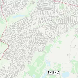
Havering RM12 5 Map
Postcode Sector Map of Havering RM12 5
Media ID 19979568
Ambleside Avenue Bradwell Close Cavendish Avenue Cavendish Crescent Chestnut Close Coniston Way Coronation Drive Derwent Way Duxford Close Eagle Close Elm Park Ennerdale Avenue Farm Way Fernbank Avenue Fulmar Road Harrier Close Havering Hunter Drive Kestrel Close Lancaster Drive Langdale Gardens Oswald Close Park Lane Penrith Crescent Robinson Close Rochester Road Rochford Close Rosewood Avenue Silverdale Drive Sopwith Close St Andrews Avenue Station Parade Windermere Avenue Wood Lane Gray Gardens
Mouse Mat
A high quality photographic print manufactured into a durable wipe clean mouse mat (27x22cm) with a non slip backing, which works with all mice.
Archive quality photographic print in a durable wipe clean mouse mat with non slip backing. Works with all computer mice
Estimated Image Size (if not cropped) is 25.4cm x 18cm (10" x 7.1")
Estimated Product Size is 26.9cm x 21.8cm (10.6" x 8.6")
These are individually made so all sizes are approximate
Artwork printed orientated as per the preview above, with landscape (horizontal) orientation to match the source image.
FEATURES IN THESE COLLECTIONS
> Map Marketing
> Postcode Sector Maps
> RM - Romford
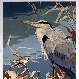
> Animals
> Birds
> Herons
> Related Images
> Europe
> United Kingdom
> England
> London
> Boroughs
> Havering
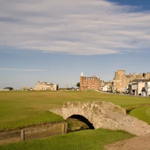
> Europe
> United Kingdom
> Scotland
> Fife
> St Andrews
> Maps and Charts
> Related Images
MADE IN THE UK
Safe Shipping with 30 Day Money Back Guarantee
FREE PERSONALISATION*
We are proud to offer a range of customisation features including Personalised Captions, Color Filters and Picture Zoom Tools
SECURE PAYMENTS
We happily accept a wide range of payment options so you can pay for the things you need in the way that is most convenient for you
* Options may vary by product and licensing agreement. Zoomed Pictures can be adjusted in the Basket.