Mounted Print > Europe > Russia > Volgograd
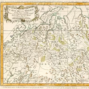
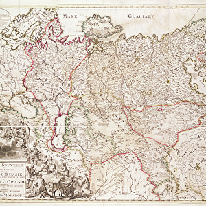
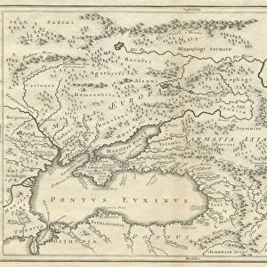
Mounted Print : Historic map of Russia


![]()
Mounted Prints from Fine Art Storehouse
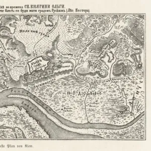
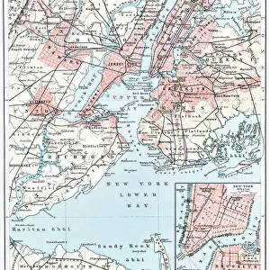
Historic map of Russia
Illustration of a historic map of Russia
Unleash your creativity and transform your space into a visual masterpiece!
Nastasic
Media ID 13589837
© This content is subject to copyright
1830 1839 Baltic Countries Baltic Sea Black Sea Chart Crimea Eastern Europe Equipment Geographical Locations Image Date Moscow Russia Navigational Equipment Russia Russian Culture Serbia South Caucasus Styles Ukraine Novgorod Obsolete Retro Styled Victorian Style Volgograd
10"x8" Mount with 8"x6" Print
Step back in time with our Historic Map of Russia by Nastasic from the Media Storehouse Mounted Photos collection. This stunning piece of fine art transports you to an era of exploration and discovery. The intricate details of the map, showcasing the vast expanse of the Russian Empire, are sure to captivate any history enthusiast. Our high-quality mounted print preserves the rich colors and textures of the original map, making it a beautiful addition to your home or office. Elevate your space with a piece of history that tells a story. Order your Historic Map of Russia by Nastasic from the Media Storehouse Mounted Photos collection today.
Printed on 8"x6" paper and suitable for use in a 10"x8" frame (frame not included). Prints are mounted with card both front and back. Featuring a custom cut aperture to match chosen image. Professional 234gsm Fujifilm Crystal Archive DP II paper.
Photo prints supplied in custom cut card mount ready for framing
Estimated Image Size (if not cropped) is 18.8cm x 15.2cm (7.4" x 6")
Estimated Product Size is 25.4cm x 20.3cm (10" x 8")
These are individually made so all sizes are approximate
Artwork printed orientated as per the preview above, with landscape (horizontal) orientation to match the source image.
FEATURES IN THESE COLLECTIONS
> Fine Art Storehouse
> The Magical World of Illustration
> Nastasic Images & Illustrations
> Fine Art Storehouse
> Map
> Historical Maps
> Europe
> Related Images
> Europe
> Russia
> Related Images
> Europe
> Serbia
> Related Images
EDITORS COMMENTS
This print showcases a historic map of Russia, taking us on a visual journey through time. The illustration, with its retro-styled and Victorian influences, transports us to the past, specifically the 19th century. It encompasses various geographical locations within Eastern Europe and the Baltic countries. The intricate details of this antique map highlight significant regions such as Moscow, Volgograd, Novgorod, Crimea, and South Caucasus. Navigational equipment from that era is depicted alongside cultural symbols representing Russian heritage. The chart includes both the Black Sea and the Baltic Sea, emphasizing Russia's extensive maritime influence during this period. Capital cities are marked with precision while cartography techniques prevalent in the 1830s-1839s are evident throughout. This piece serves as a testament to the rich history and diverse cultures that have shaped Russia over centuries. Nastasic's skillful execution brings forth an obsolete yet enchanting representation of this vast nation's past. As we gaze upon this image date-stamped 686182286 horizontally arranged before us at Fine Art Storehouse, we can't help but appreciate how art allows us to connect with historical narratives in unique ways. Let this historic map transport you back in time while celebrating Russia's enduring legacy.
MADE IN THE UK
Safe Shipping with 30 Day Money Back Guarantee
FREE PERSONALISATION*
We are proud to offer a range of customisation features including Personalised Captions, Color Filters and Picture Zoom Tools
SECURE PAYMENTS
We happily accept a wide range of payment options so you can pay for the things you need in the way that is most convenient for you
* Options may vary by product and licensing agreement. Zoomed Pictures can be adjusted in the Basket.