Metal Print > Arts > Landscape paintings > Waterfall and river artworks > River artworks
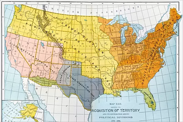
Metal Print : U. S. MAP, 1776 / 1884. A map showing United States territorial acquisitions between 1776
![]()

Metal Prints from Granger
U. S. MAP, 1776 / 1884. A map showing United States territorial acquisitions between 1776
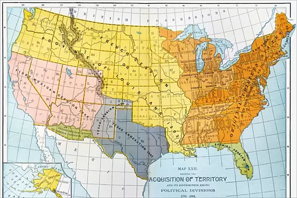
U.S. MAP, 1776/1884. A map showing United States territorial acquisitions between 1776 and 1884
Granger holds millions of images spanning more than 25,000 years of world history, from before the Stone Age to the dawn of the Space Age
Media ID 6622363
1776 1884 Annexation Louisiana Purchase Manifest Destiny Territory Texas Westward Expansion
15"x10" (38x25cm) Metal Print
Step back in time with our stunning Metal Print of the U.S. Map, 1776/1884, from the Media Storehouse collection. This captivating piece, sourced from The Granger Collection at Granger Art on Demand, showcases the United States' territorial acquisitions from 1776 to 1884. The intricate details of this historical map are brought to life through our premium metal print process, which enhances colors and textures for a vibrant and eye-catching display. Add a touch of history and sophistication to your home or office with this unique and educational artwork.
Your image is printed photographically and bonded to a 3.5mm thick, Dibond board (black polyethylene sandwiched between two sheets of white coated aluminium). The panel is then sealed with a gloss protective covering. Supplied complete with a wall mount which holds the print 10mm from the wall.
Made with durable metal and luxurious printing techniques, metal prints bring images to life and add a modern touch to any space
Estimated Product Size is 38.1cm x 25.4cm (15" x 10")
These are individually made so all sizes are approximate
Artwork printed orientated as per the preview above, with landscape (horizontal) or portrait (vertical) orientation to match the source image.
FEATURES IN THESE COLLECTIONS
> Granger Art on Demand
> Maps
> Arts
> Landscape paintings
> Waterfall and river artworks
> River artworks
> Maps and Charts
> Related Images
EDITORS COMMENTS
This print titled "U. S. MAP, 1776 / 1884" takes us on a visual journey through the territorial acquisitions of the United States between 1776 and 1884. The map, meticulously crafted by The Granger Collection, offers a fascinating glimpse into America's westward expansion during this transformative period in history. The map showcases the evolving borders of the United States as it gradually expanded its territory across the continent. From the original thirteen colonies in 1776 to encompassing vast regions by 1884, this visual representation highlights key milestones that shaped America's growth. Notable landmarks include the Louisiana Purchase in 1803, which doubled the size of the nation overnight and opened up new opportunities for exploration and settlement. The annexation of Texas in 1845 is also prominently featured, marking an important step towards manifest destiny –the belief that Americans were destined to expand their influence from coast to coast. As we trace our eyes along this historical artifact, we are reminded of rivers crossed and frontiers conquered. This map serves as a testament to both American ambition and resilience throughout centuries of progress. In essence, "U. S. MAP, 1776 / 1884" captures not only geographical changes but also embodies a spirit of adventure and pioneering that defined America's identity during this era. It stands as a powerful reminder of how far our nation has come since its humble beginnings while igniting curiosity about what lies beyond those boundaries yet uncharted.
MADE IN THE UK
Safe Shipping with 30 Day Money Back Guarantee
FREE PERSONALISATION*
We are proud to offer a range of customisation features including Personalised Captions, Color Filters and Picture Zoom Tools
SECURE PAYMENTS
We happily accept a wide range of payment options so you can pay for the things you need in the way that is most convenient for you
* Options may vary by product and licensing agreement. Zoomed Pictures can be adjusted in the Basket.

